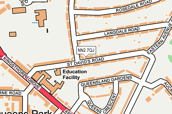
NN2 7QJ lies on St Davids Road in Northampton. NN2 7QJ is located in the Kingsthorpe South electoral ward, within the unitary authority of West Northamptonshire and the English Parliamentary constituency of Northampton North. The Sub Integrated Care Board (ICB) Location is NHS Northamptonshire ICB - 78H and the police force is Northamptonshire. This postcode has been in use since January 1980.


GetTheData
Source: OS OpenMap – Local (Ordnance Survey)
Source: OS VectorMap District (Ordnance Survey)
Licence: Open Government Licence (requires attribution)
| Easting | 475492 |
| Northing | 262929 |
| Latitude | 52.259358 |
| Longitude | -0.895376 |
GetTheData
Source: Open Postcode Geo
Licence: Open Government Licence
| Street | St Davids Road |
| Town/City | Northampton |
| Country | England |
| Postcode District | NN2 |
➜ See where NN2 is on a map ➜ Where is Northampton? | |
GetTheData
Source: Land Registry Price Paid Data
Licence: Open Government Licence
Elevation or altitude of NN2 7QJ as distance above sea level:
| Metres | Feet | |
|---|---|---|
| Elevation | 90m | 295ft |
Elevation is measured from the approximate centre of the postcode, to the nearest point on an OS contour line from OS Terrain 50, which has contour spacing of ten vertical metres.
➜ How high above sea level am I? Find the elevation of your current position using your device's GPS.
GetTheData
Source: Open Postcode Elevation
Licence: Open Government Licence
| Ward | Kingsthorpe South |
| Constituency | Northampton North |
GetTheData
Source: ONS Postcode Database
Licence: Open Government Licence
1, ST DAVIDS ROAD, NORTHAMPTON, NN2 7QJ 2022 9 SEP £390,000 |
1, ST DAVIDS ROAD, NORTHAMPTON, NN2 7QJ 2008 12 DEC £190,000 |
GetTheData
Source: HM Land Registry Price Paid Data
Licence: Contains HM Land Registry data © Crown copyright and database right 2025. This data is licensed under the Open Government Licence v3.0.
| Queensland Gardens (Kingsthorpe Grove) | Kingsley | 194m |
| Queensland Gardens (Kingsthorpe Grove) | Kingsley | 226m |
| Kingsland Avenue | St Davids | 250m |
| Kingsland Avenue | St Davids | 282m |
| Windyridge (Kingsland Avenue) | St Davids | 314m |
| Northampton Station | 2.6km |
GetTheData
Source: NaPTAN
Licence: Open Government Licence
| Percentage of properties with Next Generation Access | 96.6% |
| Percentage of properties with Superfast Broadband | 96.6% |
| Percentage of properties with Ultrafast Broadband | 96.6% |
| Percentage of properties with Full Fibre Broadband | 0.0% |
Superfast Broadband is between 30Mbps and 300Mbps
Ultrafast Broadband is > 300Mbps
| Median download speed | 100.0Mbps |
| Average download speed | 107.7Mbps |
| Maximum download speed | 350.00Mbps |
| Median upload speed | 1.1Mbps |
| Average upload speed | 1.1Mbps |
| Maximum upload speed | 1.22Mbps |
| Percentage of properties unable to receive 2Mbps | 0.0% |
| Percentage of properties unable to receive 5Mbps | 0.0% |
| Percentage of properties unable to receive 10Mbps | 0.0% |
| Percentage of properties unable to receive 30Mbps | 3.4% |
GetTheData
Source: Ofcom
Licence: Ofcom Terms of Use (requires attribution)
Estimated total energy consumption in NN2 7QJ by fuel type, 2015.
| Consumption (kWh) | 715,763 |
|---|---|
| Meter count | 56 |
| Mean (kWh/meter) | 12,781 |
| Median (kWh/meter) | 13,274 |
| Consumption (kWh) | 200,281 |
|---|---|
| Meter count | 55 |
| Mean (kWh/meter) | 3,641 |
| Median (kWh/meter) | 3,107 |
GetTheData
Source: Postcode level gas estimates: 2015 (experimental)
Source: Postcode level electricity estimates: 2015 (experimental)
Licence: Open Government Licence
GetTheData
Source: ONS Postcode Database
Licence: Open Government Licence


➜ Get more ratings from the Food Standards Agency
GetTheData
Source: Food Standards Agency
Licence: FSA terms & conditions
| Last Collection | |||
|---|---|---|---|
| Location | Mon-Fri | Sat | Distance |
| St Davids Road | 17:45 | 11:30 | 18m |
| Cock Hotel | 17:30 | 12:00 | 372m |
| Queens Park Tso | 17:30 | 11:30 | 493m |
GetTheData
Source: Dracos
Licence: Creative Commons Attribution-ShareAlike
The below table lists the International Territorial Level (ITL) codes (formerly Nomenclature of Territorial Units for Statistics (NUTS) codes) and Local Administrative Units (LAU) codes for NN2 7QJ:
| ITL 1 Code | Name |
|---|---|
| TLF | East Midlands (England) |
| ITL 2 Code | Name |
| TLF2 | Leicestershire, Rutland and Northamptonshire |
| ITL 3 Code | Name |
| TLF24 | West Northamptonshire |
| LAU 1 Code | Name |
| E07000154 | Northampton |
GetTheData
Source: ONS Postcode Directory
Licence: Open Government Licence
The below table lists the Census Output Area (OA), Lower Layer Super Output Area (LSOA), and Middle Layer Super Output Area (MSOA) for NN2 7QJ:
| Code | Name | |
|---|---|---|
| OA | E00138534 | |
| LSOA | E01027229 | Northampton 009B |
| MSOA | E02005658 | Northampton 009 |
GetTheData
Source: ONS Postcode Directory
Licence: Open Government Licence
| NN2 7QL | St Davids Road | 72m |
| NN2 7BG | Queensland Gardens | 100m |
| NN2 7QG | Nursery Lane | 130m |
| NN2 7QH | Langdale Road | 134m |
| NN2 7BQ | Queens Crescent | 149m |
| NN2 7QQ | Langdale Road | 168m |
| NN2 7BE | Eastern Avenue South | 204m |
| NN2 6NS | Kingsthorpe Grove | 208m |
| NN2 7QF | Rosedale Road | 226m |
| NN2 6NT | Kingsthorpe Grove | 227m |
GetTheData
Source: Open Postcode Geo; Land Registry Price Paid Data
Licence: Open Government Licence