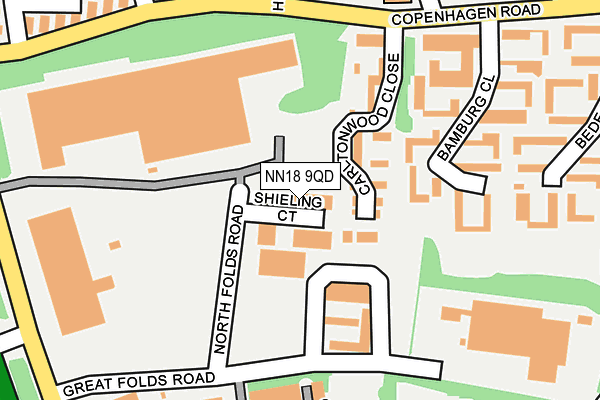
NN18 9QD is located in the Oakley electoral ward, within the unitary authority of North Northamptonshire and the English Parliamentary constituency of Corby. The Sub Integrated Care Board (ICB) Location is NHS Northamptonshire ICB - 78H and the police force is Northamptonshire. This postcode has been in use since January 1992.


GetTheData
Source: OS OpenMap – Local (Ordnance Survey)
Source: OS VectorMap District (Ordnance Survey)
Licence: Open Government Licence (requires attribution)
| Easting | 486027 |
| Northing | 286273 |
| Latitude | 52.467629 |
| Longitude | -0.735087 |
GetTheData
Source: Open Postcode Geo
Licence: Open Government Licence
| Country | England |
| Postcode District | NN18 |
➜ See where NN18 is on a map ➜ Where is Corby? | |
GetTheData
Source: Land Registry Price Paid Data
Licence: Open Government Licence
Elevation or altitude of NN18 9QD as distance above sea level:
| Metres | Feet | |
|---|---|---|
| Elevation | 110m | 361ft |
Elevation is measured from the approximate centre of the postcode, to the nearest point on an OS contour line from OS Terrain 50, which has contour spacing of ten vertical metres.
➜ How high above sea level am I? Find the elevation of your current position using your device's GPS.
GetTheData
Source: Open Postcode Elevation
Licence: Open Government Licence
| Ward | Oakley |
| Constituency | Corby |
GetTheData
Source: ONS Postcode Database
Licence: Open Government Licence
| Herford Close (Copenhagen Road) | Danesholme | 204m |
| Herford Close (Copenhagen Road) | Danesholme | 225m |
| Bamburg Close (Copenhagen Road) | Danesholme | 284m |
| Bamburg Close (Copenhagen Road) | Danesholme | 294m |
| Minden Close (Copenhagen Road) | Danesholme | 295m |
| Corby Station | 4km |
GetTheData
Source: NaPTAN
Licence: Open Government Licence
| Median download speed | 9.4Mbps |
| Average download speed | 9.9Mbps |
| Maximum download speed | 15.20Mbps |
| Median upload speed | 1.0Mbps |
| Average upload speed | 1.0Mbps |
| Maximum upload speed | 1.09Mbps |
GetTheData
Source: Ofcom
Licence: Ofcom Terms of Use (requires attribution)
Estimated total energy consumption in NN18 9QD by fuel type, 2015.
| Consumption (kWh) | 85,066 |
|---|---|
| Meter count | 7 |
| Mean (kWh/meter) | 12,152 |
| Median (kWh/meter) | 11,075 |
GetTheData
Source: Postcode level gas estimates: 2015 (experimental)
Source: Postcode level electricity estimates: 2015 (experimental)
Licence: Open Government Licence
GetTheData
Source: ONS Postcode Database
Licence: Open Government Licence


➜ Get more ratings from the Food Standards Agency
GetTheData
Source: Food Standards Agency
Licence: FSA terms & conditions
| Last Collection | |||
|---|---|---|---|
| Location | Mon-Fri | Sat | Distance |
| Great Oakley | 16:00 | 08:00 | 1,180m |
| Saxon Way East | 18:00 | 09:00 | 1,853m |
| Farmstead Road | 17:00 | 11:15 | 2,171m |
GetTheData
Source: Dracos
Licence: Creative Commons Attribution-ShareAlike
The below table lists the International Territorial Level (ITL) codes (formerly Nomenclature of Territorial Units for Statistics (NUTS) codes) and Local Administrative Units (LAU) codes for NN18 9QD:
| ITL 1 Code | Name |
|---|---|
| TLF | East Midlands (England) |
| ITL 2 Code | Name |
| TLF2 | Leicestershire, Rutland and Northamptonshire |
| ITL 3 Code | Name |
| TLF25 | North Northamptonshire |
| LAU 1 Code | Name |
| E07000150 | Corby |
GetTheData
Source: ONS Postcode Directory
Licence: Open Government Licence
The below table lists the Census Output Area (OA), Lower Layer Super Output Area (LSOA), and Middle Layer Super Output Area (MSOA) for NN18 9QD:
| Code | Name | |
|---|---|---|
| OA | E00137089 | |
| LSOA | E01026956 | Corby 008D |
| MSOA | E02006862 | Corby 008 |
GetTheData
Source: ONS Postcode Directory
Licence: Open Government Licence
| NN18 9FP | Carltonwood Close | 74m |
| NN18 9FN | Copenhagen Road | 175m |
| NN18 9PB | Bamburg Close | 176m |
| NN18 9PA | Bamburg Close | 210m |
| NN18 9EQ | Herford Close | 258m |
| NN18 9PE | Bede Close | 275m |
| NN18 9NX | Ryder Court | 307m |
| NN18 9EN | Dresden Close | 314m |
| NN18 9DG | Norse Walk | 316m |
| NN18 9PD | Bede Close | 324m |
GetTheData
Source: Open Postcode Geo; Land Registry Price Paid Data
Licence: Open Government Licence