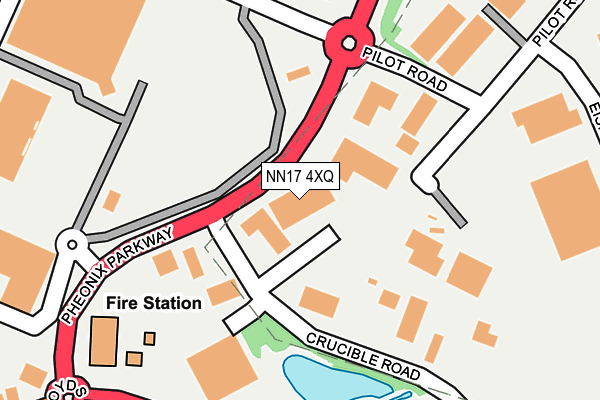
NN17 4XQ is located in the Corby Rural electoral ward, within the unitary authority of North Northamptonshire and the English Parliamentary constituency of Corby. The Sub Integrated Care Board (ICB) Location is NHS Northamptonshire ICB - 78H and the police force is Northamptonshire. This postcode has been in use since June 1999.


GetTheData
Source: OS OpenMap – Local (Ordnance Survey)
Source: OS VectorMap District (Ordnance Survey)
Licence: Open Government Licence (requires attribution)
| Easting | 489852 |
| Northing | 289360 |
| Latitude | 52.494758 |
| Longitude | -0.677966 |
GetTheData
Source: Open Postcode Geo
Licence: Open Government Licence
| Country | England |
| Postcode District | NN17 |
➜ See where NN17 is on a map ➜ Where is Corby? | |
GetTheData
Source: Land Registry Price Paid Data
Licence: Open Government Licence
Elevation or altitude of NN17 4XQ as distance above sea level:
| Metres | Feet | |
|---|---|---|
| Elevation | 100m | 328ft |
Elevation is measured from the approximate centre of the postcode, to the nearest point on an OS contour line from OS Terrain 50, which has contour spacing of ten vertical metres.
➜ How high above sea level am I? Find the elevation of your current position using your device's GPS.
GetTheData
Source: Open Postcode Elevation
Licence: Open Government Licence
| Ward | Corby Rural |
| Constituency | Corby |
GetTheData
Source: ONS Postcode Database
Licence: Open Government Licence
| Asda Superstore (Off Pheonix Parkway) | Corby Village | 203m |
| Whittle Road (Cockerell Road) | Weldon Industry | 343m |
| Tyre & Auto (Lloyds Road) | Corby Village | 384m |
| Whittle Road (Cockerell Road) | Weldon Industry | 423m |
| Madisons (Rockingham Road) | Corby Village | 486m |
| Corby Station | 1km |
GetTheData
Source: NaPTAN
Licence: Open Government Licence
GetTheData
Source: ONS Postcode Database
Licence: Open Government Licence


➜ Get more ratings from the Food Standards Agency
GetTheData
Source: Food Standards Agency
Licence: FSA terms & conditions
| Last Collection | |||
|---|---|---|---|
| Location | Mon-Fri | Sat | Distance |
| Kelvin Grove | 17:00 | 11:15 | 614m |
| Cottingham Road | 17:00 | 11:15 | 1,337m |
| Occupation Road Tso | 17:00 | 11:15 | 1,339m |
GetTheData
Source: Dracos
Licence: Creative Commons Attribution-ShareAlike
The below table lists the International Territorial Level (ITL) codes (formerly Nomenclature of Territorial Units for Statistics (NUTS) codes) and Local Administrative Units (LAU) codes for NN17 4XQ:
| ITL 1 Code | Name |
|---|---|
| TLF | East Midlands (England) |
| ITL 2 Code | Name |
| TLF2 | Leicestershire, Rutland and Northamptonshire |
| ITL 3 Code | Name |
| TLF25 | North Northamptonshire |
| LAU 1 Code | Name |
| E07000150 | Corby |
GetTheData
Source: ONS Postcode Directory
Licence: Open Government Licence
The below table lists the Census Output Area (OA), Lower Layer Super Output Area (LSOA), and Middle Layer Super Output Area (MSOA) for NN17 4XQ:
| Code | Name | |
|---|---|---|
| OA | E00137107 | |
| LSOA | E01026957 | Corby 003A |
| MSOA | E02005614 | Corby 003 |
GetTheData
Source: ONS Postcode Directory
Licence: Open Government Licence
| NN17 5TS | Crucible Road | 103m |
| NN17 1AR | Tunwell Lane | 326m |
| NN17 5DX | Whittle Road | 329m |
| NN17 1AS | West View | 385m |
| NN17 1BE | Boon Walk | 404m |
| NN17 1AT | Meeting Lane | 413m |
| NN17 1AU | Stocks Lane | 437m |
| NN17 1XA | The Nook | 450m |
| NN17 1DB | Stephenson Way | 456m |
| NN17 1DT | Stocks Court | 457m |
GetTheData
Source: Open Postcode Geo; Land Registry Price Paid Data
Licence: Open Government Licence