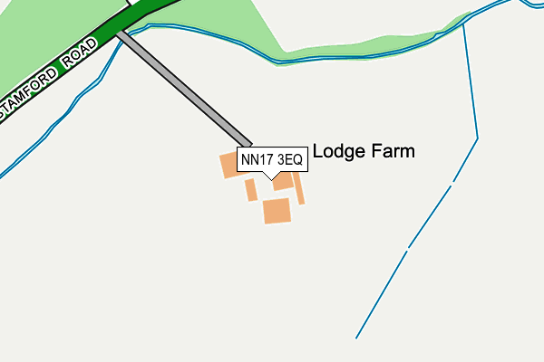
NN17 3EQ is located in the Oundle electoral ward, within the unitary authority of North Northamptonshire and the English Parliamentary constituency of Corby. The Sub Integrated Care Board (ICB) Location is NHS Northamptonshire ICB - 78H and the police force is Northamptonshire. This postcode has been in use since August 1992.


GetTheData
Source: OS OpenMap – Local (Ordnance Survey)
Source: OS VectorMap District (Ordnance Survey)
Licence: Open Government Licence (requires attribution)
| Easting | 494696 |
| Northing | 290913 |
| Latitude | 52.507897 |
| Longitude | -0.606198 |
GetTheData
Source: Open Postcode Geo
Licence: Open Government Licence
| Country | England |
| Postcode District | NN17 |
➜ See where NN17 is on a map | |
GetTheData
Source: Land Registry Price Paid Data
Licence: Open Government Licence
Elevation or altitude of NN17 3EQ as distance above sea level:
| Metres | Feet | |
|---|---|---|
| Elevation | 80m | 262ft |
Elevation is measured from the approximate centre of the postcode, to the nearest point on an OS contour line from OS Terrain 50, which has contour spacing of ten vertical metres.
➜ How high above sea level am I? Find the elevation of your current position using your device's GPS.
GetTheData
Source: Open Postcode Elevation
Licence: Open Government Licence
| Ward | Oundle |
| Constituency | Corby |
GetTheData
Source: ONS Postcode Database
Licence: Open Government Licence
| Demand Responsive Area | Deenethorpe | 1,412m |
| Phone Box (Deenethorpe Lane) | Deenethorpe | 1,431m |
| Phone Box (Deenethorpe Lane) | Deenethorpe | 1,441m |
GetTheData
Source: NaPTAN
Licence: Open Government Licence
GetTheData
Source: ONS Postcode Database
Licence: Open Government Licence


➜ Get more ratings from the Food Standards Agency
GetTheData
Source: Food Standards Agency
Licence: FSA terms & conditions
| Last Collection | |||
|---|---|---|---|
| Location | Mon-Fri | Sat | Distance |
| Bulwick Tso | 16:00 | 10:30 | 164m |
| Corby Road | 17:00 | 08:15 | 2,745m |
| Weldon Tso | 16:45 | 11:00 | 2,842m |
GetTheData
Source: Dracos
Licence: Creative Commons Attribution-ShareAlike
The below table lists the International Territorial Level (ITL) codes (formerly Nomenclature of Territorial Units for Statistics (NUTS) codes) and Local Administrative Units (LAU) codes for NN17 3EQ:
| ITL 1 Code | Name |
|---|---|
| TLF | East Midlands (England) |
| ITL 2 Code | Name |
| TLF2 | Leicestershire, Rutland and Northamptonshire |
| ITL 3 Code | Name |
| TLF25 | North Northamptonshire |
| LAU 1 Code | Name |
| E07000152 | East Northamptonshire |
GetTheData
Source: ONS Postcode Directory
Licence: Open Government Licence
The below table lists the Census Output Area (OA), Lower Layer Super Output Area (LSOA), and Middle Layer Super Output Area (MSOA) for NN17 3EQ:
| Code | Name | |
|---|---|---|
| OA | E00137552 | |
| LSOA | E01027043 | East Northamptonshire 001B |
| MSOA | E02005629 | East Northamptonshire 001 |
GetTheData
Source: ONS Postcode Directory
Licence: Open Government Licence
| NN17 3EP | 1393m | |
| NN17 3JW | East Crescent | 1870m |
| PE8 5AS | Weldon Road | 1878m |
| NN17 5FT | Park View | 1928m |
| NN17 5FW | Michaels Drive | 1978m |
| NN17 5FY | Arnold Drive | 1998m |
| NN17 3JP | Deene End | 2035m |
| NN17 3LP | Cricketers Green | 2042m |
| NN17 5FX | Duke Road | 2046m |
| NN17 5FE | Courteenhall Drive | 2080m |
GetTheData
Source: Open Postcode Geo; Land Registry Price Paid Data
Licence: Open Government Licence