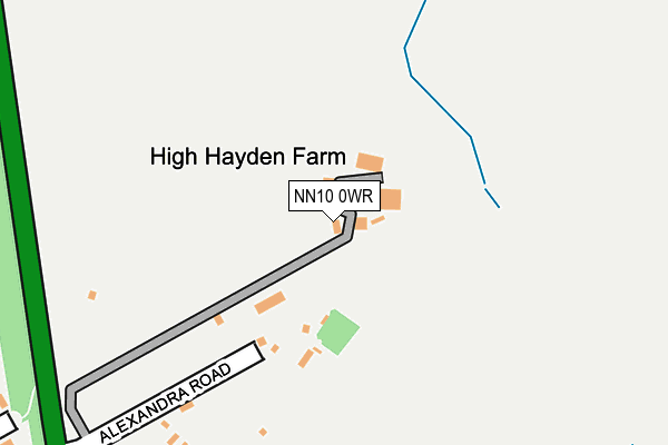
NN10 0WR is located in the Rushden South electoral ward, within the unitary authority of North Northamptonshire and the English Parliamentary constituency of Wellingborough. The Sub Integrated Care Board (ICB) Location is NHS Northamptonshire ICB - 78H and the police force is Northamptonshire. This postcode has been in use since June 2004.


GetTheData
Source: OS OpenMap – Local (Ordnance Survey)
Source: OS VectorMap District (Ordnance Survey)
Licence: Open Government Licence (requires attribution)
| Easting | 497091 |
| Northing | 267155 |
| Latitude | 52.293956 |
| Longitude | -0.577805 |
GetTheData
Source: Open Postcode Geo
Licence: Open Government Licence
| Country | England |
| Postcode District | NN10 |
➜ See where NN10 is on a map | |
GetTheData
Source: Land Registry Price Paid Data
Licence: Open Government Licence
Elevation or altitude of NN10 0WR as distance above sea level:
| Metres | Feet | |
|---|---|---|
| Elevation | 80m | 262ft |
Elevation is measured from the approximate centre of the postcode, to the nearest point on an OS contour line from OS Terrain 50, which has contour spacing of ten vertical metres.
➜ How high above sea level am I? Find the elevation of your current position using your device's GPS.
GetTheData
Source: Open Postcode Elevation
Licence: Open Government Licence
| Ward | Rushden South |
| Constituency | Wellingborough |
GetTheData
Source: ONS Postcode Database
Licence: Open Government Licence
| Ennerdale Road | Rushden | 343m |
| Whittemore Road | Rushden | 410m |
| Cartmel Way (Keswick Drive) | Rushden | 430m |
| Keswick Drive | Rushden | 445m |
| Keswick Drive | Rushden | 453m |
GetTheData
Source: NaPTAN
Licence: Open Government Licence
GetTheData
Source: ONS Postcode Database
Licence: Open Government Licence


➜ Get more ratings from the Food Standards Agency
GetTheData
Source: Food Standards Agency
Licence: FSA terms & conditions
| Last Collection | |||
|---|---|---|---|
| Location | Mon-Fri | Sat | Distance |
| The Church | 17:30 | 11:45 | 1,418m |
| High Street | 17:00 | 11:00 | 1,446m |
| College Street | 18:30 | 12:30 | 1,485m |
GetTheData
Source: Dracos
Licence: Creative Commons Attribution-ShareAlike
The below table lists the International Territorial Level (ITL) codes (formerly Nomenclature of Territorial Units for Statistics (NUTS) codes) and Local Administrative Units (LAU) codes for NN10 0WR:
| ITL 1 Code | Name |
|---|---|
| TLF | East Midlands (England) |
| ITL 2 Code | Name |
| TLF2 | Leicestershire, Rutland and Northamptonshire |
| ITL 3 Code | Name |
| TLF25 | North Northamptonshire |
| LAU 1 Code | Name |
| E07000152 | East Northamptonshire |
GetTheData
Source: ONS Postcode Directory
Licence: Open Government Licence
The below table lists the Census Output Area (OA), Lower Layer Super Output Area (LSOA), and Middle Layer Super Output Area (MSOA) for NN10 0WR:
| Code | Name | |
|---|---|---|
| OA | E00137639 | |
| LSOA | E01027061 | East Northamptonshire 008A |
| MSOA | E02005636 | East Northamptonshire 008 |
GetTheData
Source: ONS Postcode Directory
Licence: Open Government Licence
| NN10 0JL | Ennerdale Road | 368m |
| NN10 0JH | Hayden Road | 386m |
| NN10 0JN | Cartmel Way | 387m |
| NN10 0EN | Whittemore Road | 422m |
| NN10 0ET | Shannon Close | 443m |
| NN10 0JJ | Keswick Drive | 450m |
| NN10 0EP | Bradfield Close | 452m |
| NN10 0EW | Deacon Close | 457m |
| NN10 0DB | Knowles Close | 466m |
| NN10 0HT | Grafton Road | 491m |
GetTheData
Source: Open Postcode Geo; Land Registry Price Paid Data
Licence: Open Government Licence