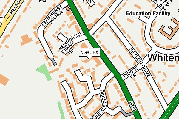
NG8 5BX is located in the Leen Valley electoral ward, within the unitary authority of Nottingham and the English Parliamentary constituency of Nottingham South. The Sub Integrated Care Board (ICB) Location is NHS Nottingham and Nottinghamshire ICB - 52R and the police force is Nottinghamshire. This postcode has been in use since January 1980.


GetTheData
Source: OS OpenMap – Local (Ordnance Survey)
Source: OS VectorMap District (Ordnance Survey)
Licence: Open Government Licence (requires attribution)
| Easting | 454584 |
| Northing | 342273 |
| Latitude | 52.975038 |
| Longitude | -1.188586 |
GetTheData
Source: Open Postcode Geo
Licence: Open Government Licence
| Country | England |
| Postcode District | NG8 |
➜ See where NG8 is on a map ➜ Where is Nottingham? | |
GetTheData
Source: Land Registry Price Paid Data
Licence: Open Government Licence
Elevation or altitude of NG8 5BX as distance above sea level:
| Metres | Feet | |
|---|---|---|
| Elevation | 50m | 164ft |
Elevation is measured from the approximate centre of the postcode, to the nearest point on an OS contour line from OS Terrain 50, which has contour spacing of ten vertical metres.
➜ How high above sea level am I? Find the elevation of your current position using your device's GPS.
GetTheData
Source: Open Postcode Elevation
Licence: Open Government Licence
| Ward | Leen Valley |
| Constituency | Nottingham South |
GetTheData
Source: ONS Postcode Database
Licence: Open Government Licence
| Basford Road (Nuthall Road) | Whitemoor | 58m |
| Basford Road (Nuthall Road) | Whitemoor | 124m |
| Western Boulevard (Nuthall Road) | Whitemoor | 206m |
| Western Boulevard (Nuthall Road) | Whitemoor | 216m |
| Bar Lane (Nuthall Road) | Cinderhill | 249m |
| Wilkinson Street Tram Stop (Wilkinson Street) | Basford | 785m |
| Basford Tram Stop (Vernon Road) | Basford | 998m |
| Shipstone Street Tram Stop (Shipstone Street) | Radford | 1,087m |
| Radford Road Tram Stop (Radford Road) | Forest Fields | 1,173m |
| David Lane Tram Stop (Vernon Road) | Basford | 1,176m |
| Bulwell Station | 2.8km |
| Nottingham Station | 4.2km |
GetTheData
Source: NaPTAN
Licence: Open Government Licence
GetTheData
Source: ONS Postcode Database
Licence: Open Government Licence


➜ Get more ratings from the Food Standards Agency
GetTheData
Source: Food Standards Agency
Licence: FSA terms & conditions
| Last Collection | |||
|---|---|---|---|
| Location | Mon-Fri | Sat | Distance |
| Nuthall Road Post Office | 17:00 | 12:00 | 271m |
| Newport Drive | 17:30 | 11:00 | 426m |
| Nuthall Gardens | 17:30 | 11:00 | 453m |
GetTheData
Source: Dracos
Licence: Creative Commons Attribution-ShareAlike
The below table lists the International Territorial Level (ITL) codes (formerly Nomenclature of Territorial Units for Statistics (NUTS) codes) and Local Administrative Units (LAU) codes for NG8 5BX:
| ITL 1 Code | Name |
|---|---|
| TLF | East Midlands (England) |
| ITL 2 Code | Name |
| TLF1 | Derbyshire and Nottinghamshire |
| ITL 3 Code | Name |
| TLF14 | Nottingham |
| LAU 1 Code | Name |
| E06000018 | Nottingham |
GetTheData
Source: ONS Postcode Directory
Licence: Open Government Licence
The below table lists the Census Output Area (OA), Lower Layer Super Output Area (LSOA), and Middle Layer Super Output Area (MSOA) for NG8 5BX:
| Code | Name | |
|---|---|---|
| OA | E00070280 | |
| LSOA | E01013934 | Nottingham 019E |
| MSOA | E02002886 | Nottingham 019 |
GetTheData
Source: ONS Postcode Directory
Licence: Open Government Licence
| NG8 5FY | Wensleydale Close | 54m |
| NG8 5DX | Nuthall Road | 68m |
| NG8 5EA | Newcastle Farm Drive | 105m |
| NG8 5FZ | Staindale Court | 114m |
| NG8 5FU | Staindale Drive | 128m |
| NG8 5BU | Nuthall Road | 135m |
| NG8 5BT | Newcastle Terrace | 147m |
| NG8 5ER | Reydon Drive | 152m |
| NG8 5DE | Melbourne Court | 160m |
| NG8 5DW | Nuthall Road | 169m |
GetTheData
Source: Open Postcode Geo; Land Registry Price Paid Data
Licence: Open Government Licence