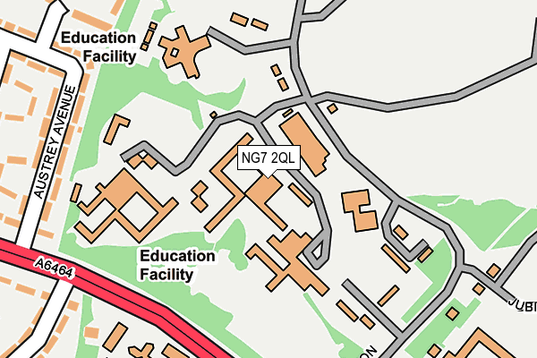
NG7 2QL is located in the Lenton & Wollaton East electoral ward, within the unitary authority of Nottingham and the English Parliamentary constituency of Nottingham South. The Sub Integrated Care Board (ICB) Location is NHS Nottingham and Nottinghamshire ICB - 52R and the police force is Nottinghamshire. This postcode has been in use since January 1980.


GetTheData
Source: OS OpenMap – Local (Ordnance Survey)
Source: OS VectorMap District (Ordnance Survey)
Licence: Open Government Licence (requires attribution)
| Easting | 453456 |
| Northing | 337961 |
| Latitude | 52.936414 |
| Longitude | -1.206089 |
GetTheData
Source: Open Postcode Geo
Licence: Open Government Licence
| Country | England |
| Postcode District | NG7 |
➜ See where NG7 is on a map ➜ Where is Nottingham? | |
GetTheData
Source: Land Registry Price Paid Data
Licence: Open Government Licence
Elevation or altitude of NG7 2QL as distance above sea level:
| Metres | Feet | |
|---|---|---|
| Elevation | 30m | 98ft |
Elevation is measured from the approximate centre of the postcode, to the nearest point on an OS contour line from OS Terrain 50, which has contour spacing of ten vertical metres.
➜ How high above sea level am I? Find the elevation of your current position using your device's GPS.
GetTheData
Source: Open Postcode Elevation
Licence: Open Government Licence
| Ward | Lenton & Wollaton East |
| Constituency | Nottingham South |
GetTheData
Source: ONS Postcode Database
Licence: Open Government Licence
| Lenton Grove (Beeston Lane) | Nottingham University Main Campus | 135m |
| Manton Crescent (Woodside Road) | Nottingham University Main Campus | 188m |
| West Gate (Woodside Road) | Nottingham University Main Campus | 207m |
| Manton Crescent (Woodside Road) | Nottingham University Main Campus | 212m |
| Lenton Grove (Beeston Lane) | Nottingham University Main Campus | 219m |
| University Boulevard Tram Stop (University Boulevard) | Nottingham University Main Campus | 536m |
| Middle Street Tram Stop (Middle Street) | Beeston | 972m |
| University Of Nottingham Tram Stop (University Boulevard) | Nottingham University Main Campus | 1,198m |
| Beeston Centre Tram Stop (Styring Street) | Beeston | 1,362m |
| Queens Medical Centre Tram Stop (South Road) | Queens Medical Centre | 1,652m |
| Beeston Station | 1.7km |
| Attenborough Station | 3.8km |
| Nottingham Station | 4.2km |
GetTheData
Source: NaPTAN
Licence: Open Government Licence
GetTheData
Source: ONS Postcode Database
Licence: Open Government Licence


➜ Get more ratings from the Food Standards Agency
GetTheData
Source: Food Standards Agency
Licence: FSA terms & conditions
| Last Collection | |||
|---|---|---|---|
| Location | Mon-Fri | Sat | Distance |
| Highfields (University) | 17:00 | 12:30 | 301m |
| Charles Avenue | 17:00 | 12:00 | 338m |
| Woodside Road | 17:00 | 12:00 | 353m |
GetTheData
Source: Dracos
Licence: Creative Commons Attribution-ShareAlike
The below table lists the International Territorial Level (ITL) codes (formerly Nomenclature of Territorial Units for Statistics (NUTS) codes) and Local Administrative Units (LAU) codes for NG7 2QL:
| ITL 1 Code | Name |
|---|---|
| TLF | East Midlands (England) |
| ITL 2 Code | Name |
| TLF1 | Derbyshire and Nottinghamshire |
| ITL 3 Code | Name |
| TLF14 | Nottingham |
| LAU 1 Code | Name |
| E06000018 | Nottingham |
GetTheData
Source: ONS Postcode Directory
Licence: Open Government Licence
The below table lists the Census Output Area (OA), Lower Layer Super Output Area (LSOA), and Middle Layer Super Output Area (MSOA) for NG7 2QL:
| Code | Name | |
|---|---|---|
| OA | E00173552 | |
| LSOA | E01013973 | Nottingham 032A |
| MSOA | E02002899 | Nottingham 032 |
GetTheData
Source: ONS Postcode Directory
Licence: Open Government Licence
| NG9 2SX | Austrey Avenue | 208m |
| NG9 2SA | Woodside Road | 253m |
| NG9 2SW | Anslow Avenue | 263m |
| NG9 2TT | Woodside Road | 279m |
| NG9 2GA | Manton Crescent | 301m |
| NG9 2SU | Baslow Drive | 326m |
| NG9 2SR | Baslow Drive | 327m |
| NG9 2SS | Aston Avenue | 350m |
| NG9 2TS | Bosley Square | 362m |
| NG9 2GB | Manton Crescent | 373m |
GetTheData
Source: Open Postcode Geo; Land Registry Price Paid Data
Licence: Open Government Licence