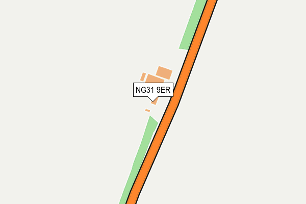
NG31 9ER is located in the Belmont electoral ward, within the local authority district of South Kesteven and the English Parliamentary constituency of Grantham and Stamford. The Sub Integrated Care Board (ICB) Location is NHS Lincolnshire ICB - 71E and the police force is Lincolnshire. This postcode has been in use since January 1980.


GetTheData
Source: OS OpenMap – Local (Ordnance Survey)
Source: OS VectorMap District (Ordnance Survey)
Licence: Open Government Licence (requires attribution)
| Easting | 495430 |
| Northing | 335864 |
| Latitude | 52.911738 |
| Longitude | -0.582354 |
GetTheData
Source: Open Postcode Geo
Licence: Open Government Licence
| Country | England |
| Postcode District | NG31 |
➜ See where NG31 is on a map | |
GetTheData
Source: Land Registry Price Paid Data
Licence: Open Government Licence
Elevation or altitude of NG31 9ER as distance above sea level:
| Metres | Feet | |
|---|---|---|
| Elevation | 120m | 394ft |
Elevation is measured from the approximate centre of the postcode, to the nearest point on an OS contour line from OS Terrain 50, which has contour spacing of ten vertical metres.
➜ How high above sea level am I? Find the elevation of your current position using your device's GPS.
GetTheData
Source: Open Postcode Elevation
Licence: Open Government Licence
| Ward | Belmont |
| Constituency | Grantham And Stamford |
GetTheData
Source: ONS Postcode Database
Licence: Open Government Licence
| Newgate Lane (Harrowby Lane) | Londonthorpe | 789m |
| Newgate Lane (Harrowby Lane) | Londonthorpe | 796m |
| Demand Responsive Area (Callconnect) | Cold Harbour | 1,143m |
| Hall Road (Harrowby Lane) | Grantham | 1,243m |
| Hall Road (Harrowby Lane) | Grantham | 1,377m |
| Grantham Station | 4.1km |
GetTheData
Source: NaPTAN
Licence: Open Government Licence
| Percentage of properties with Next Generation Access | 100.0% |
| Percentage of properties with Superfast Broadband | 0.0% |
| Percentage of properties with Ultrafast Broadband | 0.0% |
| Percentage of properties with Full Fibre Broadband | 0.0% |
Superfast Broadband is between 30Mbps and 300Mbps
Ultrafast Broadband is > 300Mbps
| Percentage of properties unable to receive 2Mbps | 0.0% |
| Percentage of properties unable to receive 5Mbps | 0.0% |
| Percentage of properties unable to receive 10Mbps | 0.0% |
| Percentage of properties unable to receive 30Mbps | 100.0% |
GetTheData
Source: Ofcom
Licence: Ofcom Terms of Use (requires attribution)
GetTheData
Source: ONS Postcode Database
Licence: Open Government Licence


➜ Get more ratings from the Food Standards Agency
GetTheData
Source: Food Standards Agency
Licence: FSA terms & conditions
| Last Collection | |||
|---|---|---|---|
| Location | Mon-Fri | Sat | Distance |
| P.w.o.g. Barracks | 15:40 | 09:00 | 1,789m |
| Princess Drive | 18:15 | 11:45 | 2,698m |
| Princess Drive Post Office | 18:30 | 11:45 | 2,698m |
GetTheData
Source: Dracos
Licence: Creative Commons Attribution-ShareAlike
The below table lists the International Territorial Level (ITL) codes (formerly Nomenclature of Territorial Units for Statistics (NUTS) codes) and Local Administrative Units (LAU) codes for NG31 9ER:
| ITL 1 Code | Name |
|---|---|
| TLF | East Midlands (England) |
| ITL 2 Code | Name |
| TLF3 | Lincolnshire |
| ITL 3 Code | Name |
| TLF30 | Lincolnshire CC |
| LAU 1 Code | Name |
| E07000141 | South Kesteven |
GetTheData
Source: ONS Postcode Directory
Licence: Open Government Licence
The below table lists the Census Output Area (OA), Lower Layer Super Output Area (LSOA), and Middle Layer Super Output Area (MSOA) for NG31 9ER:
| Code | Name | |
|---|---|---|
| OA | E00133555 | |
| LSOA | E01026293 | South Kesteven 007B |
| MSOA | E02005482 | South Kesteven 007 |
GetTheData
Source: ONS Postcode Directory
Licence: Open Government Licence
| NG31 9HB | Harrowby Lane | 711m |
| NG31 9EX | Heath Farm Lane | 783m |
| NG31 7TX | The Cottages | 1191m |
| NG31 9HD | Newgate Lane | 1199m |
| NG31 9ET | Turnor Road | 1317m |
| NG31 9TH | Fifth Avenue | 1601m |
| NG31 9HA | Hall Lane | 1623m |
| NG31 9TT | Harrowby Lane | 1625m |
| NG31 9TJ | Fifth Avenue | 1669m |
| NG31 9TG | Fifth Avenue | 1675m |
GetTheData
Source: Open Postcode Geo; Land Registry Price Paid Data
Licence: Open Government Licence