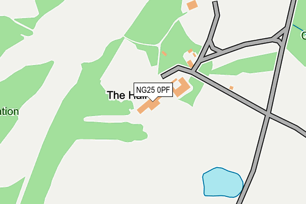
NG25 0PF is located in the Southwell electoral ward, within the local authority district of Newark and Sherwood and the English Parliamentary constituency of Newark. The Sub Integrated Care Board (ICB) Location is NHS Nottingham and Nottinghamshire ICB - 52R and the police force is Nottinghamshire. This postcode has been in use since January 1983.


GetTheData
Source: OS OpenMap – Local (Ordnance Survey)
Source: OS VectorMap District (Ordnance Survey)
Licence: Open Government Licence (requires attribution)
| Easting | 468932 |
| Northing | 354923 |
| Latitude | 53.087102 |
| Longitude | -0.972248 |
GetTheData
Source: Open Postcode Geo
Licence: Open Government Licence
| Country | England |
| Postcode District | NG25 |
➜ See where NG25 is on a map | |
GetTheData
Source: Land Registry Price Paid Data
Licence: Open Government Licence
Elevation or altitude of NG25 0PF as distance above sea level:
| Metres | Feet | |
|---|---|---|
| Elevation | 60m | 197ft |
Elevation is measured from the approximate centre of the postcode, to the nearest point on an OS contour line from OS Terrain 50, which has contour spacing of ten vertical metres.
➜ How high above sea level am I? Find the elevation of your current position using your device's GPS.
GetTheData
Source: Open Postcode Elevation
Licence: Open Government Licence
| Ward | Southwell |
| Constituency | Newark |
GetTheData
Source: ONS Postcode Database
Licence: Open Government Licence
| Halam Road | Southwell | 905m |
| Halam Road | Southwell | 912m |
| Saversick Lane (Halam Road) | Southwell | 960m |
| Saversick Lane (Halam Road) | Southwell | 975m |
| Norwood Gardens (Lower Kirklington Road) | Southwell | 1,003m |
| Fiskerton Station | 5km |
| Rolleston Station | 5.4km |
GetTheData
Source: NaPTAN
Licence: Open Government Licence
GetTheData
Source: ONS Postcode Database
Licence: Open Government Licence


➜ Get more ratings from the Food Standards Agency
GetTheData
Source: Food Standards Agency
Licence: FSA terms & conditions
| Last Collection | |||
|---|---|---|---|
| Location | Mon-Fri | Sat | Distance |
| Woodland Drive | 16:30 | 10:30 | 1,010m |
| Halam | 16:30 | 09:00 | 1,390m |
| Southwell Post Office | 17:15 | 11:30 | 1,452m |
GetTheData
Source: Dracos
Licence: Creative Commons Attribution-ShareAlike
The below table lists the International Territorial Level (ITL) codes (formerly Nomenclature of Territorial Units for Statistics (NUTS) codes) and Local Administrative Units (LAU) codes for NG25 0PF:
| ITL 1 Code | Name |
|---|---|
| TLF | East Midlands (England) |
| ITL 2 Code | Name |
| TLF1 | Derbyshire and Nottinghamshire |
| ITL 3 Code | Name |
| TLF15 | North Nottinghamshire |
| LAU 1 Code | Name |
| E07000175 | Newark and Sherwood |
GetTheData
Source: ONS Postcode Directory
Licence: Open Government Licence
The below table lists the Census Output Area (OA), Lower Layer Super Output Area (LSOA), and Middle Layer Super Output Area (MSOA) for NG25 0PF:
| Code | Name | |
|---|---|---|
| OA | E00144447 | |
| LSOA | E01028348 | Newark and Sherwood 008D |
| MSOA | E02005900 | Newark and Sherwood 008 |
GetTheData
Source: ONS Postcode Directory
Licence: Open Government Licence
| NG25 0RU | Kirklington Road | 589m |
| NG25 0DX | Lower Kirklington Road | 734m |
| NG25 0DQ | The Combes | 748m |
| NG25 0DY | Orchard Close | 811m |
| NG25 0AX | Kirklington Road | 851m |
| NG25 0RT | Hop Yard | 856m |
| NG25 0AU | Hopkiln Lane | 861m |
| NG25 0FP | The Jubilee | 882m |
| NG25 0DU | Ridgeway | 883m |
| NG25 0BS | Springfield Road | 906m |
GetTheData
Source: Open Postcode Geo; Land Registry Price Paid Data
Licence: Open Government Licence