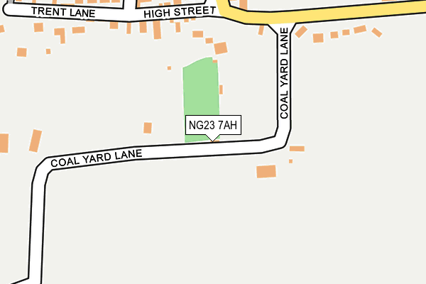
NG23 7AH lies on Coalyard Lane in South Clifton, Newark. NG23 7AH is located in the Collingham electoral ward, within the local authority district of Newark and Sherwood and the English Parliamentary constituency of Newark. The Sub Integrated Care Board (ICB) Location is NHS Nottingham and Nottinghamshire ICB - 52R and the police force is Nottinghamshire. This postcode has been in use since January 1980.


GetTheData
Source: OS OpenMap – Local (Ordnance Survey)
Source: OS VectorMap District (Ordnance Survey)
Licence: Open Government Licence (requires attribution)
| Easting | 482235 |
| Northing | 369969 |
| Latitude | 53.220440 |
| Longitude | -0.769815 |
GetTheData
Source: Open Postcode Geo
Licence: Open Government Licence
| Street | Coalyard Lane |
| Locality | South Clifton |
| Town/City | Newark |
| Country | England |
| Postcode District | NG23 |
➜ See where NG23 is on a map ➜ Where is South Clifton? | |
GetTheData
Source: Land Registry Price Paid Data
Licence: Open Government Licence
Elevation or altitude of NG23 7AH as distance above sea level:
| Metres | Feet | |
|---|---|---|
| Elevation | 10m | 33ft |
Elevation is measured from the approximate centre of the postcode, to the nearest point on an OS contour line from OS Terrain 50, which has contour spacing of ten vertical metres.
➜ How high above sea level am I? Find the elevation of your current position using your device's GPS.
GetTheData
Source: Open Postcode Elevation
Licence: Open Government Licence
| Ward | Collingham |
| Constituency | Newark |
GetTheData
Source: ONS Postcode Database
Licence: Open Government Licence
OAKFIELD HOUSE, COALYARD LANE, SOUTH CLIFTON, NEWARK, NG23 7AH 2023 23 JUN £625,000 |
2013 31 JAN £295,000 |
COOPERS BARN, COALYARD LANE, SOUTH CLIFTON, NEWARK, NG23 7AH 2012 1 JUN £340,000 |
2006 21 NOV £235,000 |
1997 25 JUL £89,000 |
GetTheData
Source: HM Land Registry Price Paid Data
Licence: Contains HM Land Registry data © Crown copyright and database right 2025. This data is licensed under the Open Government Licence v3.0.
| Front Street | South Clifton | 195m |
| Demand Responsive Area (Phoneabus) | South Clifton | 200m |
| Front Street | South Clifton | 203m |
| Church Lane | South Clifton | 516m |
| Church Lane | South Clifton | 517m |
GetTheData
Source: NaPTAN
Licence: Open Government Licence
| Percentage of properties with Next Generation Access | 100.0% |
| Percentage of properties with Superfast Broadband | 75.0% |
| Percentage of properties with Ultrafast Broadband | 0.0% |
| Percentage of properties with Full Fibre Broadband | 0.0% |
Superfast Broadband is between 30Mbps and 300Mbps
Ultrafast Broadband is > 300Mbps
| Percentage of properties unable to receive 2Mbps | 0.0% |
| Percentage of properties unable to receive 5Mbps | 0.0% |
| Percentage of properties unable to receive 10Mbps | 0.0% |
| Percentage of properties unable to receive 30Mbps | 25.0% |
GetTheData
Source: Ofcom
Licence: Ofcom Terms of Use (requires attribution)
GetTheData
Source: ONS Postcode Database
Licence: Open Government Licence


➜ Get more ratings from the Food Standards Agency
GetTheData
Source: Food Standards Agency
Licence: FSA terms & conditions
| Last Collection | |||
|---|---|---|---|
| Location | Mon-Fri | Sat | Distance |
| South Clifton | 16:15 | 09:30 | 466m |
| High Markham | 16:30 | 11:00 | 1,561m |
| Spalford | 16:15 | 11:00 | 1,625m |
GetTheData
Source: Dracos
Licence: Creative Commons Attribution-ShareAlike
The below table lists the International Territorial Level (ITL) codes (formerly Nomenclature of Territorial Units for Statistics (NUTS) codes) and Local Administrative Units (LAU) codes for NG23 7AH:
| ITL 1 Code | Name |
|---|---|
| TLF | East Midlands (England) |
| ITL 2 Code | Name |
| TLF1 | Derbyshire and Nottinghamshire |
| ITL 3 Code | Name |
| TLF15 | North Nottinghamshire |
| LAU 1 Code | Name |
| E07000175 | Newark and Sherwood |
GetTheData
Source: ONS Postcode Directory
Licence: Open Government Licence
The below table lists the Census Output Area (OA), Lower Layer Super Output Area (LSOA), and Middle Layer Super Output Area (MSOA) for NG23 7AH:
| Code | Name | |
|---|---|---|
| OA | E00144281 | |
| LSOA | E01028317 | Newark and Sherwood 004C |
| MSOA | E02005896 | Newark and Sherwood 004 |
GetTheData
Source: ONS Postcode Directory
Licence: Open Government Licence
| NG23 7AD | High Street | 175m |
| NG23 7AB | London Row | 205m |
| NG23 7AQ | Vicarage Road | 230m |
| NG23 7AE | Trent Lane | 274m |
| NG23 7AA | Front Street | 299m |
| NG23 7AJ | Trent Bank | 338m |
| NG23 7AF | Back Street | 346m |
| NG23 7AG | The Green | 470m |
| NG23 7AN | Mill Lane | 537m |
| NG23 7AW | Church Lane | 614m |
GetTheData
Source: Open Postcode Geo; Land Registry Price Paid Data
Licence: Open Government Licence