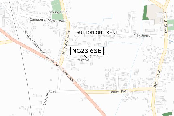
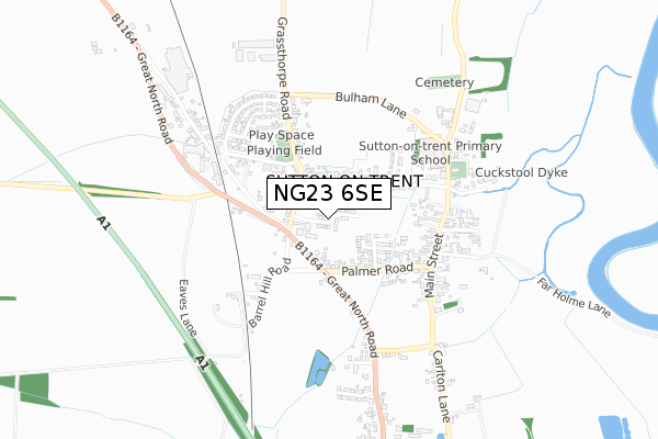
NG23 6SE is located in the Sutton-on-Trent electoral ward, within the local authority district of Newark and Sherwood and the English Parliamentary constituency of Newark. The Sub Integrated Care Board (ICB) Location is NHS Nottingham and Nottinghamshire ICB - 52R and the police force is Nottinghamshire. This postcode has been in use since December 2019.


GetTheData
Source: OS Open Zoomstack (Ordnance Survey)
Licence: Open Government Licence (requires attribution)
Attribution: Contains OS data © Crown copyright and database right 2024
Source: Open Postcode Geo
Licence: Open Government Licence (requires attribution)
Attribution: Contains OS data © Crown copyright and database right 2024; Contains Royal Mail data © Royal Mail copyright and database right 2024; Source: Office for National Statistics licensed under the Open Government Licence v.3.0
| Easting | 479638 |
| Northing | 365765 |
| Latitude | 53.183054 |
| Longitude | -0.809747 |
GetTheData
Source: Open Postcode Geo
Licence: Open Government Licence
| Country | England |
| Postcode District | NG23 |
| ➜ NG23 open data dashboard ➜ See where NG23 is on a map ➜ Where is Sutton on Trent? | |
GetTheData
Source: Land Registry Price Paid Data
Licence: Open Government Licence
| Ward | Sutton-on-trent |
| Constituency | Newark |
GetTheData
Source: ONS Postcode Database
Licence: Open Government Licence
| June 2022 | Shoplifting | On or near Nursery Lane | 116m |
| June 2022 | Anti-social behaviour | On or near Hemplands Lane | 189m |
| June 2022 | Other theft | On or near Station Road | 380m |
| ➜ Get more crime data in our Crime section | |||
GetTheData
Source: data.police.uk
Licence: Open Government Licence
| High Street | Sutton On Trent | 189m |
| High Street | Sutton On Trent | 198m |
| Palmer Road (Main Street) | Sutton On Trent | 374m |
| Palmer Road (Main Street) | Sutton On Trent | 382m |
| Main Street | Sutton On Trent | 409m |
| Collingham Station | 5.9km |
GetTheData
Source: NaPTAN
Licence: Open Government Licence
| Percentage of properties with Next Generation Access | 100.0% |
| Percentage of properties with Superfast Broadband | 100.0% |
| Percentage of properties with Ultrafast Broadband | 0.0% |
| Percentage of properties with Full Fibre Broadband | 0.0% |
Superfast Broadband is between 30Mbps and 300Mbps
Ultrafast Broadband is > 300Mbps
| Percentage of properties unable to receive 2Mbps | 0.0% |
| Percentage of properties unable to receive 5Mbps | 0.0% |
| Percentage of properties unable to receive 10Mbps | 0.0% |
| Percentage of properties unable to receive 30Mbps | 0.0% |
GetTheData
Source: Ofcom
Licence: Ofcom Terms of Use (requires attribution)
GetTheData
Source: ONS Postcode Database
Licence: Open Government Licence


➜ Get more ratings from the Food Standards Agency
GetTheData
Source: Food Standards Agency
Licence: FSA terms & conditions
| Last Collection | |||
|---|---|---|---|
| Location | Mon-Fri | Sat | Distance |
| Sutton On Trent Post Office | 17:00 | 11:30 | 175m |
| Main Street | 17:00 | 11:30 | 394m |
| Crow Park | 16:45 | 11:00 | 533m |
GetTheData
Source: Dracos
Licence: Creative Commons Attribution-ShareAlike
| Facility | Distance |
|---|---|
| Sutton-on-trent Village Sports And Community Centre Grassthorpe Road, Sutton-on-trent, Newark Grass Pitches | 1.1km |
| Besthorpe Primary (Closed) Main Road, Besthorpe, Newark Grass Pitches | 3.2km |
| St Matthews Ce Primary School Mill Lane, Normanton-on-trent, Newark Grass Pitches | 3.6km |
GetTheData
Source: Active Places
Licence: Open Government Licence
| School | Phase of Education | Distance |
|---|---|---|
| Sutton-On-Trent Primary and Nursery School Church Street, Sutton-on-Trent, Newark, NG23 6PD | Primary | 489m |
| St Matthew's CofE Primary School Mill Lane, Normanton-on-Trent, Newark, NG23 6RW | Primary | 3.6km |
| Norwell CofE Primary School School Lane, Norwell, Newark, NG23 6JP | Primary | 4.7km |
GetTheData
Source: Edubase
Licence: Open Government Licence
| Risk of NG23 6SE flooding from rivers and sea | Low |
| ➜ NG23 6SE flood map | |
GetTheData
Source: Open Flood Risk by Postcode
Licence: Open Government Licence
The below table lists the International Territorial Level (ITL) codes (formerly Nomenclature of Territorial Units for Statistics (NUTS) codes) and Local Administrative Units (LAU) codes for NG23 6SE:
| ITL 1 Code | Name |
|---|---|
| TLF | East Midlands (England) |
| ITL 2 Code | Name |
| TLF1 | Derbyshire and Nottinghamshire |
| ITL 3 Code | Name |
| TLF15 | North Nottinghamshire |
| LAU 1 Code | Name |
| E07000175 | Newark and Sherwood |
GetTheData
Source: ONS Postcode Directory
Licence: Open Government Licence
The below table lists the Census Output Area (OA), Lower Layer Super Output Area (LSOA), and Middle Layer Super Output Area (MSOA) for NG23 6SE:
| Code | Name | |
|---|---|---|
| OA | E00144461 | |
| LSOA | E01028350 | Newark and Sherwood 003E |
| MSOA | E02005895 | Newark and Sherwood 003 |
GetTheData
Source: ONS Postcode Directory
Licence: Open Government Licence
| NG23 6PY | Nursery Lane | 78m |
| NG23 6PX | Hounsfield Way | 114m |
| NG23 6QT | Willow Holt | 132m |
| NG23 6QA | High Street | 179m |
| NG23 6PZ | Forge Close | 181m |
| NG23 6PA | Rose Farm Drive | 181m |
| NG23 6PB | Poplar Close | 203m |
| NG23 6PU | Hemplands Lane | 214m |
| NG23 6PT | Great North Road | 217m |
| NG23 6PP | Palmer Road | 227m |
GetTheData
Source: Open Postcode Geo; Land Registry Price Paid Data
Licence: Open Government Licence