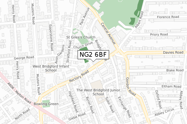
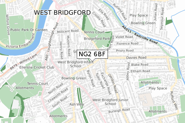
NG2 6BF is located in the Trent Bridge electoral ward, within the local authority district of Rushcliffe and the English Parliamentary constituency of Rushcliffe. The Sub Integrated Care Board (ICB) Location is NHS Nottingham and Nottinghamshire ICB - 52R and the police force is Nottinghamshire. This postcode has been in use since June 2019.


GetTheData
Source: OS Open Zoomstack (Ordnance Survey)
Licence: Open Government Licence (requires attribution)
Attribution: Contains OS data © Crown copyright and database right 2024
Source: Open Postcode Geo
Licence: Open Government Licence (requires attribution)
Attribution: Contains OS data © Crown copyright and database right 2024; Contains Royal Mail data © Royal Mail copyright and database right 2024; Source: Office for National Statistics licensed under the Open Government Licence v.3.0
| Easting | 458707 |
| Northing | 337388 |
| Latitude | 52.930716 |
| Longitude | -1.128074 |
GetTheData
Source: Open Postcode Geo
Licence: Open Government Licence
| Country | England |
| Postcode District | NG2 |
| ➜ NG2 open data dashboard ➜ See where NG2 is on a map ➜ Where is West Bridgford? | |
GetTheData
Source: Land Registry Price Paid Data
Licence: Open Government Licence
| Ward | Trent Bridge |
| Constituency | Rushcliffe |
GetTheData
Source: ONS Postcode Database
Licence: Open Government Licence
| January 2024 | Violence and sexual offences | On or near Parking Area | 198m |
| January 2024 | Vehicle crime | On or near Parking Area | 253m |
| December 2023 | Other theft | On or near Parking Area | 198m |
| ➜ Get more crime data in our Crime section | |||
GetTheData
Source: data.police.uk
Licence: Open Government Licence
| Rectory Road | West Bridgford | 40m |
| Rectory Road | West Bridgford | 42m |
| Central Avenue | West Bridgford | 160m |
| Central Avenue | West Bridgford | 165m |
| Gordon Road | West Bridgford | 217m |
| Nottingham Station | 2.2km |
| Netherfield Station | 4.7km |
| Carlton Station | 5.1km |
GetTheData
Source: NaPTAN
Licence: Open Government Licence
| Percentage of properties with Next Generation Access | 100.0% |
| Percentage of properties with Superfast Broadband | 100.0% |
| Percentage of properties with Ultrafast Broadband | 100.0% |
| Percentage of properties with Full Fibre Broadband | 0.0% |
Superfast Broadband is between 30Mbps and 300Mbps
Ultrafast Broadband is > 300Mbps
| Percentage of properties unable to receive 2Mbps | 0.0% |
| Percentage of properties unable to receive 5Mbps | 0.0% |
| Percentage of properties unable to receive 10Mbps | 0.0% |
| Percentage of properties unable to receive 30Mbps | 0.0% |
GetTheData
Source: Ofcom
Licence: Ofcom Terms of Use (requires attribution)
GetTheData
Source: ONS Postcode Database
Licence: Open Government Licence

➜ Get more ratings from the Food Standards Agency
GetTheData
Source: Food Standards Agency
Licence: FSA terms & conditions
| Last Collection | |||
|---|---|---|---|
| Location | Mon-Fri | Sat | Distance |
| Tudor Square | 17:30 | 12:30 | 139m |
| Tudor Square | 17:30 | 12:30 | 139m |
| Bridgford Road | 17:00 | 12:30 | 227m |
GetTheData
Source: Dracos
Licence: Creative Commons Attribution-ShareAlike
| Facility | Distance |
|---|---|
| The Fountain Ladies Health Studio (Closed) Gordon Road, West Bridgford, Nottingham Health and Fitness Gym | 179m |
| Musters Tennis Club Rectory Road, West Bridgford, Nottingham Outdoor Tennis Courts | 303m |
| The Fitness Space (West Bridgford) (Closed) Bridgford Road, West Bridgford, Nottingham Health and Fitness Gym | 339m |
GetTheData
Source: Active Places
Licence: Open Government Licence
| School | Phase of Education | Distance |
|---|---|---|
| West Bridgford Infant School Avon Gardens, George Road, West Bridgford, Nottingham, NG2 6BP | Primary | 227m |
| West Bridgford Junior School Exchange Road, West Bridgford, Nottingham, NG2 6DB | Primary | 641m |
| Abbey Road Primary School Tewkesbury Close, West Bridgford, Nottingham, NG2 5ND | Primary | 778m |
GetTheData
Source: Edubase
Licence: Open Government Licence
| Risk of NG2 6BF flooding from rivers and sea | Low |
| ➜ NG2 6BF flood map | |
GetTheData
Source: Open Flood Risk by Postcode
Licence: Open Government Licence
The below table lists the International Territorial Level (ITL) codes (formerly Nomenclature of Territorial Units for Statistics (NUTS) codes) and Local Administrative Units (LAU) codes for NG2 6BF:
| ITL 1 Code | Name |
|---|---|
| TLF | East Midlands (England) |
| ITL 2 Code | Name |
| TLF1 | Derbyshire and Nottinghamshire |
| ITL 3 Code | Name |
| TLF16 | South Nottinghamshire |
| LAU 1 Code | Name |
| E07000176 | Rushcliffe |
GetTheData
Source: ONS Postcode Directory
Licence: Open Government Licence
The below table lists the Census Output Area (OA), Lower Layer Super Output Area (LSOA), and Middle Layer Super Output Area (MSOA) for NG2 6BF:
| Code | Name | |
|---|---|---|
| OA | E00144800 | |
| LSOA | E01028416 | Rushcliffe 005D |
| MSOA | E02005910 | Rushcliffe 005 |
GetTheData
Source: ONS Postcode Directory
Licence: Open Government Licence
| NG2 6BS | Rectory Court | 62m |
| NG2 6BU | Rectory Road | 70m |
| NG2 6BW | The Poplars | 83m |
| NG2 6BB | Wellington Crescent | 91m |
| NG2 6AY | Church Drive | 118m |
| NG2 6EE | Tudor Road | 124m |
| NG2 6BE | Rectory Road | 130m |
| NG2 6BA | Stratford Road | 159m |
| NG2 5GR | Central Avenue | 160m |
| NG2 6AZ | Stratford Road | 163m |
GetTheData
Source: Open Postcode Geo; Land Registry Price Paid Data
Licence: Open Government Licence