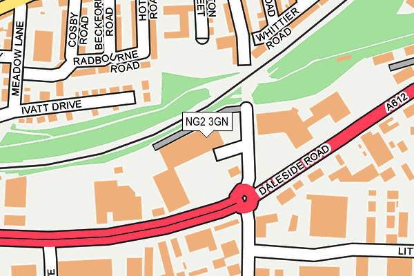
NG2 3GN is located in the Dales electoral ward, within the unitary authority of Nottingham and the English Parliamentary constituency of Nottingham East. The Sub Integrated Care Board (ICB) Location is NHS Nottingham and Nottinghamshire ICB - 52R and the police force is Nottinghamshire. This postcode has been in use since November 2015.


GetTheData
Source: OS OpenMap – Local (Ordnance Survey)
Source: OS VectorMap District (Ordnance Survey)
Licence: Open Government Licence (requires attribution)
| Easting | 458914 |
| Northing | 339252 |
| Latitude | 52.947447 |
| Longitude | -1.124657 |
GetTheData
Source: Open Postcode Geo
Licence: Open Government Licence
| Country | England |
| Postcode District | NG2 |
➜ See where NG2 is on a map ➜ Where is Nottingham? | |
GetTheData
Source: Land Registry Price Paid Data
Licence: Open Government Licence
Elevation or altitude of NG2 3GN as distance above sea level:
| Metres | Feet | |
|---|---|---|
| Elevation | 30m | 98ft |
Elevation is measured from the approximate centre of the postcode, to the nearest point on an OS contour line from OS Terrain 50, which has contour spacing of ten vertical metres.
➜ How high above sea level am I? Find the elevation of your current position using your device's GPS.
GetTheData
Source: Open Postcode Elevation
Licence: Open Government Licence
| Ward | Dales |
| Constituency | Nottingham East |
GetTheData
Source: ONS Postcode Database
Licence: Open Government Licence
| Trent Lane (Daleside Road) | Meadow Lane Industrial Estate | 89m |
| Trent Lane (Daleside Road) | Meadow Lane Industrial Estate | 110m |
| Poulton Drive (Daleside Road) | Meadow Lane Industrial Estate | 177m |
| Poulton Drive (Daleside Road) | Meadow Lane Industrial Estate | 211m |
| Virgin Media (Daleside Road) | Sneinton | 223m |
| Nottingham Station Tram Stop (N/A) | Nottingham | 1,412m |
| Lace Market Tram Stop (Fletcher Gate) | Nottingham | 1,529m |
| Nottingham Station | 1.5km |
| Netherfield Station | 3.4km |
| Carlton Station | 3.7km |
GetTheData
Source: NaPTAN
Licence: Open Government Licence
GetTheData
Source: ONS Postcode Database
Licence: Open Government Licence


➜ Get more ratings from the Food Standards Agency
GetTheData
Source: Food Standards Agency
Licence: FSA terms & conditions
| Last Collection | |||
|---|---|---|---|
| Location | Mon-Fri | Sat | Distance |
| Trent Lane | 17:00 | 11:30 | 178m |
| Thoresby Avenue | 18:45 | 11:00 | 278m |
| Kentwood Road | 17:00 | 11:00 | 331m |
GetTheData
Source: Dracos
Licence: Creative Commons Attribution-ShareAlike
The below table lists the International Territorial Level (ITL) codes (formerly Nomenclature of Territorial Units for Statistics (NUTS) codes) and Local Administrative Units (LAU) codes for NG2 3GN:
| ITL 1 Code | Name |
|---|---|
| TLF | East Midlands (England) |
| ITL 2 Code | Name |
| TLF1 | Derbyshire and Nottinghamshire |
| ITL 3 Code | Name |
| TLF14 | Nottingham |
| LAU 1 Code | Name |
| E06000018 | Nottingham |
GetTheData
Source: ONS Postcode Directory
Licence: Open Government Licence
The below table lists the Census Output Area (OA), Lower Layer Super Output Area (LSOA), and Middle Layer Super Output Area (MSOA) for NG2 3GN:
| Code | Name | |
|---|---|---|
| OA | E00173466 | |
| LSOA | E01013920 | Nottingham 029C |
| MSOA | E02002896 | Nottingham 029 |
GetTheData
Source: ONS Postcode Directory
Licence: Open Government Licence
| NG2 4BZ | Hoten Road | 188m |
| NG2 4DD | Hutton Street | 198m |
| NG2 4BY | Beckford Road | 215m |
| NG2 4DS | Trent Lane | 223m |
| NG2 4DF | Trent Lane | 224m |
| NG2 4BW | Cosby Road | 240m |
| NG2 3GG | Daleside Road | 245m |
| NG2 4DA | Colwick Road | 246m |
| NG2 4AR | Kingsley Road | 270m |
| NG2 4BU | Colwick Road | 278m |
GetTheData
Source: Open Postcode Geo; Land Registry Price Paid Data
Licence: Open Government Licence