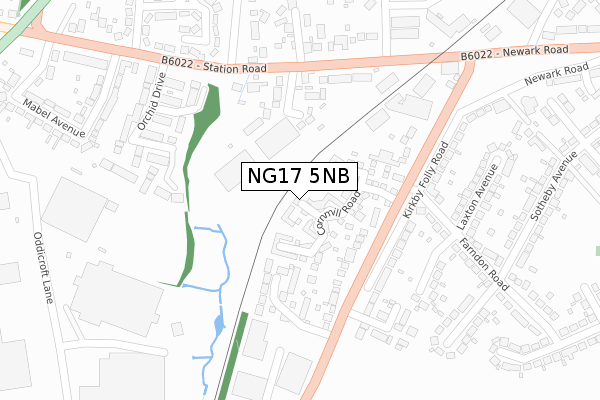
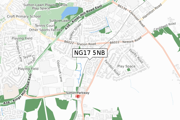
NG17 5NB is located in the Sutton Junction & Harlow Wood electoral ward, within the local authority district of Ashfield and the English Parliamentary constituency of Ashfield. The Sub Integrated Care Board (ICB) Location is NHS Nottingham and Nottinghamshire ICB - 52R and the police force is Nottinghamshire. This postcode has been in use since December 2019.


GetTheData
Source: OS Open Zoomstack (Ordnance Survey)
Licence: Open Government Licence (requires attribution)
Attribution: Contains OS data © Crown copyright and database right 2024
Source: Open Postcode Geo
Licence: Open Government Licence (requires attribution)
Attribution: Contains OS data © Crown copyright and database right 2024; Contains Royal Mail data © Royal Mail copyright and database right 2024; Source: Office for National Statistics licensed under the Open Government Licence v.3.0
| Easting | 452505 |
| Northing | 358990 |
| Latitude | 53.125520 |
| Longitude | -1.216823 |
GetTheData
Source: Open Postcode Geo
Licence: Open Government Licence
| Country | England |
| Postcode District | NG17 |
| ➜ NG17 open data dashboard ➜ See where NG17 is on a map | |
GetTheData
Source: Land Registry Price Paid Data
Licence: Open Government Licence
| Ward | Sutton Junction & Harlow Wood |
| Constituency | Ashfield |
GetTheData
Source: ONS Postcode Database
Licence: Open Government Licence
| June 2022 | Vehicle crime | On or near Lower Oakham Way | 325m |
| June 2022 | Vehicle crime | On or near Lower Oakham Way | 325m |
| June 2022 | Vehicle crime | On or near Lower Oakham Way | 325m |
| ➜ Get more crime data in our Crime section | |||
GetTheData
Source: data.police.uk
Licence: Open Government Licence
| Rainbow International (Lower Oakham Way) | Oakham Business Park | 343m |
| Hamilton Road | Sutton Junction | 1,003m |
| Hamilton Road (Coxmoor Road) | Sutton Junction | 1,044m |
| Hamilton Road (Coxmoor Road) | Sutton Junction | 1,053m |
| Matlock Avenue (Sheepbridge Lane) | High Oakham | 1,072m |
| Mansfield Station | 2.2km |
| Sutton Parkway Station | 2.3km |
| Kirkby in Ashfield Station | 3.7km |
GetTheData
Source: NaPTAN
Licence: Open Government Licence
GetTheData
Source: ONS Postcode Database
Licence: Open Government Licence


➜ Get more ratings from the Food Standards Agency
GetTheData
Source: Food Standards Agency
Licence: FSA terms & conditions
| Last Collection | |||
|---|---|---|---|
| Location | Mon-Fri | Sat | Distance |
| Sheepbridge Lane | 17:15 | 11:00 | 1,068m |
| Kings Mill Hospital | 17:00 | 11:00 | 1,409m |
| Moor Lane | 17:30 | 11:00 | 1,659m |
GetTheData
Source: Dracos
Licence: Creative Commons Attribution-ShareAlike
| Facility | Distance |
|---|---|
| High Oakham Primary School Nottingham Road, Mansfield Grass Pitches | 1.5km |
| Mansfield Athletic Fc (Lane End) Unwin Road, Sutton-in-ashfield Grass Pitches | 1.5km |
| Polly Bowls Sports Ground Unwin Road, Sutton-in-ashfield Grass Pitches | 1.6km |
GetTheData
Source: Active Places
Licence: Open Government Licence
| School | Phase of Education | Distance |
|---|---|---|
| High Oakham Primary School Nottingham Road, Mansfield, NG18 4SH | Primary | 1.5km |
| Sutton Road Primary School Moor Lane, Mansfield, NG18 5SF | Primary | 1.7km |
| West Nottinghamshire College Derby Road, Mansfield, NG18 5BH | 16 plus | 1.7km |
GetTheData
Source: Edubase
Licence: Open Government Licence
The below table lists the International Territorial Level (ITL) codes (formerly Nomenclature of Territorial Units for Statistics (NUTS) codes) and Local Administrative Units (LAU) codes for NG17 5NB:
| ITL 1 Code | Name |
|---|---|
| TLF | East Midlands (England) |
| ITL 2 Code | Name |
| TLF1 | Derbyshire and Nottinghamshire |
| ITL 3 Code | Name |
| TLF15 | North Nottinghamshire |
| LAU 1 Code | Name |
| E07000170 | Ashfield |
GetTheData
Source: ONS Postcode Directory
Licence: Open Government Licence
The below table lists the Census Output Area (OA), Lower Layer Super Output Area (LSOA), and Middle Layer Super Output Area (MSOA) for NG17 5NB:
| Code | Name | |
|---|---|---|
| OA | E00142548 | |
| LSOA | E01027973 | Ashfield 007E |
| MSOA | E02005825 | Ashfield 007 |
GetTheData
Source: ONS Postcode Directory
Licence: Open Government Licence
| NG18 5FT | Kestral Road | 589m |
| NG17 5LU | Cauldwell Road | 650m |
| NG17 5LB | Cauldwell Road | 654m |
| NG18 5ES | Hermitage Way | 734m |
| NG18 5ER | Kings Mill Way | 766m |
| NG18 5FA | Hamilton Place | 859m |
| NG18 5FB | Hamilton Court | 929m |
| NG18 5HG | The Hermitage | 991m |
| NG18 5AR | High Oakham Grange | 1005m |
| NG18 5GR | Worsbrough Close | 1023m |
GetTheData
Source: Open Postcode Geo; Land Registry Price Paid Data
Licence: Open Government Licence