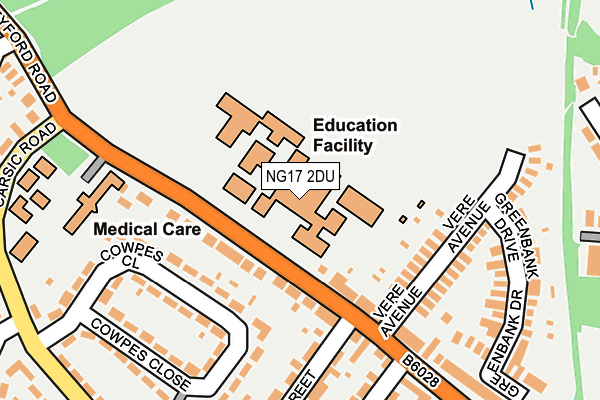
NG17 2DU is located in the The Dales electoral ward, within the local authority district of Ashfield and the English Parliamentary constituency of Ashfield. The Sub Integrated Care Board (ICB) Location is NHS Nottingham and Nottinghamshire ICB - 52R and the police force is Nottinghamshire. This postcode has been in use since January 1980.


GetTheData
Source: OS OpenMap – Local (Ordnance Survey)
Source: OS VectorMap District (Ordnance Survey)
Licence: Open Government Licence (requires attribution)
| Easting | 449180 |
| Northing | 360081 |
| Latitude | 53.135624 |
| Longitude | -1.266342 |
GetTheData
Source: Open Postcode Geo
Licence: Open Government Licence
| Country | England |
| Postcode District | NG17 |
➜ See where NG17 is on a map ➜ Where is Sutton in Ashfield? | |
GetTheData
Source: Land Registry Price Paid Data
Licence: Open Government Licence
Elevation or altitude of NG17 2DU as distance above sea level:
| Metres | Feet | |
|---|---|---|
| Elevation | 160m | 525ft |
Elevation is measured from the approximate centre of the postcode, to the nearest point on an OS contour line from OS Terrain 50, which has contour spacing of ten vertical metres.
➜ How high above sea level am I? Find the elevation of your current position using your device's GPS.
GetTheData
Source: Open Postcode Elevation
Licence: Open Government Licence
| Ward | The Dales |
| Constituency | Ashfield |
GetTheData
Source: ONS Postcode Database
Licence: Open Government Licence
| Fern Street (Stoneyford Road) | Sutton In Ashfield | 84m |
| Fern Street (Stoneyford Road) | Sutton In Ashfield | 85m |
| Glen Street (Stoneyford Road) | Sutton In Ashfield | 231m |
| Glen Street (Stoneyford Road) | Sutton In Ashfield | 239m |
| Stoneyford Road | Sutton In Ashfield | 292m |
| Sutton Parkway Station | 2.8km |
| Kirkby in Ashfield Station | 4.1km |
| Mansfield Station | 4.6km |
GetTheData
Source: NaPTAN
Licence: Open Government Licence
GetTheData
Source: ONS Postcode Database
Licence: Open Government Licence


➜ Get more ratings from the Food Standards Agency
GetTheData
Source: Food Standards Agency
Licence: FSA terms & conditions
| Last Collection | |||
|---|---|---|---|
| Location | Mon-Fri | Sat | Distance |
| Stoneyford Road | 17:00 | 10:30 | 184m |
| Sowter Avenue | 16:45 | 10:30 | 522m |
| The Oval Post Office | 16:45 | 11:00 | 601m |
GetTheData
Source: Dracos
Licence: Creative Commons Attribution-ShareAlike
The below table lists the International Territorial Level (ITL) codes (formerly Nomenclature of Territorial Units for Statistics (NUTS) codes) and Local Administrative Units (LAU) codes for NG17 2DU:
| ITL 1 Code | Name |
|---|---|
| TLF | East Midlands (England) |
| ITL 2 Code | Name |
| TLF1 | Derbyshire and Nottinghamshire |
| ITL 3 Code | Name |
| TLF15 | North Nottinghamshire |
| LAU 1 Code | Name |
| E07000170 | Ashfield |
GetTheData
Source: ONS Postcode Directory
Licence: Open Government Licence
The below table lists the Census Output Area (OA), Lower Layer Super Output Area (LSOA), and Middle Layer Super Output Area (MSOA) for NG17 2DU:
| Code | Name | |
|---|---|---|
| OA | E00142488 | |
| LSOA | E01027964 | Ashfield 005A |
| MSOA | E02005823 | Ashfield 005 |
GetTheData
Source: ONS Postcode Directory
Licence: Open Government Licence
| NG17 2DR | Stoneyford Road | 86m |
| NG17 2DT | Stoneyford Road | 111m |
| NG17 2BU | Cowpes Close | 122m |
| NG17 2DS | Vere Avenue | 168m |
| NG17 2DN | Stoneyford Road | 181m |
| NG17 2BT | Cowpes Close | 206m |
| NG17 2DW | Fern Street | 218m |
| NG17 2DP | Glen Street | 224m |
| NG17 2DY | Greenbank Drive | 230m |
| NG17 2DL | Stoneyford Road | 268m |
GetTheData
Source: Open Postcode Geo; Land Registry Price Paid Data
Licence: Open Government Licence