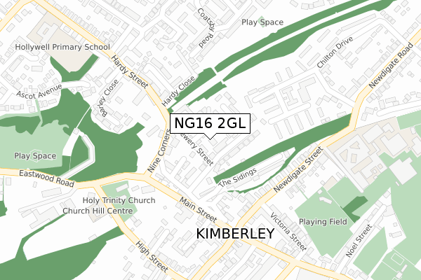
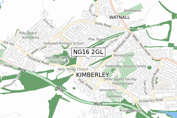
NG16 2GL lies on Cider Orchard Place in Kimberley, Nottingham. NG16 2GL is located in the Kimberley electoral ward, within the local authority district of Broxtowe and the English Parliamentary constituency of Broxtowe. The Sub Integrated Care Board (ICB) Location is NHS Nottingham and Nottinghamshire ICB - 52R and the police force is Nottinghamshire. This postcode has been in use since August 2008.


GetTheData
Source: OS Open Zoomstack (Ordnance Survey)
Licence: Open Government Licence (requires attribution)
Attribution: Contains OS data © Crown copyright and database right 2025
Source: Open Postcode Geo
Licence: Open Government Licence (requires attribution)
Attribution: Contains OS data © Crown copyright and database right 2025; Contains Royal Mail data © Royal Mail copyright and database right 2025; Source: Office for National Statistics licensed under the Open Government Licence v.3.0
| Easting | 449901 |
| Northing | 344941 |
| Latitude | 52.999493 |
| Longitude | -1.257906 |
GetTheData
Source: Open Postcode Geo
Licence: Open Government Licence
| Street | Cider Orchard Place |
| Locality | Kimberley |
| Town/City | Nottingham |
| Country | England |
| Postcode District | NG16 |
➜ See where NG16 is on a map ➜ Where is Kimberley? | |
GetTheData
Source: Land Registry Price Paid Data
Licence: Open Government Licence
Elevation or altitude of NG16 2GL as distance above sea level:
| Metres | Feet | |
|---|---|---|
| Elevation | 100m | 328ft |
Elevation is measured from the approximate centre of the postcode, to the nearest point on an OS contour line from OS Terrain 50, which has contour spacing of ten vertical metres.
➜ How high above sea level am I? Find the elevation of your current position using your device's GPS.
GetTheData
Source: Open Postcode Elevation
Licence: Open Government Licence
| Ward | Kimberley |
| Constituency | Broxtowe |
GetTheData
Source: ONS Postcode Database
Licence: Open Government Licence
2, CIDER ORCHARD PLACE, KIMBERLEY, NOTTINGHAM, NG16 2GL 2014 9 DEC £150,000 |
2, CIDER ORCHARD PLACE, KIMBERLEY, NOTTINGHAM, NG16 2GL 2009 24 JUL £176,500 |
1, CIDER ORCHARD PLACE, KIMBERLEY, NOTTINGHAM, NG16 2GL 2008 6 AUG £147,500 |
GetTheData
Source: HM Land Registry Price Paid Data
Licence: Contains HM Land Registry data © Crown copyright and database right 2025. This data is licensed under the Open Government Licence v3.0.
| Nine Corners | Kimberley | 133m |
| Nine Corners (Main Street) | Kimberley | 156m |
| Nine Corners (Eastwood Road) | Kimberley | 251m |
| Library (Main Street) | Kimberley | 271m |
| School (Newdigate Street) | Kimberley | 276m |
| Ilkeston Station | 3.3km |
| Bulwell Station | 4.1km |
| Langley Mill Station | 5.3km |
GetTheData
Source: NaPTAN
Licence: Open Government Licence
| Percentage of properties with Next Generation Access | 100.0% |
| Percentage of properties with Superfast Broadband | 50.0% |
| Percentage of properties with Ultrafast Broadband | 0.0% |
| Percentage of properties with Full Fibre Broadband | 0.0% |
Superfast Broadband is between 30Mbps and 300Mbps
Ultrafast Broadband is > 300Mbps
| Percentage of properties unable to receive 2Mbps | 0.0% |
| Percentage of properties unable to receive 5Mbps | 0.0% |
| Percentage of properties unable to receive 10Mbps | 0.0% |
| Percentage of properties unable to receive 30Mbps | 50.0% |
GetTheData
Source: Ofcom
Licence: Ofcom Terms of Use (requires attribution)
GetTheData
Source: ONS Postcode Database
Licence: Open Government Licence


➜ Get more ratings from the Food Standards Agency
GetTheData
Source: Food Standards Agency
Licence: FSA terms & conditions
| Last Collection | |||
|---|---|---|---|
| Location | Mon-Fri | Sat | Distance |
| Kimberley Post Office | 17:15 | 12:00 | 204m |
| Broomhill Road | 16:30 | 11:45 | 460m |
| Newdigate | 16:30 | 12:15 | 520m |
GetTheData
Source: Dracos
Licence: Creative Commons Attribution-ShareAlike
The below table lists the International Territorial Level (ITL) codes (formerly Nomenclature of Territorial Units for Statistics (NUTS) codes) and Local Administrative Units (LAU) codes for NG16 2GL:
| ITL 1 Code | Name |
|---|---|
| TLF | East Midlands (England) |
| ITL 2 Code | Name |
| TLF1 | Derbyshire and Nottinghamshire |
| ITL 3 Code | Name |
| TLF16 | South Nottinghamshire |
| LAU 1 Code | Name |
| E07000172 | Broxtowe |
GetTheData
Source: ONS Postcode Directory
Licence: Open Government Licence
The below table lists the Census Output Area (OA), Lower Layer Super Output Area (LSOA), and Middle Layer Super Output Area (MSOA) for NG16 2GL:
| Code | Name | |
|---|---|---|
| OA | E00143208 | |
| LSOA | E01028103 | Broxtowe 004B |
| MSOA | E02005853 | Broxtowe 004 |
GetTheData
Source: ONS Postcode Directory
Licence: Open Government Licence
| NG16 2JS | Brewery Street | 28m |
| NG16 2JT | Critchs Flats | 32m |
| NG16 2JR | Edgwood Road | 64m |
| NG16 2JU | Browns Flats | 77m |
| NG16 2JP | Rock Side | 82m |
| NG16 2NQ | Chapel Place | 89m |
| NG16 2HT | Abba Close | 111m |
| NG16 2WR | The Sidings | 130m |
| NG16 2NN | Railway Cottages | 131m |
| NG16 2NR | Station Road | 138m |
GetTheData
Source: Open Postcode Geo; Land Registry Price Paid Data
Licence: Open Government Licence