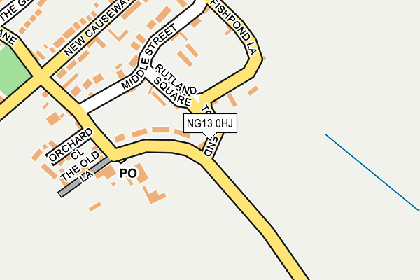
NG13 0HJ lies on Town End in Barkestone, Nottingham. NG13 0HJ is located in the Long Clawson and Stathern electoral ward, within the local authority district of Melton and the English Parliamentary constituency of Rutland and Melton. The Sub Integrated Care Board (ICB) Location is NHS Leicester, Leicestershire and Rutland ICB - 03W and the police force is Leicestershire. This postcode has been in use since January 1980.


GetTheData
Source: OS OpenMap – Local (Ordnance Survey)
Source: OS VectorMap District (Ordnance Survey)
Licence: Open Government Licence (requires attribution)
| Easting | 478177 |
| Northing | 334766 |
| Latitude | 52.904674 |
| Longitude | -0.839111 |
GetTheData
Source: Open Postcode Geo
Licence: Open Government Licence
| Street | Town End |
| Locality | Barkestone |
| Town/City | Nottingham |
| Country | England |
| Postcode District | NG13 |
➜ See where NG13 is on a map ➜ Where is Barkestone-le-Vale? | |
GetTheData
Source: Land Registry Price Paid Data
Licence: Open Government Licence
Elevation or altitude of NG13 0HJ as distance above sea level:
| Metres | Feet | |
|---|---|---|
| Elevation | 60m | 197ft |
Elevation is measured from the approximate centre of the postcode, to the nearest point on an OS contour line from OS Terrain 50, which has contour spacing of ten vertical metres.
➜ How high above sea level am I? Find the elevation of your current position using your device's GPS.
GetTheData
Source: Open Postcode Elevation
Licence: Open Government Licence
| Ward | Long Clawson And Stathern |
| Constituency | Rutland And Melton |
GetTheData
Source: ONS Postcode Database
Licence: Open Government Licence
| Chapel Street (New Causeway) | Barkestone-le-vale | 233m |
| Chapel Street (New Causeway) | Barkestone-le-vale | 241m |
| Church (Plungar Lane) | Plungar | 1,449m |
| Church (Plungar Lane) | Plungar | 1,451m |
| The Anchor (Granby Lane) | Plungar | 1,573m |
| Bottesford Station | 5.4km |
GetTheData
Source: NaPTAN
Licence: Open Government Licence
| Percentage of properties with Next Generation Access | 100.0% |
| Percentage of properties with Superfast Broadband | 100.0% |
| Percentage of properties with Ultrafast Broadband | 0.0% |
| Percentage of properties with Full Fibre Broadband | 0.0% |
Superfast Broadband is between 30Mbps and 300Mbps
Ultrafast Broadband is > 300Mbps
| Percentage of properties unable to receive 2Mbps | 0.0% |
| Percentage of properties unable to receive 5Mbps | 0.0% |
| Percentage of properties unable to receive 10Mbps | 0.0% |
| Percentage of properties unable to receive 30Mbps | 0.0% |
GetTheData
Source: Ofcom
Licence: Ofcom Terms of Use (requires attribution)
GetTheData
Source: ONS Postcode Database
Licence: Open Government Licence


➜ Get more ratings from the Food Standards Agency
GetTheData
Source: Food Standards Agency
Licence: FSA terms & conditions
| Last Collection | |||
|---|---|---|---|
| Location | Mon-Fri | Sat | Distance |
| Sutton Cum Granby | 16:30 | 09:30 | 3,384m |
| Granby | 16:30 | 09:30 | 3,517m |
| Elton | 16:45 | 09:45 | 4,338m |
GetTheData
Source: Dracos
Licence: Creative Commons Attribution-ShareAlike
The below table lists the International Territorial Level (ITL) codes (formerly Nomenclature of Territorial Units for Statistics (NUTS) codes) and Local Administrative Units (LAU) codes for NG13 0HJ:
| ITL 1 Code | Name |
|---|---|
| TLF | East Midlands (England) |
| ITL 2 Code | Name |
| TLF2 | Leicestershire, Rutland and Northamptonshire |
| ITL 3 Code | Name |
| TLF22 | Leicestershire CC and Rutland |
| LAU 1 Code | Name |
| E07000133 | Melton |
GetTheData
Source: ONS Postcode Directory
Licence: Open Government Licence
The below table lists the Census Output Area (OA), Lower Layer Super Output Area (LSOA), and Middle Layer Super Output Area (MSOA) for NG13 0HJ:
| Code | Name | |
|---|---|---|
| OA | E00131386 | |
| LSOA | E01025892 | Melton 001F |
| MSOA | E02005391 | Melton 001 |
GetTheData
Source: ONS Postcode Directory
Licence: Open Government Licence
| NG13 0HN | Rutland Square | 68m |
| NG13 0HG | Fishpond Lane | 69m |
| NG13 0HB | Middle Street | 154m |
| NG13 0HE | Chapel Street | 167m |
| NG13 0HD | The Old Lane | 194m |
| NG13 0HA | New Causeway | 221m |
| NG13 0HU | Orchard Close | 240m |
| NG13 0HR | Marshall Farm Close | 304m |
| NG13 0HH | The Green | 314m |
| NG13 0HF | Jericho Lane | 390m |
GetTheData
Source: Open Postcode Geo; Land Registry Price Paid Data
Licence: Open Government Licence