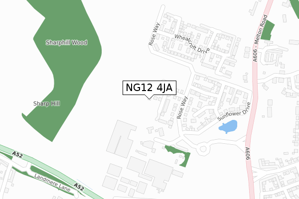
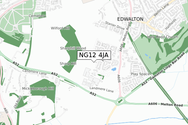
NG12 4JA is located in the Edwalton electoral ward, within the local authority district of Rushcliffe and the English Parliamentary constituency of Rushcliffe. The Sub Integrated Care Board (ICB) Location is NHS Nottingham and Nottinghamshire ICB - 52R and the police force is Nottinghamshire. This postcode has been in use since November 2019.


GetTheData
Source: OS Open Zoomstack (Ordnance Survey)
Licence: Open Government Licence (requires attribution)
Attribution: Contains OS data © Crown copyright and database right 2024
Source: Open Postcode Geo
Licence: Open Government Licence (requires attribution)
Attribution: Contains OS data © Crown copyright and database right 2024; Contains Royal Mail data © Royal Mail copyright and database right 2024; Source: Office for National Statistics licensed under the Open Government Licence v.3.0
| Easting | 458948 |
| Northing | 334663 |
| Latitude | 52.906197 |
| Longitude | -1.124983 |
GetTheData
Source: Open Postcode Geo
Licence: Open Government Licence
| Country | England |
| Postcode District | NG12 |
| ➜ NG12 open data dashboard ➜ See where NG12 is on a map ➜ Where is Edwalton? | |
GetTheData
Source: Land Registry Price Paid Data
Licence: Open Government Licence
| Ward | Edwalton |
| Constituency | Rushcliffe |
GetTheData
Source: ONS Postcode Database
Licence: Open Government Licence
| June 2022 | Violence and sexual offences | On or near Hill Farm Court | 391m |
| June 2022 | Violence and sexual offences | On or near Hill Farm Court | 391m |
| June 2022 | Violence and sexual offences | On or near Hill Farm Court | 391m |
| ➜ Get more crime data in our Crime section | |||
GetTheData
Source: data.police.uk
Licence: Open Government Licence
| Hill Farm Court (Melton Road) | Edwalton | 391m |
| Hill Farm Court (Melton Road) | Edwalton | 403m |
| Wheatcrofts (Melton Road) | Edwalton | 472m |
| Wheatcrofts (Melton Road) | Edwalton | 489m |
| Edwalton Hall (Melton Road) | Edwalton | 762m |
| Nottingham Station | 4.8km |
GetTheData
Source: NaPTAN
Licence: Open Government Licence
GetTheData
Source: ONS Postcode Database
Licence: Open Government Licence


➜ Get more ratings from the Food Standards Agency
GetTheData
Source: Food Standards Agency
Licence: FSA terms & conditions
| Last Collection | |||
|---|---|---|---|
| Location | Mon-Fri | Sat | Distance |
| Edwalton Hall | 17:00 | 11:00 | 753m |
| Landmere Lane | 17:30 | 09:30 | 851m |
| Edwalton Post Office | 17:00 | 12:00 | 1,092m |
GetTheData
Source: Dracos
Licence: Creative Commons Attribution-ShareAlike
| Facility | Distance |
|---|---|
| Rosecliffe Spencer Academy Rose Way, Rose Way, Edwalton, Nottingham Grass Pitches | 254m |
| Rushcliffe School Boundary Road, West Bridgford, Nottingham Grass Pitches, Sports Hall, Artificial Grass Pitch | 1km |
| Rushcliffe Leisure Centre (Closed) Boundary Road, West Bridgford, Nottingham Sports Hall, Swimming Pool, Health and Fitness Gym, Artificial Grass Pitch, Studio, Squash Courts | 1km |
GetTheData
Source: Active Places
Licence: Open Government Licence
| School | Phase of Education | Distance |
|---|---|---|
| Rosecliffe Spencer Academy 73 Rose Way, Edwalton, Nottingham, NG12 4JE | Primary | 254m |
| Rushcliffe Spencer Academy Boundary Road, West Bridgford, Nottingham, NG2 7BW | Secondary | 1km |
| Jesse Gray Primary School Musters Road, West Bridgford, Nottingham, NG2 7DD | Primary | 1.4km |
GetTheData
Source: Edubase
Licence: Open Government Licence
The below table lists the International Territorial Level (ITL) codes (formerly Nomenclature of Territorial Units for Statistics (NUTS) codes) and Local Administrative Units (LAU) codes for NG12 4JA:
| ITL 1 Code | Name |
|---|---|
| TLF | East Midlands (England) |
| ITL 2 Code | Name |
| TLF1 | Derbyshire and Nottinghamshire |
| ITL 3 Code | Name |
| TLF16 | South Nottinghamshire |
| LAU 1 Code | Name |
| E07000176 | Rushcliffe |
GetTheData
Source: ONS Postcode Directory
Licence: Open Government Licence
The below table lists the Census Output Area (OA), Lower Layer Super Output Area (LSOA), and Middle Layer Super Output Area (MSOA) for NG12 4JA:
| Code | Name | |
|---|---|---|
| OA | E00144575 | |
| LSOA | E01028373 | Rushcliffe 008B |
| MSOA | E02005913 | Rushcliffe 008 |
GetTheData
Source: ONS Postcode Directory
Licence: Open Government Licence
| NG12 4DG | Landmere Lane | 303m |
| NG12 4DB | Melton Road | 378m |
| NG12 4DD | Melton Road | 433m |
| NG12 4DP | Hill Farm Court | 436m |
| NG11 6NL | Wayte Court | 559m |
| NG12 4FB | Birkdale Close | 651m |
| NG12 4DT | Edwalton Lodge Close | 698m |
| NG12 4DS | Machins Lane | 715m |
| NG12 4AR | The Paddocks | 724m |
| NG12 4HE | Village Street | 729m |
GetTheData
Source: Open Postcode Geo; Land Registry Price Paid Data
Licence: Open Government Licence