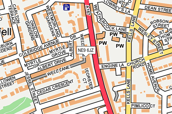
NE9 6JZ is located in the Low Fell electoral ward, within the metropolitan district of Gateshead and the English Parliamentary constituency of Gateshead. The Sub Integrated Care Board (ICB) Location is NHS North East and North Cumbria ICB - 13T and the police force is Northumbria. This postcode has been in use since April 2006.


GetTheData
Source: OS OpenMap – Local (Ordnance Survey)
Source: OS VectorMap District (Ordnance Survey)
Licence: Open Government Licence (requires attribution)
| Easting | 425756 |
| Northing | 560001 |
| Latitude | 54.934025 |
| Longitude | -1.599565 |
GetTheData
Source: Open Postcode Geo
Licence: Open Government Licence
| Country | England |
| Postcode District | NE9 |
➜ See where NE9 is on a map ➜ Where is Gateshead? | |
GetTheData
Source: Land Registry Price Paid Data
Licence: Open Government Licence
Elevation or altitude of NE9 6JZ as distance above sea level:
| Metres | Feet | |
|---|---|---|
| Elevation | 80m | 262ft |
Elevation is measured from the approximate centre of the postcode, to the nearest point on an OS contour line from OS Terrain 50, which has contour spacing of ten vertical metres.
➜ How high above sea level am I? Find the elevation of your current position using your device's GPS.
GetTheData
Source: Open Postcode Elevation
Licence: Open Government Licence
| Ward | Low Fell |
| Constituency | Gateshead |
GetTheData
Source: ONS Postcode Database
Licence: Open Government Licence
| Durham Road-engine Lane (Durham Road) | Low Fell | 35m |
| Durham Road-albert Drive (Durham Road) | Low Fell | 52m |
| Kells Lane-albert Place (Kells Lane) | Low Fell | 154m |
| Kells Lane-lowreys Lane (Kells Lane) | Low Fell | 214m |
| Kells Lane-wesley Street (Kells Lane) | Low Fell | 215m |
| Dunston Station | 3.3km |
| Heworth Station | 3.4km |
| Newcastle Station | 4km |
GetTheData
Source: NaPTAN
Licence: Open Government Licence
| Percentage of properties with Next Generation Access | 100.0% |
| Percentage of properties with Superfast Broadband | 100.0% |
| Percentage of properties with Ultrafast Broadband | 0.0% |
| Percentage of properties with Full Fibre Broadband | 0.0% |
Superfast Broadband is between 30Mbps and 300Mbps
Ultrafast Broadband is > 300Mbps
| Percentage of properties unable to receive 2Mbps | 0.0% |
| Percentage of properties unable to receive 5Mbps | 0.0% |
| Percentage of properties unable to receive 10Mbps | 0.0% |
| Percentage of properties unable to receive 30Mbps | 0.0% |
GetTheData
Source: Ofcom
Licence: Ofcom Terms of Use (requires attribution)
GetTheData
Source: ONS Postcode Database
Licence: Open Government Licence


➜ Get more ratings from the Food Standards Agency
GetTheData
Source: Food Standards Agency
Licence: FSA terms & conditions
| Last Collection | |||
|---|---|---|---|
| Location | Mon-Fri | Sat | Distance |
| Low Fell Delivery Office | 17:00 | 12:00 | 210m |
| Killowen Street | 17:30 | 12:00 | 221m |
| Glenbrooke Terrace | 17:30 | 12:00 | 237m |
GetTheData
Source: Dracos
Licence: Creative Commons Attribution-ShareAlike
The below table lists the International Territorial Level (ITL) codes (formerly Nomenclature of Territorial Units for Statistics (NUTS) codes) and Local Administrative Units (LAU) codes for NE9 6JZ:
| ITL 1 Code | Name |
|---|---|
| TLC | North East (England) |
| ITL 2 Code | Name |
| TLC2 | Northumberland, and Tyne and Wear |
| ITL 3 Code | Name |
| TLC22 | Tyneside |
| LAU 1 Code | Name |
| E08000037 | Gateshead |
GetTheData
Source: ONS Postcode Directory
Licence: Open Government Licence
The below table lists the Census Output Area (OA), Lower Layer Super Output Area (LSOA), and Middle Layer Super Output Area (MSOA) for NE9 6JZ:
| Code | Name | |
|---|---|---|
| OA | E00041757 | |
| LSOA | E01008239 | Gateshead 020D |
| MSOA | E02001701 | Gateshead 020 |
GetTheData
Source: ONS Postcode Directory
Licence: Open Government Licence
| NE9 6JW | Well Lane | 14m |
| NE9 5JJ | Engine Lane | 76m |
| NE9 6HX | Durham Road | 78m |
| NE9 6HZ | Forster Court | 78m |
| NE9 6EH | Albert Drive | 95m |
| NE9 6EJ | Albert Drive | 105m |
| NE9 5HA | Durham Road | 111m |
| NE9 5EY | Durham Road | 117m |
| NE9 6ER | Cedar Crescent | 127m |
| NE9 6EB | Callaurie Court | 131m |
GetTheData
Source: Open Postcode Geo; Land Registry Price Paid Data
Licence: Open Government Licence