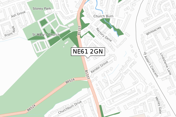
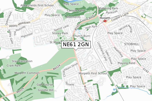
NE61 2GN is located in the Morpeth Kirkhill electoral ward, within the unitary authority of Northumberland and the English Parliamentary constituency of Wansbeck. The Sub Integrated Care Board (ICB) Location is NHS North East and North Cumbria ICB - 00L and the police force is Northumbria. This postcode has been in use since September 2018.


GetTheData
Source: OS Open Zoomstack (Ordnance Survey)
Licence: Open Government Licence (requires attribution)
Attribution: Contains OS data © Crown copyright and database right 2024
Source: Open Postcode Geo
Licence: Open Government Licence (requires attribution)
Attribution: Contains OS data © Crown copyright and database right 2024; Contains Royal Mail data © Royal Mail copyright and database right 2024; Source: Office for National Statistics licensed under the Open Government Licence v.3.0
| Easting | 419809 |
| Northing | 584897 |
| Latitude | 55.158014 |
| Longitude | -1.690671 |
GetTheData
Source: Open Postcode Geo
Licence: Open Government Licence
| Country | England |
| Postcode District | NE61 |
| ➜ NE61 open data dashboard ➜ See where NE61 is on a map ➜ Where is Morpeth? | |
GetTheData
Source: Land Registry Price Paid Data
Licence: Open Government Licence
| Ward | Morpeth Kirkhill |
| Constituency | Wansbeck |
GetTheData
Source: ONS Postcode Database
Licence: Open Government Licence
| September 2023 | Anti-social behaviour | On or near Merley Gate | 465m |
| June 2022 | Violence and sexual offences | On or near Kendor Grove | 82m |
| June 2022 | Bicycle theft | On or near Hillside | 263m |
| ➜ Get more crime data in our Crime section | |||
GetTheData
Source: data.police.uk
Licence: Open Government Licence
| Morpeth Cottage Hospital (A197) | Loansdean | 43m |
| The Kylins (A197) | Loansdean | 167m |
| The Kylins (A197) | Loansdean | 221m |
| Sun Inn (A197) | Morpeth | 348m |
| Sun Inn (A197) | Morpeth | 365m |
| Morpeth Station | 0.7km |
| Pegswood Station | 3.7km |
GetTheData
Source: NaPTAN
Licence: Open Government Licence
➜ Broadband speed and availability dashboard for NE61 2GN
| Percentage of properties with Next Generation Access | 100.0% |
| Percentage of properties with Superfast Broadband | 100.0% |
| Percentage of properties with Ultrafast Broadband | 0.0% |
| Percentage of properties with Full Fibre Broadband | 0.0% |
Superfast Broadband is between 30Mbps and 300Mbps
Ultrafast Broadband is > 300Mbps
| Median download speed | 40.0Mbps |
| Average download speed | 39.7Mbps |
| Maximum download speed | 79.98Mbps |
| Median upload speed | 10.0Mbps |
| Average upload speed | 8.4Mbps |
| Maximum upload speed | 20.00Mbps |
| Percentage of properties unable to receive 2Mbps | 0.0% |
| Percentage of properties unable to receive 5Mbps | 0.0% |
| Percentage of properties unable to receive 10Mbps | 0.0% |
| Percentage of properties unable to receive 30Mbps | 0.0% |
➜ Broadband speed and availability dashboard for NE61 2GN
GetTheData
Source: Ofcom
Licence: Ofcom Terms of Use (requires attribution)
GetTheData
Source: ONS Postcode Database
Licence: Open Government Licence


➜ Get more ratings from the Food Standards Agency
GetTheData
Source: Food Standards Agency
Licence: FSA terms & conditions
| Last Collection | |||
|---|---|---|---|
| Location | Mon-Fri | Sat | Distance |
| Railway Station | 17:30 | 11:45 | 697m |
| Chantry Place | 17:30 | 12:00 | 1,031m |
| Chantry Place | 17:30 | 12:00 | 1,031m |
GetTheData
Source: Dracos
Licence: Creative Commons Attribution-ShareAlike
| Facility | Distance |
|---|---|
| Morpeth Golf Club Loansdean, Morpeth Golf | 87m |
| Storey Park St. Marys Field, Morpeth Grass Pitches | 394m |
| Carlisle Park Castle Square, Morpeth Outdoor Tennis Courts | 790m |
GetTheData
Source: Active Places
Licence: Open Government Licence
| School | Phase of Education | Distance |
|---|---|---|
| Morpeth First School Loansdean, Morpeth, NE61 2AP | Primary | 460m |
| Kyloe House Care of: Northumberland County Council, County Hall, Morpeth, NE61 2EF | Not applicable | 627m |
| Abbeyfields First School Abbot's Way, Morpeth, NE61 2LZ | Primary | 964m |
GetTheData
Source: Edubase
Licence: Open Government Licence
The below table lists the International Territorial Level (ITL) codes (formerly Nomenclature of Territorial Units for Statistics (NUTS) codes) and Local Administrative Units (LAU) codes for NE61 2GN:
| ITL 1 Code | Name |
|---|---|
| TLC | North East (England) |
| ITL 2 Code | Name |
| TLC2 | Northumberland, and Tyne and Wear |
| ITL 3 Code | Name |
| TLC21 | Northumberland |
| LAU 1 Code | Name |
| E06000057 | Northumberland |
GetTheData
Source: ONS Postcode Directory
Licence: Open Government Licence
The below table lists the Census Output Area (OA), Lower Layer Super Output Area (LSOA), and Middle Layer Super Output Area (MSOA) for NE61 2GN:
| Code | Name | |
|---|---|---|
| OA | E00139751 | |
| LSOA | E01027458 | Northumberland 018C |
| MSOA | E02005724 | Northumberland 018 |
GetTheData
Source: ONS Postcode Directory
Licence: Open Government Licence
| NE61 2BU | Kendor Grove | 102m |
| NE61 2BX | Loansdean Cottage | 136m |
| NE61 2TD | Rectory Dene | 187m |
| NE61 2SZ | Rectory Park | 197m |
| NE61 2FB | Loansdean Wood | 214m |
| NE61 2BY | Churchburn Drive | 218m |
| NE61 2DZ | Sweethope Dene | 223m |
| NE61 2SU | Hillside | 263m |
| NE61 2QF | St Marys Field | 289m |
| NE61 2DQ | The Crescent | 291m |
GetTheData
Source: Open Postcode Geo; Land Registry Price Paid Data
Licence: Open Government Licence