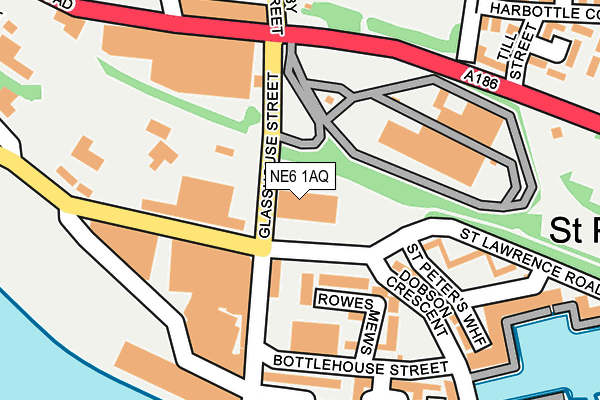
NE6 1AQ is located in the Byker electoral ward, within the metropolitan district of Newcastle upon Tyne and the English Parliamentary constituency of Newcastle upon Tyne East. The Sub Integrated Care Board (ICB) Location is NHS North East and North Cumbria ICB - 13T and the police force is Northumbria. This postcode has been in use since June 1996.


GetTheData
Source: OS OpenMap – Local (Ordnance Survey)
Source: OS VectorMap District (Ordnance Survey)
Licence: Open Government Licence (requires attribution)
| Easting | 427190 |
| Northing | 563720 |
| Latitude | 54.967368 |
| Longitude | -1.576835 |
GetTheData
Source: Open Postcode Geo
Licence: Open Government Licence
| Country | England |
| Postcode District | NE6 |
➜ See where NE6 is on a map ➜ Where is Newcastle upon Tyne? | |
GetTheData
Source: Land Registry Price Paid Data
Licence: Open Government Licence
Elevation or altitude of NE6 1AQ as distance above sea level:
| Metres | Feet | |
|---|---|---|
| Elevation | 10m | 33ft |
Elevation is measured from the approximate centre of the postcode, to the nearest point on an OS contour line from OS Terrain 50, which has contour spacing of ten vertical metres.
➜ How high above sea level am I? Find the elevation of your current position using your device's GPS.
GetTheData
Source: Open Postcode Elevation
Licence: Open Government Licence
| Ward | Byker |
| Constituency | Newcastle Upon Tyne East |
GetTheData
Source: ONS Postcode Database
Licence: Open Government Licence
| St Lawrence Road | St Peter's | 52m |
| Walker Road-raby Street (Walker Road) | St Peter's | 169m |
| St Peters Basin (Bottlehouse Street) | St Peter's | 170m |
| Walker Road-brinkburn Street (Walker Road) | St Peter's | 194m |
| Walker Road-brinkburn Street (Walker Road) | St Peter's | 202m |
| Byker (Tyne And Wear Metro Station) (Byker Bridge) | Byker | 991m |
| Gateshead Stadium (Tyne And Wear Metro Station) (St James Road) | Gateshead Stadium | 1,283m |
| Manors Station | 1.9km |
| Heworth Station | 2.2km |
| Newcastle Station | 2.6km |
GetTheData
Source: NaPTAN
Licence: Open Government Licence
GetTheData
Source: ONS Postcode Database
Licence: Open Government Licence


➜ Get more ratings from the Food Standards Agency
GetTheData
Source: Food Standards Agency
Licence: FSA terms & conditions
| Last Collection | |||
|---|---|---|---|
| Location | Mon-Fri | Sat | Distance |
| Allendale Road | 17:30 | 12:00 | 640m |
| St Lawrence Road | 18:30 | 12:30 | 650m |
| Saltmeadows Road | 17:45 | 12:00 | 654m |
GetTheData
Source: Dracos
Licence: Creative Commons Attribution-ShareAlike
The below table lists the International Territorial Level (ITL) codes (formerly Nomenclature of Territorial Units for Statistics (NUTS) codes) and Local Administrative Units (LAU) codes for NE6 1AQ:
| ITL 1 Code | Name |
|---|---|
| TLC | North East (England) |
| ITL 2 Code | Name |
| TLC2 | Northumberland, and Tyne and Wear |
| ITL 3 Code | Name |
| TLC22 | Tyneside |
| LAU 1 Code | Name |
| E08000021 | Newcastle upon Tyne |
GetTheData
Source: ONS Postcode Directory
Licence: Open Government Licence
The below table lists the Census Output Area (OA), Lower Layer Super Output Area (LSOA), and Middle Layer Super Output Area (MSOA) for NE6 1AQ:
| Code | Name | |
|---|---|---|
| OA | E00042117 | |
| LSOA | E01008301 | Newcastle upon Tyne 026A |
| MSOA | E02001733 | Newcastle upon Tyne 026 |
GetTheData
Source: ONS Postcode Directory
Licence: Open Government Licence
| NE6 1TX | Rowes Mews | 131m |
| NE6 1TT | Dobson Crescent | 169m |
| NE6 1UG | Foundry Court | 184m |
| NE6 1BH | Churchill Mews | 208m |
| NE6 1TW | St Peters Wharf | 226m |
| NE6 1TZ | St Peters Wharf | 233m |
| NE6 1TR | Merchants Wharf | 235m |
| NE6 2AW | Ruddock Square | 274m |
| NE6 1UQ | Chandlers Quay | 305m |
| NE6 2BA | St Peters Road | 307m |
GetTheData
Source: Open Postcode Geo; Land Registry Price Paid Data
Licence: Open Government Licence