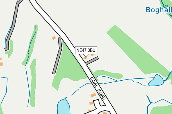
NE47 0BU lies on Fell Cottages in Slaley, Hexham. NE47 0BU is located in the South Tynedale electoral ward, within the unitary authority of Northumberland and the English Parliamentary constituency of Hexham. The Sub Integrated Care Board (ICB) Location is NHS North East and North Cumbria ICB - 00L and the police force is Northumbria. This postcode has been in use since January 1980.


GetTheData
Source: OS OpenMap – Local (Ordnance Survey)
Source: OS VectorMap District (Ordnance Survey)
Licence: Open Government Licence (requires attribution)
| Easting | 398843 |
| Northing | 556365 |
| Latitude | 54.902007 |
| Longitude | -2.019571 |
GetTheData
Source: Open Postcode Geo
Licence: Open Government Licence
| Street | Fell Cottages |
| Locality | Slaley |
| Town/City | Hexham |
| Country | England |
| Postcode District | NE47 |
➜ See where NE47 is on a map | |
GetTheData
Source: Land Registry Price Paid Data
Licence: Open Government Licence
Elevation or altitude of NE47 0BU as distance above sea level:
| Metres | Feet | |
|---|---|---|
| Elevation | 220m | 722ft |
Elevation is measured from the approximate centre of the postcode, to the nearest point on an OS contour line from OS Terrain 50, which has contour spacing of ten vertical metres.
➜ How high above sea level am I? Find the elevation of your current position using your device's GPS.
GetTheData
Source: Open Postcode Elevation
Licence: Open Government Licence
| Ward | South Tynedale |
| Constituency | Hexham |
GetTheData
Source: ONS Postcode Database
Licence: Open Government Licence
| Hotel Lodge (Hotel Approach) | Slaley | 454m |
| The Glen (Street) | Slaley | 587m |
| The Glen (Street) | Slaley | 588m |
| Slaley Hall Road End (Street) | Slaley | 676m |
| Slaley Hall Road End (Street) | Slaley | 684m |
GetTheData
Source: NaPTAN
Licence: Open Government Licence
| Percentage of properties with Next Generation Access | 100.0% |
| Percentage of properties with Superfast Broadband | 100.0% |
| Percentage of properties with Ultrafast Broadband | 0.0% |
| Percentage of properties with Full Fibre Broadband | 0.0% |
Superfast Broadband is between 30Mbps and 300Mbps
Ultrafast Broadband is > 300Mbps
| Percentage of properties unable to receive 2Mbps | 0.0% |
| Percentage of properties unable to receive 5Mbps | 0.0% |
| Percentage of properties unable to receive 10Mbps | 0.0% |
| Percentage of properties unable to receive 30Mbps | 0.0% |
GetTheData
Source: Ofcom
Licence: Ofcom Terms of Use (requires attribution)
GetTheData
Source: ONS Postcode Database
Licence: Open Government Licence


➜ Get more ratings from the Food Standards Agency
GetTheData
Source: Food Standards Agency
Licence: FSA terms & conditions
| Last Collection | |||
|---|---|---|---|
| Location | Mon-Fri | Sat | Distance |
| Healey | 16:15 | 10:00 | 3,207m |
GetTheData
Source: Dracos
Licence: Creative Commons Attribution-ShareAlike
The below table lists the International Territorial Level (ITL) codes (formerly Nomenclature of Territorial Units for Statistics (NUTS) codes) and Local Administrative Units (LAU) codes for NE47 0BU:
| ITL 1 Code | Name |
|---|---|
| TLC | North East (England) |
| ITL 2 Code | Name |
| TLC2 | Northumberland, and Tyne and Wear |
| ITL 3 Code | Name |
| TLC21 | Northumberland |
| LAU 1 Code | Name |
| E06000057 | Northumberland |
GetTheData
Source: ONS Postcode Directory
Licence: Open Government Licence
The below table lists the Census Output Area (OA), Lower Layer Super Output Area (LSOA), and Middle Layer Super Output Area (MSOA) for NE47 0BU:
| Code | Name | |
|---|---|---|
| OA | E00139989 | |
| LSOA | E01027505 | Northumberland 040E |
| MSOA | E02005733 | Northumberland 040 |
GetTheData
Source: ONS Postcode Directory
Licence: Open Government Licence
| NE47 0BT | 305m | |
| NE47 0BX | 557m | |
| NE47 0BN | 566m | |
| NE47 0BG | Slaley Park | 662m |
| NE47 0BP | 802m | |
| NE47 0BL | 1145m | |
| NE47 0BY | 1223m | |
| NE47 0BD | Reaston View | 1647m |
| NE47 0BB | 1671m | |
| NE47 0BQ | 1713m |
GetTheData
Source: Open Postcode Geo; Land Registry Price Paid Data
Licence: Open Government Licence