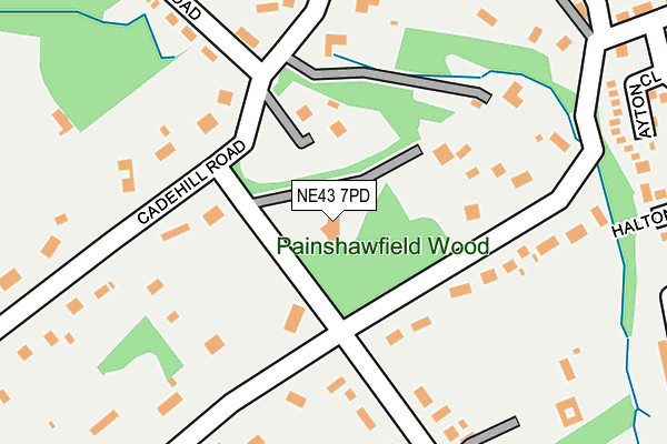
NE43 7PD lies on Apperley Road in Stocksfield. NE43 7PD is located in the Stocksfield and Broomhaugh electoral ward, within the unitary authority of Northumberland and the English Parliamentary constituency of Hexham. The Sub Integrated Care Board (ICB) Location is NHS North East and North Cumbria ICB - 00L and the police force is Northumbria. This postcode has been in use since January 1980.


GetTheData
Source: OS OpenMap – Local (Ordnance Survey)
Source: OS VectorMap District (Ordnance Survey)
Licence: Open Government Licence (requires attribution)
| Easting | 406254 |
| Northing | 560810 |
| Latitude | 54.941923 |
| Longitude | -1.903917 |
GetTheData
Source: Open Postcode Geo
Licence: Open Government Licence
| Street | Apperley Road |
| Town/City | Stocksfield |
| Country | England |
| Postcode District | NE43 |
➜ See where NE43 is on a map ➜ Where is Stocksfield? | |
GetTheData
Source: Land Registry Price Paid Data
Licence: Open Government Licence
Elevation or altitude of NE43 7PD as distance above sea level:
| Metres | Feet | |
|---|---|---|
| Elevation | 50m | 164ft |
Elevation is measured from the approximate centre of the postcode, to the nearest point on an OS contour line from OS Terrain 50, which has contour spacing of ten vertical metres.
➜ How high above sea level am I? Find the elevation of your current position using your device's GPS.
GetTheData
Source: Open Postcode Elevation
Licence: Open Government Licence
| Ward | Stocksfield And Broomhaugh |
| Constituency | Hexham |
GetTheData
Source: ONS Postcode Database
Licence: Open Government Licence
3, APPERLEY ROAD, STOCKSFIELD, NE43 7PD 2022 31 JAN £1,018,000 |
5, APPERLEY ROAD, STOCKSFIELD, NE43 7PD 2005 26 OCT £600,000 |
GetTheData
Source: HM Land Registry Price Paid Data
Licence: Contains HM Land Registry data © Crown copyright and database right 2025. This data is licensed under the Open Government Licence v3.0.
| Cottages (A695) | Birches Nook | 381m |
| Cottages (A695) | Birches Nook | 468m |
| Surgery (A695) | Branch End | 592m |
| New Ridley Road | Painshawfield | 632m |
| New Ridley Road | Painshawfield | 662m |
| Stocksfield Station | 1km |
| Prudhoe Station | 3.7km |
| Riding Mill Station | 4.4km |
GetTheData
Source: NaPTAN
Licence: Open Government Licence
| Percentage of properties with Next Generation Access | 100.0% |
| Percentage of properties with Superfast Broadband | 100.0% |
| Percentage of properties with Ultrafast Broadband | 0.0% |
| Percentage of properties with Full Fibre Broadband | 0.0% |
Superfast Broadband is between 30Mbps and 300Mbps
Ultrafast Broadband is > 300Mbps
| Percentage of properties unable to receive 2Mbps | 0.0% |
| Percentage of properties unable to receive 5Mbps | 0.0% |
| Percentage of properties unable to receive 10Mbps | 0.0% |
| Percentage of properties unable to receive 30Mbps | 0.0% |
GetTheData
Source: Ofcom
Licence: Ofcom Terms of Use (requires attribution)
GetTheData
Source: ONS Postcode Database
Licence: Open Government Licence


➜ Get more ratings from the Food Standards Agency
GetTheData
Source: Food Standards Agency
Licence: FSA terms & conditions
| Last Collection | |||
|---|---|---|---|
| Location | Mon-Fri | Sat | Distance |
| Cadehill Road | 16:30 | 11:45 | 140m |
| Apperley Road | 16:30 | 11:45 | 381m |
| Meadowfield Road | 16:30 | 11:45 | 430m |
GetTheData
Source: Dracos
Licence: Creative Commons Attribution-ShareAlike
The below table lists the International Territorial Level (ITL) codes (formerly Nomenclature of Territorial Units for Statistics (NUTS) codes) and Local Administrative Units (LAU) codes for NE43 7PD:
| ITL 1 Code | Name |
|---|---|
| TLC | North East (England) |
| ITL 2 Code | Name |
| TLC2 | Northumberland, and Tyne and Wear |
| ITL 3 Code | Name |
| TLC21 | Northumberland |
| LAU 1 Code | Name |
| E06000057 | Northumberland |
GetTheData
Source: ONS Postcode Directory
Licence: Open Government Licence
The below table lists the Census Output Area (OA), Lower Layer Super Output Area (LSOA), and Middle Layer Super Output Area (MSOA) for NE43 7PD:
| Code | Name | |
|---|---|---|
| OA | E00140001 | |
| LSOA | E01027507 | Northumberland 039E |
| MSOA | E02005732 | Northumberland 039 |
GetTheData
Source: ONS Postcode Directory
Licence: Open Government Licence
| NE43 7PE | Apperley Road | 95m |
| NE43 7DZ | Painshawfield Road | 162m |
| NE43 7PT | Cade Hill Road | 188m |
| NE43 7PB | Cade Hill Road | 204m |
| NE43 7PF | Painshawfield Road | 211m |
| NE43 7DX | Cade Hill Road | 237m |
| NE43 7DY | Painshawfield Road | 249m |
| NE43 7ES | Ayton Close | 271m |
| NE43 7DU | Main Road | 295m |
| NE43 7ET | Halton Close | 306m |
GetTheData
Source: Open Postcode Geo; Land Registry Price Paid Data
Licence: Open Government Licence