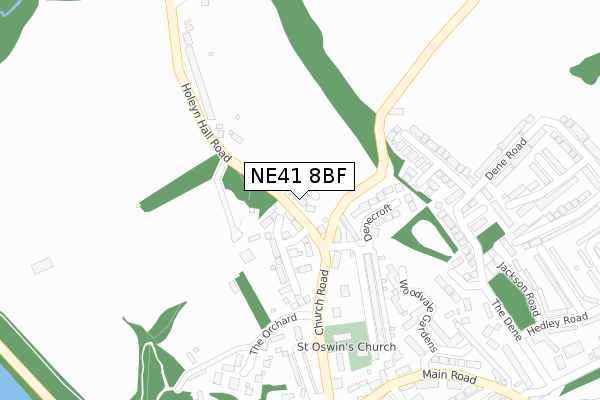
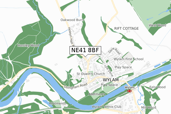
NE41 8BF is located in the Bywell electoral ward, within the unitary authority of Northumberland and the English Parliamentary constituency of Hexham. The Sub Integrated Care Board (ICB) Location is NHS North East and North Cumbria ICB - 00L and the police force is Northumbria. This postcode has been in use since August 2017.


GetTheData
Source: OS Open Zoomstack (Ordnance Survey)
Licence: Open Government Licence (requires attribution)
Attribution: Contains OS data © Crown copyright and database right 2024
Source: Open Postcode Geo
Licence: Open Government Licence (requires attribution)
Attribution: Contains OS data © Crown copyright and database right 2024; Contains Royal Mail data © Royal Mail copyright and database right 2024; Source: Office for National Statistics licensed under the Open Government Licence v.3.0
| Easting | 411293 |
| Northing | 564965 |
| Latitude | 54.979172 |
| Longitude | -1.825100 |
GetTheData
Source: Open Postcode Geo
Licence: Open Government Licence
| Country | England |
| Postcode District | NE41 |
| ➜ NE41 open data dashboard ➜ See where NE41 is on a map ➜ Where is Wylam? | |
GetTheData
Source: Land Registry Price Paid Data
Licence: Open Government Licence
| Ward | Bywell |
| Constituency | Hexham |
GetTheData
Source: ONS Postcode Database
Licence: Open Government Licence
| June 2022 | Anti-social behaviour | On or near Woodvale Gardens | 289m |
| June 2022 | Violence and sexual offences | On or near Chapel Lane | 388m |
| June 2022 | Violence and sexual offences | On or near Chapel Lane | 388m |
| ➜ Get more crime data in our Crime section | |||
GetTheData
Source: data.police.uk
Licence: Open Government Licence
| Holeyn Hall Road | Wylam | 123m |
| Holeyn Hall Road | Wylam | 146m |
| Black Bull (Main Road) | Wylam | 343m |
| Black Bull (Main Road) | Wylam | 357m |
| Charlie's Corner (Church Road) | Wylam | 379m |
| Wylam Station | 0.8km |
| Prudhoe Station | 2.9km |
GetTheData
Source: NaPTAN
Licence: Open Government Licence
➜ Broadband speed and availability dashboard for NE41 8BF
| Percentage of properties with Next Generation Access | 100.0% |
| Percentage of properties with Superfast Broadband | 100.0% |
| Percentage of properties with Ultrafast Broadband | 0.0% |
| Percentage of properties with Full Fibre Broadband | 0.0% |
Superfast Broadband is between 30Mbps and 300Mbps
Ultrafast Broadband is > 300Mbps
| Median download speed | 29.2Mbps |
| Average download speed | 33.6Mbps |
| Maximum download speed | 65.44Mbps |
| Median upload speed | 1.2Mbps |
| Average upload speed | 5.2Mbps |
| Maximum upload speed | 16.14Mbps |
| Percentage of properties unable to receive 2Mbps | 0.0% |
| Percentage of properties unable to receive 5Mbps | 0.0% |
| Percentage of properties unable to receive 10Mbps | 0.0% |
| Percentage of properties unable to receive 30Mbps | 0.0% |
➜ Broadband speed and availability dashboard for NE41 8BF
GetTheData
Source: Ofcom
Licence: Ofcom Terms of Use (requires attribution)
GetTheData
Source: ONS Postcode Database
Licence: Open Government Licence


➜ Get more ratings from the Food Standards Agency
GetTheData
Source: Food Standards Agency
Licence: FSA terms & conditions
| Last Collection | |||
|---|---|---|---|
| Location | Mon-Fri | Sat | Distance |
| The Dene | 16:30 | 12:00 | 275m |
| Wylam Post Office | 17:45 | 12:00 | 353m |
| Wylam Post Office | 17:45 | 12:00 | 353m |
GetTheData
Source: Dracos
Licence: Creative Commons Attribution-ShareAlike
| Facility | Distance |
|---|---|
| The Munroe Hall At Wylam Institute Church Road, Wylam Sports Hall | 313m |
| Wylam Jubilee Field Main Road, Wylam Grass Pitches | 574m |
| Wylam First School Bell Road, Wylam Grass Pitches | 589m |
GetTheData
Source: Active Places
Licence: Open Government Licence
| School | Phase of Education | Distance |
|---|---|---|
| Wylam First School Bell Road, Wylam, NE41 8EH | Primary | 598m |
| Adderlane Academy Broomhill Road, Adderlane Academy, Prudhoe, NE42 5HX | Primary | 2km |
| Heddon-on-the-Wall, St Andrew's Church of England Primary School Trajan Walk, Heddon-on-the-Wall, Newcastle-upon-Tyne, NE15 0BJ | Primary | 2.7km |
GetTheData
Source: Edubase
Licence: Open Government Licence
The below table lists the International Territorial Level (ITL) codes (formerly Nomenclature of Territorial Units for Statistics (NUTS) codes) and Local Administrative Units (LAU) codes for NE41 8BF:
| ITL 1 Code | Name |
|---|---|
| TLC | North East (England) |
| ITL 2 Code | Name |
| TLC2 | Northumberland, and Tyne and Wear |
| ITL 3 Code | Name |
| TLC21 | Northumberland |
| LAU 1 Code | Name |
| E06000057 | Northumberland |
GetTheData
Source: ONS Postcode Directory
Licence: Open Government Licence
The below table lists the Census Output Area (OA), Lower Layer Super Output Area (LSOA), and Middle Layer Super Output Area (MSOA) for NE41 8BF:
| Code | Name | |
|---|---|---|
| OA | E00140036 | |
| LSOA | E01027513 | Northumberland 036D |
| MSOA | E02005729 | Northumberland 036 |
GetTheData
Source: ONS Postcode Directory
Licence: Open Government Licence
| NE41 8BA | Holeyn Hall Road | 48m |
| NE41 8AZ | Dene Terrace West | 83m |
| NE41 8AY | Dene Terrace East | 91m |
| NE41 8DE | Denecroft | 149m |
| NE41 8AT | Church Road | 173m |
| NE41 8AX | Algernon Terrace | 207m |
| NE41 8EU | Bluebell Close | 209m |
| NE41 8ER | Woodvale Gardens | 214m |
| NE41 8EY | Dene Road | 264m |
| NE41 8BB | Holeyn Hall Road | 271m |
GetTheData
Source: Open Postcode Geo; Land Registry Price Paid Data
Licence: Open Government Licence