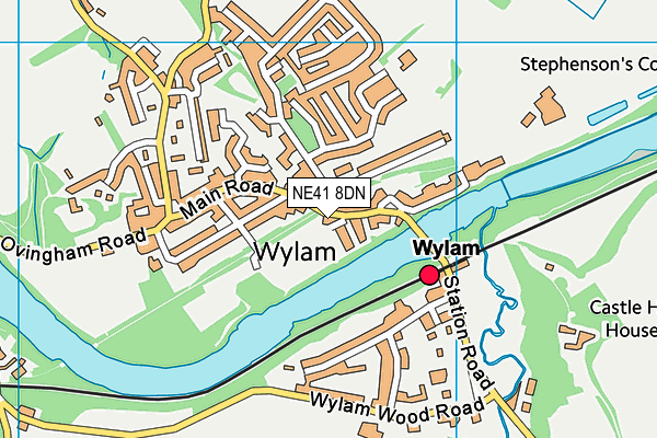
Wylam Jubilee Field
Wylam Jubilee Field is located in Wylam (NE41), and offers Grass Pitches.
| Address | Main Road, Wylam, NE41 8DN |
| Management Type | Community Organisation |
| Management Group | Others |
| Owner Type | Community Organisation |
| Owner Group | Community Organisation |
| Education Phase | Not applicable |
Aliases
Wylam Jubilee Field is also known as:
Facilities
| Accessibility | Sports Club / Community Association |
| Management Type | Sport Club |
| Year Built | 1975 |
| Changing Rooms | Yes |
| Year Changing Rooms Refurbished | 1993 |
| Date Record Checked | 12th Oct 2023 |
| Opening Times | Dawn To Dusk |
Facility specifics
Disabled access
| Disabled Access | Yes |
| Disabled Toilets | Yes |
| Spectator Areas | Yes |
| Accessibility | Sports Club / Community Association |
| Management Type | Community Organisation |
| Year Built | 1975 |
| Changing Rooms | Yes |
| Year Changing Rooms Refurbished | 1993 |
| Date Record Checked | 12th Oct 2023 |
| Opening Times | Dawn To Dusk |
Facility specifics
Disabled access
| Disabled Access | Yes |
| Disabled Toilets | Yes |
| Spectator Areas | Yes |
Contact
Disabled access
Disabled access for Wylam Jubilee Field
| Disabled Access | Yes |
| Finding/Reaching Entrance | Yes |
| Activity Areas | Yes |
| Disabled Toilets | Yes |
| Spectator Areas | Yes |
| Notes | We have two different types of swing for disabled children and a wheelchair accessible roundabout for disabled people of all ages. |
Where is Wylam Jubilee Field?
| Sub Building Name | |
| Building Name | |
| Building Number | 0 |
| Dependent Thoroughfare | |
| Thoroughfare Name | Main Road |
| Double Dependent Locality | |
| Dependent Locality | |
| PostTown | Wylam |
| Postcode | NE41 8DN |
Wylam Jubilee Field on a map

Wylam Jubilee Field geodata
| Easting | 411625.79 |
| Northing | 564497.44 |
| Latitude | 54.974956 |
| Longitude | -1.819908 |
| Local Authority Name | Northumberland |
| Local Authority Code | E06000057 |
| Parliamentary Constituency Name | Hexham |
| Parliamentary Constituency Code | E14000746 |
| Region Name | North East |
| Region Code | E15000001 |
| Ward Name | Bywell |
| Ward Code | E05009106 |
| Output Area Code | E00140035 |
About this data
This data is open data sourced from Active Places Power and licenced under the Active Places Open Data Licence.
| Created On | 18th May 2007 |
| Audited On | 12th Oct 2023 |
| Checked On | 12th Oct 2023 |
