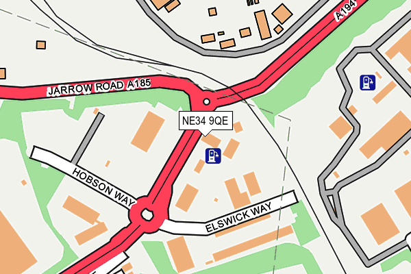
NE34 9QE is located in the Simonside and Rekendyke electoral ward, within the metropolitan district of South Tyneside and the English Parliamentary constituency of South Shields. The Sub Integrated Care Board (ICB) Location is NHS North East and North Cumbria ICB - 00N and the police force is Northumbria. This postcode has been in use since January 1980.


GetTheData
Source: OS OpenMap – Local (Ordnance Survey)
Source: OS VectorMap District (Ordnance Survey)
Licence: Open Government Licence (requires attribution)
| Easting | 435233 |
| Northing | 564738 |
| Latitude | 54.976021 |
| Longitude | -1.451101 |
GetTheData
Source: Open Postcode Geo
Licence: Open Government Licence
| Country | England |
| Postcode District | NE34 |
➜ See where NE34 is on a map ➜ Where is Jarrow? | |
GetTheData
Source: Land Registry Price Paid Data
Licence: Open Government Licence
Elevation or altitude of NE34 9QE as distance above sea level:
| Metres | Feet | |
|---|---|---|
| Elevation | 10m | 33ft |
Elevation is measured from the approximate centre of the postcode, to the nearest point on an OS contour line from OS Terrain 50, which has contour spacing of ten vertical metres.
➜ How high above sea level am I? Find the elevation of your current position using your device's GPS.
GetTheData
Source: Open Postcode Elevation
Licence: Open Government Licence
| Ward | Simonside And Rekendyke |
| Constituency | South Shields |
GetTheData
Source: ONS Postcode Database
Licence: Open Government Licence
| Jarrow Road-tyne Dock Offices (Jarrow Road) | Tyne Dock | 111m |
| Jarrow Road-tyne Dock Offices (Jarrow Road) | Tyne Dock | 134m |
| Newcastle Road-colman Avenue (Newcastle Road) | Simonside | 252m |
| Newcastle Road-simonside Arms (Newcastle Road) | Simonside | 366m |
| Hudson Street | Tyne Dock | 430m |
| Simonside (Tyne And Wear Metro Station) (Not Specified) | Simonside | 557m |
| Tyne Dock (Tyne And Wear Metro Station) (Napier Street) | Tyne Dock | 602m |
| Bede (Tyne And Wear Metro Station) (Monksway) | Bede | 916m |
| Chichester (Tyne And Wear Metro Station) (Laygate) | Chichester | 1,690m |
| Brockley Whins Station | 1.9km |
| East Boldon Station | 3.8km |
GetTheData
Source: NaPTAN
Licence: Open Government Licence
GetTheData
Source: ONS Postcode Database
Licence: Open Government Licence


➜ Get more ratings from the Food Standards Agency
GetTheData
Source: Food Standards Agency
Licence: FSA terms & conditions
| Last Collection | |||
|---|---|---|---|
| Location | Mon-Fri | Sat | Distance |
| Wenlock Road | 16:00 | 10:30 | 432m |
| Hudson Street | 16:00 | 11:30 | 451m |
| Simonside Post Office | 16:00 | 10:30 | 730m |
GetTheData
Source: Dracos
Licence: Creative Commons Attribution-ShareAlike
The below table lists the International Territorial Level (ITL) codes (formerly Nomenclature of Territorial Units for Statistics (NUTS) codes) and Local Administrative Units (LAU) codes for NE34 9QE:
| ITL 1 Code | Name |
|---|---|
| TLC | North East (England) |
| ITL 2 Code | Name |
| TLC2 | Northumberland, and Tyne and Wear |
| ITL 3 Code | Name |
| TLC22 | Tyneside |
| LAU 1 Code | Name |
| E08000023 | South Tyneside |
GetTheData
Source: ONS Postcode Directory
Licence: Open Government Licence
The below table lists the Census Output Area (OA), Lower Layer Super Output Area (LSOA), and Middle Layer Super Output Area (MSOA) for NE34 9QE:
| Code | Name | |
|---|---|---|
| OA | E00044017 | |
| LSOA | E01008672 | South Tyneside 012D |
| MSOA | E02001779 | South Tyneside 012 |
GetTheData
Source: ONS Postcode Directory
Licence: Open Government Licence
| NE34 9AB | Colman Avenue | 269m |
| NE34 9AD | Margaret Grove | 295m |
| NE34 9AA | Newcastle Road | 308m |
| NE34 9AE | Hyperion Avenue | 359m |
| NE34 9AF | Newton Grove | 367m |
| NE34 0AD | Hudson Street | 405m |
| NE34 9BU | Linthorpe Court | 406m |
| NE34 9AG | Colman Avenue | 434m |
| NE34 9BX | Eyemouth Court | 443m |
| NE34 9AJ | Fenwick Avenue | 448m |
GetTheData
Source: Open Postcode Geo; Land Registry Price Paid Data
Licence: Open Government Licence