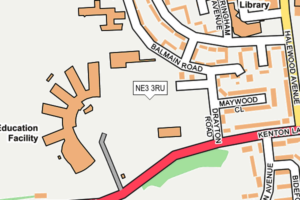
NE3 3RU is located in the Kenton electoral ward, within the metropolitan district of Newcastle upon Tyne and the English Parliamentary constituency of Newcastle upon Tyne Central. The Sub Integrated Care Board (ICB) Location is NHS North East and North Cumbria ICB - 13T and the police force is Northumbria. This postcode has been in use since January 1980.


GetTheData
Source: OS OpenMap – Local (Ordnance Survey)
Source: OS VectorMap District (Ordnance Survey)
Licence: Open Government Licence (requires attribution)
| Easting | 421915 |
| Northing | 567771 |
| Latitude | 55.004036 |
| Longitude | -1.658933 |
GetTheData
Source: Open Postcode Geo
Licence: Open Government Licence
| Country | England |
| Postcode District | NE3 |
➜ See where NE3 is on a map ➜ Where is Newcastle upon Tyne? | |
GetTheData
Source: Land Registry Price Paid Data
Licence: Open Government Licence
Elevation or altitude of NE3 3RU as distance above sea level:
| Metres | Feet | |
|---|---|---|
| Elevation | 100m | 328ft |
Elevation is measured from the approximate centre of the postcode, to the nearest point on an OS contour line from OS Terrain 50, which has contour spacing of ten vertical metres.
➜ How high above sea level am I? Find the elevation of your current position using your device's GPS.
GetTheData
Source: Open Postcode Elevation
Licence: Open Government Licence
| Ward | Kenton |
| Constituency | Newcastle Upon Tyne Central |
GetTheData
Source: ONS Postcode Database
Licence: Open Government Licence
| Kenton School (Drayton Road) | North Kenton | 141m |
| Kenton Lane-moor Lane (Kenton Lane) | Kenton Bar | 173m |
| St Cuthberts Rc Primary School (Balmain Road) | North Kenton | 199m |
| Kenton Lane-moor Lane (Kenton Lane) | Kenton Bar | 204m |
| Kenton Lane-drayton Road (Kenton Lane) | Kenton | 272m |
| Kingston Park (Tyne And Wear Metro Station) (Brunton Lane) | Kingston Park | 1,217m |
| Fawdon (Tyne And Wear Metro Station) (Fawdon Lane) | Fawdon | 1,415m |
| Bank Foot (Tyne And Wear Metro Station) (Station Road) | Kenton Bank Foot | 1,656m |
| Newcastle Station | 4.8km |
| Newcastle Airport Metro | 4.9km |
| Manors Station | 4.9km |
GetTheData
Source: NaPTAN
Licence: Open Government Licence
GetTheData
Source: ONS Postcode Database
Licence: Open Government Licence


➜ Get more ratings from the Food Standards Agency
GetTheData
Source: Food Standards Agency
Licence: FSA terms & conditions
| Last Collection | |||
|---|---|---|---|
| Location | Mon-Fri | Sat | Distance |
| Creighton Avenue | 17:30 | 11:30 | 379m |
| Mallowburn Crescent | 17:30 | 11:30 | 445m |
| The Cross Way | 17:30 | 11:15 | 809m |
GetTheData
Source: Dracos
Licence: Creative Commons Attribution-ShareAlike
The below table lists the International Territorial Level (ITL) codes (formerly Nomenclature of Territorial Units for Statistics (NUTS) codes) and Local Administrative Units (LAU) codes for NE3 3RU:
| ITL 1 Code | Name |
|---|---|
| TLC | North East (England) |
| ITL 2 Code | Name |
| TLC2 | Northumberland, and Tyne and Wear |
| ITL 3 Code | Name |
| TLC22 | Tyneside |
| LAU 1 Code | Name |
| E08000021 | Newcastle upon Tyne |
GetTheData
Source: ONS Postcode Directory
Licence: Open Government Licence
The below table lists the Census Output Area (OA), Lower Layer Super Output Area (LSOA), and Middle Layer Super Output Area (MSOA) for NE3 3RU:
| Code | Name | |
|---|---|---|
| OA | E00042491 | |
| LSOA | E01008377 | Newcastle upon Tyne 008E |
| MSOA | E02001715 | Newcastle upon Tyne 008 |
GetTheData
Source: ONS Postcode Directory
Licence: Open Government Licence
| NE3 3EB | Kenton Lane | 164m |
| NE3 3EE | Kenton Lane | 216m |
| NE3 3EF | Moor Lane | 216m |
| NE3 3QR | Balmain Road | 231m |
| NE3 3EH | Moor View | 242m |
| NE5 3YQ | Orchard Green | 270m |
| NE3 3QY | Stapeley View | 276m |
| NE3 3QU | Runnymede Way | 284m |
| NE3 3QS | Drayton Road | 305m |
| NE5 3XE | Bedale Green | 307m |
GetTheData
Source: Open Postcode Geo; Land Registry Price Paid Data
Licence: Open Government Licence