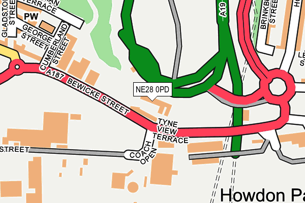
NE28 0PD is located in the Riverside electoral ward, within the metropolitan district of North Tyneside and the English Parliamentary constituency of North Tyneside. The Sub Integrated Care Board (ICB) Location is NHS North East and North Cumbria ICB - 99C and the police force is Northumbria. This postcode has been in use since January 1980.


GetTheData
Source: OS OpenMap – Local (Ordnance Survey)
Source: OS VectorMap District (Ordnance Survey)
Licence: Open Government Licence (requires attribution)
| Easting | 432934 |
| Northing | 566316 |
| Latitude | 54.990350 |
| Longitude | -1.486822 |
GetTheData
Source: Open Postcode Geo
Licence: Open Government Licence
| Country | England |
| Postcode District | NE28 |
➜ See where NE28 is on a map ➜ Where is Wallsend? | |
GetTheData
Source: Land Registry Price Paid Data
Licence: Open Government Licence
Elevation or altitude of NE28 0PD as distance above sea level:
| Metres | Feet | |
|---|---|---|
| Elevation | 10m | 33ft |
Elevation is measured from the approximate centre of the postcode, to the nearest point on an OS contour line from OS Terrain 50, which has contour spacing of ten vertical metres.
➜ How high above sea level am I? Find the elevation of your current position using your device's GPS.
GetTheData
Source: Open Postcode Elevation
Licence: Open Government Licence
| Ward | Riverside |
| Constituency | North Tyneside |
GetTheData
Source: ONS Postcode Database
Licence: Open Government Licence
| Bewicke Street-coach Open (Bewicke Street) | Willington Quay | 50m |
| East Howdon (Bewicke Street) | Willington Quay | 60m |
| Pedestrian Tunnel North (Tyne View Terrace) | East Howdon | 123m |
| Tyne View Terrace | East Howdon | 191m |
| Howdon Road - Meldon Street (Howdon Road) | East Howdon | 270m |
| Howdon (Tyne And Wear Metro Station) (Howdon Lane) | Howdon | 765m |
| Jarrow (Tyne And Wear Metro Station) (Grant Street) | Jarrow | 1,285m |
| Percy Main (Tyne And Wear Metro Station) (Burdon Street) | Percy Main | 1,298m |
| Meadow Well (Tyne And Wear Metro Station) (Ripley Avenue) | Meadow Well | 1,866m |
| Brockley Whins Station | 3.8km |
| Heworth Station | 6.2km |
| East Boldon Station | 6.5km |
GetTheData
Source: NaPTAN
Licence: Open Government Licence
GetTheData
Source: ONS Postcode Database
Licence: Open Government Licence


➜ Get more ratings from the Food Standards Agency
GetTheData
Source: Food Standards Agency
Licence: FSA terms & conditions
| Last Collection | |||
|---|---|---|---|
| Location | Mon-Fri | Sat | Distance |
| Warkworth Avenue | 16:15 | 11:45 | 778m |
| Ellison Street | 17:30 | 10:30 | 1,009m |
| High Street | 17:00 | 10:30 | 1,018m |
GetTheData
Source: Dracos
Licence: Creative Commons Attribution-ShareAlike
The below table lists the International Territorial Level (ITL) codes (formerly Nomenclature of Territorial Units for Statistics (NUTS) codes) and Local Administrative Units (LAU) codes for NE28 0PD:
| ITL 1 Code | Name |
|---|---|
| TLC | North East (England) |
| ITL 2 Code | Name |
| TLC2 | Northumberland, and Tyne and Wear |
| ITL 3 Code | Name |
| TLC22 | Tyneside |
| LAU 1 Code | Name |
| E08000022 | North Tyneside |
GetTheData
Source: ONS Postcode Directory
Licence: Open Government Licence
The below table lists the Census Output Area (OA), Lower Layer Super Output Area (LSOA), and Middle Layer Super Output Area (MSOA) for NE28 0PD:
| Code | Name | |
|---|---|---|
| OA | E00043347 | |
| LSOA | E01008543 | North Tyneside 028C |
| MSOA | E02001765 | North Tyneside 028 |
GetTheData
Source: ONS Postcode Directory
Licence: Open Government Licence
| NE28 6SL | George Street | 276m |
| NE28 0JJ | Brinkburn Street | 289m |
| NE28 0JN | Gallant Terrace | 313m |
| NE28 6SJ | Gladstone Street | 325m |
| NE28 6SH | Bewicke Road | 338m |
| NE28 0JW | Easten Terrace | 338m |
| NE28 0JX | Lesbury Street | 349m |
| NE28 0JL | Mitford Street | 357m |
| NE28 6SN | Westmorland Avenue | 361m |
| NE28 6SW | Clavering Street | 369m |
GetTheData
Source: Open Postcode Geo; Land Registry Price Paid Data
Licence: Open Government Licence