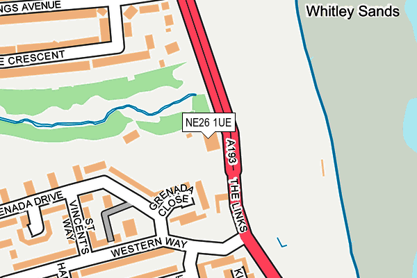
NE26 1UE is located in the St Mary's electoral ward, within the metropolitan district of North Tyneside and the English Parliamentary constituency of Tynemouth. The Sub Integrated Care Board (ICB) Location is NHS North East and North Cumbria ICB - 99C and the police force is Northumbria. This postcode has been in use since January 1980.


GetTheData
Source: OS OpenMap – Local (Ordnance Survey)
Source: OS VectorMap District (Ordnance Survey)
Licence: Open Government Licence (requires attribution)
| Easting | 434895 |
| Northing | 573813 |
| Latitude | 55.057583 |
| Longitude | -1.455264 |
GetTheData
Source: Open Postcode Geo
Licence: Open Government Licence
| Country | England |
| Postcode District | NE26 |
➜ See where NE26 is on a map ➜ Where is Whitley Bay? | |
GetTheData
Source: Land Registry Price Paid Data
Licence: Open Government Licence
Elevation or altitude of NE26 1UE as distance above sea level:
| Metres | Feet | |
|---|---|---|
| Elevation | 10m | 33ft |
Elevation is measured from the approximate centre of the postcode, to the nearest point on an OS contour line from OS Terrain 50, which has contour spacing of ten vertical metres.
➜ How high above sea level am I? Find the elevation of your current position using your device's GPS.
GetTheData
Source: Open Postcode Elevation
Licence: Open Government Licence
| Ward | St Mary's |
| Constituency | Tynemouth |
GetTheData
Source: ONS Postcode Database
Licence: Open Government Licence
| The Links-briar Dene (The Links) | Whitley Bay | 44m |
| The Links-briar Dene (The Links) | Whitley Bay | 50m |
| The Links-kingston Drive (The Links) | Whitley Bay | 268m |
| The Links-kingston Drive (The Links) | Whitley Bay | 268m |
| The Links-hastings Avenue (The Links) | Whitley Bay | 277m |
GetTheData
Source: NaPTAN
Licence: Open Government Licence
GetTheData
Source: ONS Postcode Database
Licence: Open Government Licence


➜ Get more ratings from the Food Standards Agency
GetTheData
Source: Food Standards Agency
Licence: FSA terms & conditions
| Last Collection | |||
|---|---|---|---|
| Location | Mon-Fri | Sat | Distance |
| Hastings Avenue | 16:30 | 12:15 | 227m |
| Whitley Lodge Post Office | 17:30 | 12:15 | 586m |
| Queens Road | 16:45 | 12:00 | 1,001m |
GetTheData
Source: Dracos
Licence: Creative Commons Attribution-ShareAlike
The below table lists the International Territorial Level (ITL) codes (formerly Nomenclature of Territorial Units for Statistics (NUTS) codes) and Local Administrative Units (LAU) codes for NE26 1UE:
| ITL 1 Code | Name |
|---|---|
| TLC | North East (England) |
| ITL 2 Code | Name |
| TLC2 | Northumberland, and Tyne and Wear |
| ITL 3 Code | Name |
| TLC22 | Tyneside |
| LAU 1 Code | Name |
| E08000022 | North Tyneside |
GetTheData
Source: ONS Postcode Directory
Licence: Open Government Licence
The below table lists the Census Output Area (OA), Lower Layer Super Output Area (LSOA), and Middle Layer Super Output Area (MSOA) for NE26 1UE:
| Code | Name | |
|---|---|---|
| OA | E00043394 | |
| LSOA | E01008551 | North Tyneside 001D |
| MSOA | E02001738 | North Tyneside 001 |
GetTheData
Source: ONS Postcode Directory
Licence: Open Government Licence
| NE26 1HP | Grenada Close | 76m |
| NE26 4AA | Brierdene Close | 157m |
| NE26 1HW | Grenada Drive | 170m |
| NE26 1JR | Western Court | 178m |
| NE26 4NF | The Links | 183m |
| NE26 1JP | Kingston Court | 202m |
| NE26 1JD | Western Way | 218m |
| NE26 1HT | St Vincents Place | 231m |
| NE26 1JG | Hamilton Drive | 231m |
| NE26 1JW | Kingston Close | 234m |
GetTheData
Source: Open Postcode Geo; Land Registry Price Paid Data
Licence: Open Government Licence