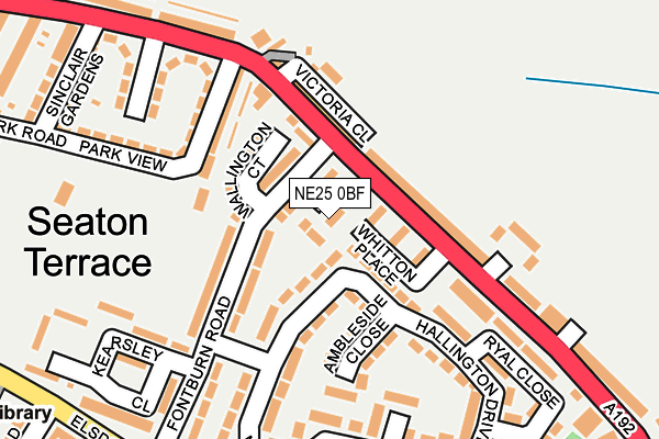
NE25 0BF lies on Nursery Gardens in Seaton Delaval, Whitley Bay. NE25 0BF is located in the Holywell electoral ward, within the unitary authority of Northumberland and the English Parliamentary constituency of Blyth Valley. The Sub Integrated Care Board (ICB) Location is NHS North East and North Cumbria ICB - 00L and the police force is Northumbria. This postcode has been in use since June 2012.


GetTheData
Source: OS OpenMap – Local (Ordnance Survey)
Source: OS VectorMap District (Ordnance Survey)
Licence: Open Government Licence (requires attribution)
| Easting | 430840 |
| Northing | 575268 |
| Latitude | 55.070924 |
| Longitude | -1.518584 |
GetTheData
Source: Open Postcode Geo
Licence: Open Government Licence
| Street | Nursery Gardens |
| Locality | Seaton Delaval |
| Town/City | Whitley Bay |
| Country | England |
| Postcode District | NE25 |
➜ See where NE25 is on a map ➜ Where is Seaton Delaval? | |
GetTheData
Source: Land Registry Price Paid Data
Licence: Open Government Licence
Elevation or altitude of NE25 0BF as distance above sea level:
| Metres | Feet | |
|---|---|---|
| Elevation | 40m | 131ft |
Elevation is measured from the approximate centre of the postcode, to the nearest point on an OS contour line from OS Terrain 50, which has contour spacing of ten vertical metres.
➜ How high above sea level am I? Find the elevation of your current position using your device's GPS.
GetTheData
Source: Open Postcode Elevation
Licence: Open Government Licence
| Ward | Holywell |
| Constituency | Blyth Valley |
GetTheData
Source: ONS Postcode Database
Licence: Open Government Licence
2017 20 OCT £230,000 |
2015 29 MAY £175,000 |
2014 19 DEC £200,000 |
4, NURSERY GARDENS, SEATON DELAVAL, WHITLEY BAY, NE25 0BF 2012 21 DEC £199,995 |
2012 28 OCT £204,995 |
1, NURSERY GARDENS, SEATON DELAVAL, WHITLEY BAY, NE25 0BF 2012 26 SEP £237,995 |
5, NURSERY GARDENS, SEATON DELAVAL, WHITLEY BAY, NE25 0BF 2012 14 SEP £249,995 |
2012 13 JUL £199,995 |
GetTheData
Source: HM Land Registry Price Paid Data
Licence: Contains HM Land Registry data © Crown copyright and database right 2025. This data is licensed under the Open Government Licence v3.0.
| Seaton Terrace (A192) | Seaton Delaval | 51m |
| Seaton Terrace (A192) | Seaton Delaval | 115m |
| Westbourne Garage (A192) | Seaton Delaval | 209m |
| Elsdon Avenue Shops (Elsdon Avenue) | Seaton Delaval | 278m |
| Elsdon Avenue Shops (Elsdon Avenue) | Seaton Delaval | 288m |
GetTheData
Source: NaPTAN
Licence: Open Government Licence
| Percentage of properties with Next Generation Access | 100.0% |
| Percentage of properties with Superfast Broadband | 100.0% |
| Percentage of properties with Ultrafast Broadband | 0.0% |
| Percentage of properties with Full Fibre Broadband | 0.0% |
Superfast Broadband is between 30Mbps and 300Mbps
Ultrafast Broadband is > 300Mbps
| Percentage of properties unable to receive 2Mbps | 0.0% |
| Percentage of properties unable to receive 5Mbps | 0.0% |
| Percentage of properties unable to receive 10Mbps | 0.0% |
| Percentage of properties unable to receive 30Mbps | 0.0% |
GetTheData
Source: Ofcom
Licence: Ofcom Terms of Use (requires attribution)
GetTheData
Source: ONS Postcode Database
Licence: Open Government Licence


➜ Get more ratings from the Food Standards Agency
GetTheData
Source: Food Standards Agency
Licence: FSA terms & conditions
| Last Collection | |||
|---|---|---|---|
| Location | Mon-Fri | Sat | Distance |
| Seaton Terrace | 16:30 | 11:30 | 139m |
| Elsdon Avenue | 16:30 | 11:30 | 252m |
| Seaton Delaval Post Office | 17:45 | 11:30 | 460m |
GetTheData
Source: Dracos
Licence: Creative Commons Attribution-ShareAlike
The below table lists the International Territorial Level (ITL) codes (formerly Nomenclature of Territorial Units for Statistics (NUTS) codes) and Local Administrative Units (LAU) codes for NE25 0BF:
| ITL 1 Code | Name |
|---|---|
| TLC | North East (England) |
| ITL 2 Code | Name |
| TLC2 | Northumberland, and Tyne and Wear |
| ITL 3 Code | Name |
| TLC21 | Northumberland |
| LAU 1 Code | Name |
| E06000057 | Northumberland |
GetTheData
Source: ONS Postcode Directory
Licence: Open Government Licence
The below table lists the Census Output Area (OA), Lower Layer Super Output Area (LSOA), and Middle Layer Super Output Area (MSOA) for NE25 0BF:
| Code | Name | |
|---|---|---|
| OA | E00139545 | |
| LSOA | E01027421 | Northumberland 030E |
| MSOA | E02005717 | Northumberland 030 |
GetTheData
Source: ONS Postcode Directory
Licence: Open Government Licence
| NE25 0BJ | Whitton Place | 41m |
| NE25 0AX | Baxters Buildings | 84m |
| NE25 0AY | Hartburn Terrace | 90m |
| NE25 0DA | Wallington Court | 102m |
| NE25 0BH | Fontburn Road | 105m |
| NE25 0JB | Hallington Drive | 112m |
| NE25 0AS | Cooperative Buildings | 126m |
| NE25 0AW | Avenue Terrace | 133m |
| NE25 0JD | Ambleside Close | 136m |
| NE25 0JA | Hallington Drive | 167m |
GetTheData
Source: Open Postcode Geo; Land Registry Price Paid Data
Licence: Open Government Licence