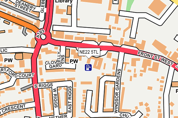
NE22 5TL is located in the Bedlington Central electoral ward, within the unitary authority of Northumberland and the English Parliamentary constituency of Wansbeck. The Sub Integrated Care Board (ICB) Location is NHS North East and North Cumbria ICB - 00L and the police force is Northumbria. This postcode has been in use since January 1980.


GetTheData
Source: OS OpenMap – Local (Ordnance Survey)
Source: OS VectorMap District (Ordnance Survey)
Licence: Open Government Licence (requires attribution)
| Easting | 425756 |
| Northing | 581900 |
| Latitude | 55.130806 |
| Longitude | -1.597599 |
GetTheData
Source: Open Postcode Geo
Licence: Open Government Licence
| Country | England |
| Postcode District | NE22 |
➜ See where NE22 is on a map ➜ Where is Bedlington? | |
GetTheData
Source: Land Registry Price Paid Data
Licence: Open Government Licence
Elevation or altitude of NE22 5TL as distance above sea level:
| Metres | Feet | |
|---|---|---|
| Elevation | 50m | 164ft |
Elevation is measured from the approximate centre of the postcode, to the nearest point on an OS contour line from OS Terrain 50, which has contour spacing of ten vertical metres.
➜ How high above sea level am I? Find the elevation of your current position using your device's GPS.
GetTheData
Source: Open Postcode Elevation
Licence: Open Government Licence
| Ward | Bedlington Central |
| Constituency | Wansbeck |
GetTheData
Source: ONS Postcode Database
Licence: Open Government Licence
| Front Street West | Red Lion | 42m |
| Front Street West | Red Lion | 92m |
| Market Place (Front Street West) | Bedlington | 150m |
| Glebe Road (A1068) | Red Lion | 207m |
| Hartford Crescent (Hartford Road) | Bedlington | 219m |
| Cramlington Station | 4.8km |
GetTheData
Source: NaPTAN
Licence: Open Government Licence
GetTheData
Source: ONS Postcode Database
Licence: Open Government Licence


➜ Get more ratings from the Food Standards Agency
GetTheData
Source: Food Standards Agency
Licence: FSA terms & conditions
| Last Collection | |||
|---|---|---|---|
| Location | Mon-Fri | Sat | Distance |
| Market Place | 17:15 | 11:30 | 60m |
| West Front Street | 16:30 | 11:30 | 250m |
| Hartlands | 16:45 | 11:15 | 364m |
GetTheData
Source: Dracos
Licence: Creative Commons Attribution-ShareAlike
The below table lists the International Territorial Level (ITL) codes (formerly Nomenclature of Territorial Units for Statistics (NUTS) codes) and Local Administrative Units (LAU) codes for NE22 5TL:
| ITL 1 Code | Name |
|---|---|
| TLC | North East (England) |
| ITL 2 Code | Name |
| TLC2 | Northumberland, and Tyne and Wear |
| ITL 3 Code | Name |
| TLC21 | Northumberland |
| LAU 1 Code | Name |
| E06000057 | Northumberland |
GetTheData
Source: ONS Postcode Directory
Licence: Open Government Licence
The below table lists the Census Output Area (OA), Lower Layer Super Output Area (LSOA), and Middle Layer Super Output Area (MSOA) for NE22 5TL:
| Code | Name | |
|---|---|---|
| OA | E00140041 | |
| LSOA | E01027514 | Northumberland 021A |
| MSOA | E02005741 | Northumberland 021 |
GetTheData
Source: ONS Postcode Directory
Licence: Open Government Licence
| NE22 5UB | Front Street West | 65m |
| NE22 5TX | Front Street West | 70m |
| NE22 5TZ | Front Street West | 76m |
| NE22 5UG | Clovelly Gardens | 113m |
| NE22 5SQ | South Riggs | 120m |
| NE22 5PB | Windsor Court | 140m |
| NE22 5SY | Windsor Gardens | 142m |
| NE22 5SH | East Riggs | 143m |
| NE22 5UA | Front Street West | 144m |
| NE22 5TT | Front Street West | 150m |
GetTheData
Source: Open Postcode Geo; Land Registry Price Paid Data
Licence: Open Government Licence