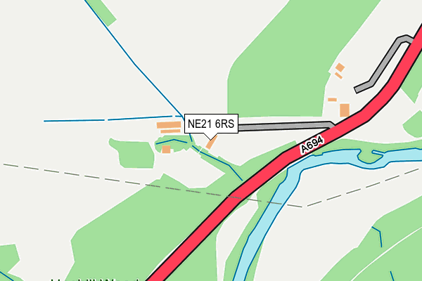
NE21 6RS is in Blaydon-on-tyne. NE21 6RS is located in the Blaydon electoral ward, within the metropolitan district of Gateshead and the English Parliamentary constituency of Blaydon. The Sub Integrated Care Board (ICB) Location is NHS North East and North Cumbria ICB - 13T and the police force is Northumbria. This postcode has been in use since January 1980.


GetTheData
Source: OS OpenMap – Local (Ordnance Survey)
Source: OS VectorMap District (Ordnance Survey)
Licence: Open Government Licence (requires attribution)
| Easting | 418818 |
| Northing | 561373 |
| Latitude | 54.946669 |
| Longitude | -1.707764 |
GetTheData
Source: Open Postcode Geo
Licence: Open Government Licence
| Town/City | Blaydon-on-tyne |
| Country | England |
| Postcode District | NE21 |
➜ See where NE21 is on a map ➜ Where is Blaydon? | |
GetTheData
Source: Land Registry Price Paid Data
Licence: Open Government Licence
Elevation or altitude of NE21 6RS as distance above sea level:
| Metres | Feet | |
|---|---|---|
| Elevation | 30m | 98ft |
Elevation is measured from the approximate centre of the postcode, to the nearest point on an OS contour line from OS Terrain 50, which has contour spacing of ten vertical metres.
➜ How high above sea level am I? Find the elevation of your current position using your device's GPS.
GetTheData
Source: Open Postcode Elevation
Licence: Open Government Licence
| Ward | Blaydon |
| Constituency | Blaydon |
GetTheData
Source: ONS Postcode Database
Licence: Open Government Licence
2021 8 FEB £681,000 |
2004 16 DEC £465,000 |
GetTheData
Source: HM Land Registry Price Paid Data
Licence: Contains HM Land Registry data © Crown copyright and database right 2025. This data is licensed under the Open Government Licence v3.0.
| Derwenthaugh (A694) | Winlaton Mill | 268m |
| Derwenthaugh | Winlaton Mill | 290m |
| Spa Well Road - Noel Avenue (Spa Well Road) | Winlaton Mill | 385m |
| Spa Well Road | Winlaton Mill | 471m |
| Spa Well Road | Winlaton Mill | 512m |
| Blaydon Station | 2.2km |
| Metrocentre Station | 3km |
| Dunston Station | 4.2km |
GetTheData
Source: NaPTAN
Licence: Open Government Licence
| Percentage of properties with Next Generation Access | 100.0% |
| Percentage of properties with Superfast Broadband | 50.0% |
| Percentage of properties with Ultrafast Broadband | 0.0% |
| Percentage of properties with Full Fibre Broadband | 0.0% |
Superfast Broadband is between 30Mbps and 300Mbps
Ultrafast Broadband is > 300Mbps
| Percentage of properties unable to receive 2Mbps | 0.0% |
| Percentage of properties unable to receive 5Mbps | 0.0% |
| Percentage of properties unable to receive 10Mbps | 0.0% |
| Percentage of properties unable to receive 30Mbps | 50.0% |
GetTheData
Source: Ofcom
Licence: Ofcom Terms of Use (requires attribution)
GetTheData
Source: ONS Postcode Database
Licence: Open Government Licence


➜ Get more ratings from the Food Standards Agency
GetTheData
Source: Food Standards Agency
Licence: FSA terms & conditions
| Last Collection | |||
|---|---|---|---|
| Location | Mon-Fri | Sat | Distance |
| Winlaton Mill Post Office | 17:30 | 11:30 | 542m |
| Parkhead Gardens | 16:45 | 11:15 | 1,024m |
| Deneside | 16:30 | 11:00 | 1,108m |
GetTheData
Source: Dracos
Licence: Creative Commons Attribution-ShareAlike
The below table lists the International Territorial Level (ITL) codes (formerly Nomenclature of Territorial Units for Statistics (NUTS) codes) and Local Administrative Units (LAU) codes for NE21 6RS:
| ITL 1 Code | Name |
|---|---|
| TLC | North East (England) |
| ITL 2 Code | Name |
| TLC2 | Northumberland, and Tyne and Wear |
| ITL 3 Code | Name |
| TLC22 | Tyneside |
| LAU 1 Code | Name |
| E08000037 | Gateshead |
GetTheData
Source: ONS Postcode Directory
Licence: Open Government Licence
The below table lists the Census Output Area (OA), Lower Layer Super Output Area (LSOA), and Middle Layer Super Output Area (MSOA) for NE21 6RS:
| Code | Name | |
|---|---|---|
| OA | E00041460 | |
| LSOA | E01008181 | Gateshead 005C |
| MSOA | E02001686 | Gateshead 005 |
GetTheData
Source: ONS Postcode Directory
Licence: Open Government Licence
| NE21 6RX | Landswood Terrace | 380m |
| NE21 6SD | Noel Terrace | 407m |
| NE21 6SE | Manor Terrace | 473m |
| NE21 6AU | Millwood Green | 521m |
| NE21 6SF | May Avenue | 583m |
| NE21 6SH | Noel Avenue | 584m |
| NE21 6SA | Naylor Avenue | 597m |
| NE21 6SY | Kirkstone Close | 608m |
| NE21 6SZ | Swindale Close | 648m |
| NE21 6SQ | June Avenue | 649m |
GetTheData
Source: Open Postcode Geo; Land Registry Price Paid Data
Licence: Open Government Licence