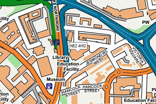
NE2 4HQ is located in the Monument electoral ward, within the metropolitan district of Newcastle upon Tyne and the English Parliamentary constituency of Newcastle upon Tyne East. The Sub Integrated Care Board (ICB) Location is NHS North East and North Cumbria ICB - 13T and the police force is Northumbria. This postcode has been in use since March 1983.


GetTheData
Source: OS OpenMap – Local (Ordnance Survey)
Source: OS VectorMap District (Ordnance Survey)
Licence: Open Government Licence (requires attribution)
| Easting | 424984 |
| Northing | 565230 |
| Latitude | 54.981051 |
| Longitude | -1.611160 |
GetTheData
Source: Open Postcode Geo
Licence: Open Government Licence
| Country | England |
| Postcode District | NE2 |
➜ See where NE2 is on a map ➜ Where is Newcastle upon Tyne? | |
GetTheData
Source: Land Registry Price Paid Data
Licence: Open Government Licence
Elevation or altitude of NE2 4HQ as distance above sea level:
| Metres | Feet | |
|---|---|---|
| Elevation | 50m | 164ft |
Elevation is measured from the approximate centre of the postcode, to the nearest point on an OS contour line from OS Terrain 50, which has contour spacing of ten vertical metres.
➜ How high above sea level am I? Find the elevation of your current position using your device's GPS.
GetTheData
Source: Open Postcode Elevation
Licence: Open Government Licence
| Ward | Monument |
| Constituency | Newcastle Upon Tyne East |
GetTheData
Source: ONS Postcode Database
Licence: Open Government Licence
| Sandyford Road-civic Centre (Sandyford Road) | Newcastle Upon Tyne | 252m |
| Northumbria University (Sandyford Road) | Newcastle Upon Tyne | 275m |
| Claremont Road-museum (Claremont Road) | Newcastle Upon Tyne | 283m |
| Haymarket Barras Bridge (Barras Bridge) | Newcastle Upon Tyne | 284m |
| Claremont Road-university (Claremont Road) | Newcastle Upon Tyne | 316m |
| Jesmond (Tyne And Wear Metro Station) (Eslington Road) | Jesmond | 428m |
| Haymarket (Tyne And Wear Metro Station) (Percy Street) | Newcastle Upon Tyne | 431m |
| Monument (Tyne And Wear Metro Station) (Blackett Street) | Newcastle Upon Tyne | 833m |
| Manors (Tyne And Wear Metro Station) (Argyll Street) | Manors | 881m |
| St James (Tyne And Wear Metro Station) (Strawberry Place) | Newcastle Upon Tyne | 999m |
| Manors Station | 1km |
| Newcastle Station | 1.5km |
| Dunston Station | 4km |
GetTheData
Source: NaPTAN
Licence: Open Government Licence
GetTheData
Source: ONS Postcode Database
Licence: Open Government Licence


➜ Get more ratings from the Food Standards Agency
GetTheData
Source: Food Standards Agency
Licence: FSA terms & conditions
| Last Collection | |||
|---|---|---|---|
| Location | Mon-Fri | Sat | Distance |
| Windsor Terrace | 17:30 | 11:30 | 106m |
| Brandling Park | 17:30 | 12:00 | 361m |
| Newcastle University | 18:30 | 11:45 | 362m |
GetTheData
Source: Dracos
Licence: Creative Commons Attribution-ShareAlike
The below table lists the International Territorial Level (ITL) codes (formerly Nomenclature of Territorial Units for Statistics (NUTS) codes) and Local Administrative Units (LAU) codes for NE2 4HQ:
| ITL 1 Code | Name |
|---|---|
| TLC | North East (England) |
| ITL 2 Code | Name |
| TLC2 | Northumberland, and Tyne and Wear |
| ITL 3 Code | Name |
| TLC22 | Tyneside |
| LAU 1 Code | Name |
| E08000021 | Newcastle upon Tyne |
GetTheData
Source: ONS Postcode Directory
Licence: Open Government Licence
The below table lists the Census Output Area (OA), Lower Layer Super Output Area (LSOA), and Middle Layer Super Output Area (MSOA) for NE2 4HQ:
| Code | Name | |
|---|---|---|
| OA | E00175564 | |
| LSOA | E01008397 | Newcastle upon Tyne 024C |
| MSOA | E02001731 | Newcastle upon Tyne 024 |
GetTheData
Source: ONS Postcode Directory
Licence: Open Government Licence
| NE2 4PD | Carlton Terrace | 77m |
| NE2 4HE | Windsor Terrace | 127m |
| NE2 4PS | Great North Road | 131m |
| NE2 4PQ | Carlton Terrace | 134m |
| NE1 8HW | Sandyford Road | 139m |
| NE2 4PF | Sloane Court | 187m |
| NE2 4DE | Victoria Square | 217m |
| NE2 4QA | Brandling Park | 278m |
| NE2 4RX | Lambton Road | 320m |
| NE1 7PQ | St Marys Place | 361m |
GetTheData
Source: Open Postcode Geo; Land Registry Price Paid Data
Licence: Open Government Licence