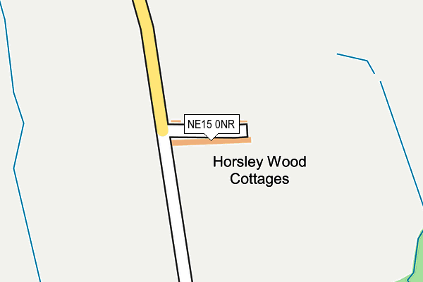
NE15 0NR lies on Horsley Wood Cottages in Horsley, Newcastle Upon Tyne. NE15 0NR is located in the Bywell electoral ward, within the unitary authority of Northumberland and the English Parliamentary constituency of Hexham. The Sub Integrated Care Board (ICB) Location is NHS North East and North Cumbria ICB - 00L and the police force is Northumbria. This postcode has been in use since January 1980.


GetTheData
Source: OS OpenMap – Local (Ordnance Survey)
Source: OS VectorMap District (Ordnance Survey)
Licence: Open Government Licence (requires attribution)
| Easting | 409855 |
| Northing | 565213 |
| Latitude | 54.981424 |
| Longitude | -1.847548 |
GetTheData
Source: Open Postcode Geo
Licence: Open Government Licence
| Street | Horsley Wood Cottages |
| Locality | Horsley |
| Town/City | Newcastle Upon Tyne |
| Country | England |
| Postcode District | NE15 |
➜ See where NE15 is on a map | |
GetTheData
Source: Land Registry Price Paid Data
Licence: Open Government Licence
Elevation or altitude of NE15 0NR as distance above sea level:
| Metres | Feet | |
|---|---|---|
| Elevation | 70m | 230ft |
Elevation is measured from the approximate centre of the postcode, to the nearest point on an OS contour line from OS Terrain 50, which has contour spacing of ten vertical metres.
➜ How high above sea level am I? Find the elevation of your current position using your device's GPS.
GetTheData
Source: Open Postcode Elevation
Licence: Open Government Licence
| Ward | Bywell |
| Constituency | Hexham |
GetTheData
Source: ONS Postcode Database
Licence: Open Government Licence
| Stonecroft (B6528) | Horsley | 853m |
| Stonecroft (B6528) | Horsley | 860m |
| Lion And Lamb (B6528) | Horsley | 892m |
| Lion And Lamb (B6528) | Horsley | 911m |
| South Farm (B6528) | Horsley | 976m |
| Prudhoe Station | 2.1km |
| Wylam Station | 2.3km |
| Stocksfield Station | 5.9km |
GetTheData
Source: NaPTAN
Licence: Open Government Licence
| Percentage of properties with Next Generation Access | 100.0% |
| Percentage of properties with Superfast Broadband | 0.0% |
| Percentage of properties with Ultrafast Broadband | 0.0% |
| Percentage of properties with Full Fibre Broadband | 0.0% |
Superfast Broadband is between 30Mbps and 300Mbps
Ultrafast Broadband is > 300Mbps
| Median download speed | 7.1Mbps |
| Average download speed | 9.7Mbps |
| Maximum download speed | 24.32Mbps |
| Median upload speed | 0.8Mbps |
| Average upload speed | 1.5Mbps |
| Maximum upload speed | 3.10Mbps |
| Percentage of properties unable to receive 2Mbps | 0.0% |
| Percentage of properties unable to receive 5Mbps | 0.0% |
| Percentage of properties unable to receive 10Mbps | 0.0% |
| Percentage of properties unable to receive 30Mbps | 100.0% |
GetTheData
Source: Ofcom
Licence: Ofcom Terms of Use (requires attribution)
Estimated total energy consumption in NE15 0NR by fuel type, 2015.
| Consumption (kWh) | 54,561 |
|---|---|
| Meter count | 19 |
| Mean (kWh/meter) | 2,872 |
| Median (kWh/meter) | 2,531 |
GetTheData
Source: Postcode level gas estimates: 2015 (experimental)
Source: Postcode level electricity estimates: 2015 (experimental)
Licence: Open Government Licence
GetTheData
Source: ONS Postcode Database
Licence: Open Government Licence


➜ Get more ratings from the Food Standards Agency
GetTheData
Source: Food Standards Agency
Licence: FSA terms & conditions
| Last Collection | |||
|---|---|---|---|
| Location | Mon-Fri | Sat | Distance |
| Acombe Drive | 16:30 | 12:00 | 1,236m |
| Prudhoe Delivery Office | 18:15 | 12:00 | 1,387m |
| Hagg Bank | 16:15 | 09:45 | 1,440m |
GetTheData
Source: Dracos
Licence: Creative Commons Attribution-ShareAlike
The below table lists the International Territorial Level (ITL) codes (formerly Nomenclature of Territorial Units for Statistics (NUTS) codes) and Local Administrative Units (LAU) codes for NE15 0NR:
| ITL 1 Code | Name |
|---|---|
| TLC | North East (England) |
| ITL 2 Code | Name |
| TLC2 | Northumberland, and Tyne and Wear |
| ITL 3 Code | Name |
| TLC21 | Northumberland |
| LAU 1 Code | Name |
| E06000057 | Northumberland |
GetTheData
Source: ONS Postcode Directory
Licence: Open Government Licence
The below table lists the Census Output Area (OA), Lower Layer Super Output Area (LSOA), and Middle Layer Super Output Area (MSOA) for NE15 0NR:
| Code | Name | |
|---|---|---|
| OA | E00139871 | |
| LSOA | E01027483 | Northumberland 036A |
| MSOA | E02005729 | Northumberland 036 |
GetTheData
Source: ONS Postcode Directory
Licence: Open Government Licence
| NE42 6HJ | 656m | |
| NE42 6HL | 686m | |
| NE15 0NH | Crofts Lane | 812m |
| NE15 0NQ | Croft Terrace | 826m |
| NE41 8JY | 843m | |
| NE15 0NG | Crown & Anchor Cottages | 864m |
| NE15 0AG | Castle View | 865m |
| NE15 0NJ | South Lea | 872m |
| NE15 0NS | 876m | |
| NE15 0AF | Stonecroft | 893m |
GetTheData
Source: Open Postcode Geo; Land Registry Price Paid Data
Licence: Open Government Licence