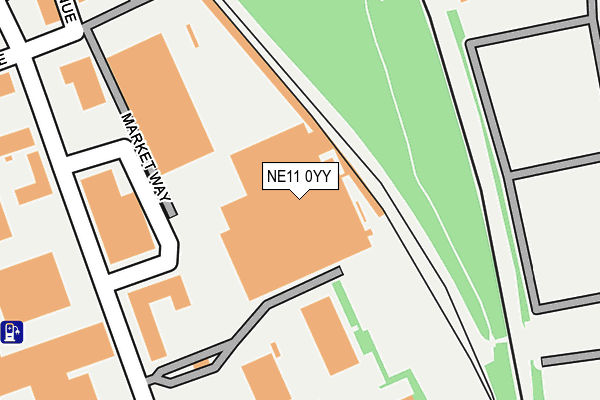
NE11 0YY is located in the Lobley Hill and Bensham electoral ward, within the metropolitan district of Gateshead and the English Parliamentary constituency of Gateshead. The Sub Integrated Care Board (ICB) Location is NHS North East and North Cumbria ICB - 13T and the police force is Northumbria. This postcode has been in use since January 1995.


GetTheData
Source: OS OpenMap – Local (Ordnance Survey)
Source: OS VectorMap District (Ordnance Survey)
Licence: Open Government Licence (requires attribution)
| Easting | 424768 |
| Northing | 560860 |
| Latitude | 54.941793 |
| Longitude | -1.614910 |
GetTheData
Source: Open Postcode Geo
Licence: Open Government Licence
| Country | England |
| Postcode District | NE11 |
➜ See where NE11 is on a map ➜ Where is Gateshead? | |
GetTheData
Source: Land Registry Price Paid Data
Licence: Open Government Licence
Elevation or altitude of NE11 0YY as distance above sea level:
| Metres | Feet | |
|---|---|---|
| Elevation | 10m | 33ft |
Elevation is measured from the approximate centre of the postcode, to the nearest point on an OS contour line from OS Terrain 50, which has contour spacing of ten vertical metres.
➜ How high above sea level am I? Find the elevation of your current position using your device's GPS.
GetTheData
Source: Open Postcode Elevation
Licence: Open Government Licence
| Ward | Lobley Hill And Bensham |
| Constituency | Gateshead |
GetTheData
Source: ONS Postcode Database
Licence: Open Government Licence
| Earlsway - Royal Mail (Earlsway) | Team Valley | 213m |
| Third Avenue - Royal Mail (Team Valley) | Team Valley | 318m |
| Saltwell Road-saltwell Cemetery (Saltwell Road) | Saltwell | 393m |
| Earlsway | Team Valley | 413m |
| Racecourse Estate (Fontwell Drive) | Bensham | 425m |
| Dunston Station | 2km |
| Newcastle Station | 3km |
| Manors Station | 3.5km |
GetTheData
Source: NaPTAN
Licence: Open Government Licence
GetTheData
Source: ONS Postcode Database
Licence: Open Government Licence


➜ Get more ratings from the Food Standards Agency
GetTheData
Source: Food Standards Agency
Licence: FSA terms & conditions
| Last Collection | |||
|---|---|---|---|
| Location | Mon-Fri | Sat | Distance |
| Tyneside Mail Centre | 19:30 | 12:45 | 83m |
| Third Avenue | 17:30 | 12:15 | 592m |
| Armstrong Street | 17:30 | 12:15 | 622m |
GetTheData
Source: Dracos
Licence: Creative Commons Attribution-ShareAlike
The below table lists the International Territorial Level (ITL) codes (formerly Nomenclature of Territorial Units for Statistics (NUTS) codes) and Local Administrative Units (LAU) codes for NE11 0YY:
| ITL 1 Code | Name |
|---|---|
| TLC | North East (England) |
| ITL 2 Code | Name |
| TLC2 | Northumberland, and Tyne and Wear |
| ITL 3 Code | Name |
| TLC22 | Tyneside |
| LAU 1 Code | Name |
| E08000037 | Gateshead |
GetTheData
Source: ONS Postcode Directory
Licence: Open Government Licence
The below table lists the Census Output Area (OA), Lower Layer Super Output Area (LSOA), and Middle Layer Super Output Area (MSOA) for NE11 0YY:
| Code | Name | |
|---|---|---|
| OA | E00041888 | |
| LSOA | E01008259 | Gateshead 007D |
| MSOA | E02001688 | Gateshead 007 |
GetTheData
Source: ONS Postcode Directory
Licence: Open Government Licence
| NE11 0RH | First Avenue | 153m |
| NE8 4UD | Harrison Gardens | 352m |
| NE8 4UA | Barry Street | 389m |
| NE11 0QY | North East Fruit & Vegetable Market | 391m |
| NE11 0TX | Bamburgh Court | 397m |
| NE8 4YX | Fontwell Drive | 410m |
| NE8 4TY | Arkwright Street | 431m |
| NE8 4TQ | Saltwell Road | 433m |
| NE11 0NY | Queensway North | 453m |
| NE8 4TN | Saltwell Road | 456m |
GetTheData
Source: Open Postcode Geo; Land Registry Price Paid Data
Licence: Open Government Licence