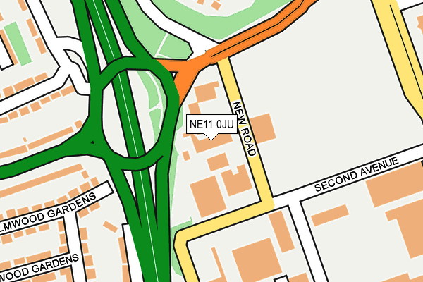
NE11 0JU is located in the Lobley Hill and Bensham electoral ward, within the metropolitan district of Gateshead and the English Parliamentary constituency of Gateshead. The Sub Integrated Care Board (ICB) Location is NHS North East and North Cumbria ICB - 13T and the police force is Northumbria. This postcode has been in use since January 1980.


GetTheData
Source: OS OpenMap – Local (Ordnance Survey)
Source: OS VectorMap District (Ordnance Survey)
Licence: Open Government Licence (requires attribution)
| Easting | 423883 |
| Northing | 560693 |
| Latitude | 54.940336 |
| Longitude | -1.628738 |
GetTheData
Source: Open Postcode Geo
Licence: Open Government Licence
| Country | England |
| Postcode District | NE11 |
➜ See where NE11 is on a map ➜ Where is Gateshead? | |
GetTheData
Source: Land Registry Price Paid Data
Licence: Open Government Licence
Elevation or altitude of NE11 0JU as distance above sea level:
| Metres | Feet | |
|---|---|---|
| Elevation | 20m | 66ft |
Elevation is measured from the approximate centre of the postcode, to the nearest point on an OS contour line from OS Terrain 50, which has contour spacing of ten vertical metres.
➜ How high above sea level am I? Find the elevation of your current position using your device's GPS.
GetTheData
Source: Open Postcode Elevation
Licence: Open Government Licence
| Ward | Lobley Hill And Bensham |
| Constituency | Gateshead |
GetTheData
Source: ONS Postcode Database
Licence: Open Government Licence
| Lobley Hill Road - New Road (Lobley Hill Road) | Team Valley | 150m |
| Lobley Hill Road-chiltern Gardens (Lobley Hill Road) | Lobley Hill | 179m |
| Chiltern Gardens-oakfield Road (Chiltern Gardens) | Lobley Hill | 209m |
| Lobley Hill Road - Beechwood Gardens (Lobley Hill Road) | Lobley Hill | 244m |
| Dukesway | Team Valley | 260m |
| Dunston Station | 1.4km |
| Metrocentre Station | 3.1km |
| Newcastle Station | 3.2km |
GetTheData
Source: NaPTAN
Licence: Open Government Licence
| Percentage of properties with Next Generation Access | 100.0% |
| Percentage of properties with Superfast Broadband | 100.0% |
| Percentage of properties with Ultrafast Broadband | 0.0% |
| Percentage of properties with Full Fibre Broadband | 0.0% |
Superfast Broadband is between 30Mbps and 300Mbps
Ultrafast Broadband is > 300Mbps
| Percentage of properties unable to receive 2Mbps | 0.0% |
| Percentage of properties unable to receive 5Mbps | 0.0% |
| Percentage of properties unable to receive 10Mbps | 0.0% |
| Percentage of properties unable to receive 30Mbps | 0.0% |
GetTheData
Source: Ofcom
Licence: Ofcom Terms of Use (requires attribution)
GetTheData
Source: ONS Postcode Database
Licence: Open Government Licence


➜ Get more ratings from the Food Standards Agency
GetTheData
Source: Food Standards Agency
Licence: FSA terms & conditions
| Last Collection | |||
|---|---|---|---|
| Location | Mon-Fri | Sat | Distance |
| Festival Park Drive | 18:00 | 12:15 | 342m |
| Cotswold Gardens | 18:00 | 12:00 | 352m |
| Lobley Hill | 17:45 | 12:00 | 361m |
GetTheData
Source: Dracos
Licence: Creative Commons Attribution-ShareAlike
The below table lists the International Territorial Level (ITL) codes (formerly Nomenclature of Territorial Units for Statistics (NUTS) codes) and Local Administrative Units (LAU) codes for NE11 0JU:
| ITL 1 Code | Name |
|---|---|
| TLC | North East (England) |
| ITL 2 Code | Name |
| TLC2 | Northumberland, and Tyne and Wear |
| ITL 3 Code | Name |
| TLC22 | Tyneside |
| LAU 1 Code | Name |
| E08000037 | Gateshead |
GetTheData
Source: ONS Postcode Directory
Licence: Open Government Licence
The below table lists the Census Output Area (OA), Lower Layer Super Output Area (LSOA), and Middle Layer Super Output Area (MSOA) for NE11 0JU:
| Code | Name | |
|---|---|---|
| OA | E00041887 | |
| LSOA | E01008260 | Gateshead 019B |
| MSOA | E02001700 | Gateshead 019 |
GetTheData
Source: ONS Postcode Directory
Licence: Open Government Licence
| NE11 0DY | Coach Road | 254m |
| NE11 9TZ | Camberwell Close | 262m |
| NE11 0BX | Elmwood Gardens | 263m |
| NE11 9NB | Team Vale Villas | 280m |
| NE11 0DD | Oakwood Gardens | 285m |
| NE11 0BT | Lobley Hill Road | 301m |
| NE11 0BS | Lobley Hill Road | 304m |
| NE11 0AA | Oakfield Road | 306m |
| NE11 0AB | Oakfield Road | 340m |
| NE11 0DB | Thornwood Gardens | 345m |
GetTheData
Source: Open Postcode Geo; Land Registry Price Paid Data
Licence: Open Government Licence