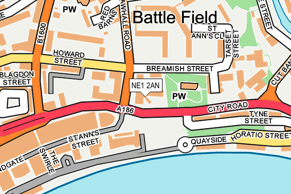
NE1 2AN is located in the Ouseburn electoral ward, within the metropolitan district of Newcastle upon Tyne and the English Parliamentary constituency of Newcastle upon Tyne East. The Sub Integrated Care Board (ICB) Location is NHS North East and North Cumbria ICB - 13T and the police force is Northumbria. This postcode has been in use since January 1980.


GetTheData
Source: OS OpenMap – Local (Ordnance Survey)
Source: OS VectorMap District (Ordnance Survey)
Licence: Open Government Licence (requires attribution)
| Easting | 425973 |
| Northing | 564254 |
| Latitude | 54.972231 |
| Longitude | -1.595795 |
GetTheData
Source: Open Postcode Geo
Licence: Open Government Licence
| Country | England |
| Postcode District | NE1 |
➜ See where NE1 is on a map ➜ Where is Newcastle upon Tyne? | |
GetTheData
Source: Land Registry Price Paid Data
Licence: Open Government Licence
Elevation or altitude of NE1 2AN as distance above sea level:
| Metres | Feet | |
|---|---|---|
| Elevation | 20m | 66ft |
Elevation is measured from the approximate centre of the postcode, to the nearest point on an OS contour line from OS Terrain 50, which has contour spacing of ten vertical metres.
➜ How high above sea level am I? Find the elevation of your current position using your device's GPS.
GetTheData
Source: Open Postcode Elevation
Licence: Open Government Licence
| Ward | Ouseburn |
| Constituency | Newcastle Upon Tyne East |
GetTheData
Source: ONS Postcode Database
Licence: Open Government Licence
| City Road-tyne Tees (City Road) | Newcastle Upon Tyne | 103m |
| Ouseburn Mariners Wharf (Quayside) | Newcastle Upon Tyne | 122m |
| City Road-breamish Street (City Road) | St Lawrence | 146m |
| City Road-breamish Street (City Road) | St Lawrence | 175m |
| City Road-gibson Street (City Road) | Newcastle Upon Tyne | 196m |
| Manors (Tyne And Wear Metro Station) (Argyll Street) | Manors | 611m |
| Byker (Tyne And Wear Metro Station) (Byker Bridge) | Byker | 1,127m |
| Monument (Tyne And Wear Metro Station) (Blackett Street) | Newcastle Upon Tyne | 1,147m |
| Haymarket (Tyne And Wear Metro Station) (Percy Street) | Newcastle Upon Tyne | 1,298m |
| Gateshead (Tyne And Wear Metro Station) (Bensham Road) | Gateshead | 1,321m |
| Manors Station | 0.6km |
| Newcastle Station | 1.4km |
| Heworth Station | 3.4km |
GetTheData
Source: NaPTAN
Licence: Open Government Licence
GetTheData
Source: ONS Postcode Database
Licence: Open Government Licence


➜ Get more ratings from the Food Standards Agency
GetTheData
Source: Food Standards Agency
Licence: FSA terms & conditions
| Last Collection | |||
|---|---|---|---|
| Location | Mon-Fri | Sat | Distance |
| Howard Street | 18:30 | 12:00 | 60m |
| Sandgate Quayside | 18:30 | 12:00 | 251m |
| Crawhall Road | 18:30 | 11:45 | 265m |
GetTheData
Source: Dracos
Licence: Creative Commons Attribution-ShareAlike
The below table lists the International Territorial Level (ITL) codes (formerly Nomenclature of Territorial Units for Statistics (NUTS) codes) and Local Administrative Units (LAU) codes for NE1 2AN:
| ITL 1 Code | Name |
|---|---|
| TLC | North East (England) |
| ITL 2 Code | Name |
| TLC2 | Northumberland, and Tyne and Wear |
| ITL 3 Code | Name |
| TLC22 | Tyneside |
| LAU 1 Code | Name |
| E08000021 | Newcastle upon Tyne |
GetTheData
Source: ONS Postcode Directory
Licence: Open Government Licence
The below table lists the Census Output Area (OA), Lower Layer Super Output Area (LSOA), and Middle Layer Super Output Area (MSOA) for NE1 2AN:
| Code | Name | |
|---|---|---|
| OA | E00042674 | |
| LSOA | E01033548 | Newcastle upon Tyne 023G |
| MSOA | E02001730 | Newcastle upon Tyne 023 |
GetTheData
Source: ONS Postcode Directory
Licence: Open Government Licence
| NE1 2DJ | St Anns Street | 99m |
| NE1 3BB | Quayside | 99m |
| NE1 2QT | 107m | |
| NE1 2DZ | Breamish Quays | 132m |
| NE1 2QS | 134m | |
| NE1 2QX | 168m | |
| NE1 2QJ | 173m | |
| NE1 2QP | 177m | |
| NE1 2AZ | Howard Street | 178m |
| NE1 2AT | Howard Street | 184m |
GetTheData
Source: Open Postcode Geo; Land Registry Price Paid Data
Licence: Open Government Licence