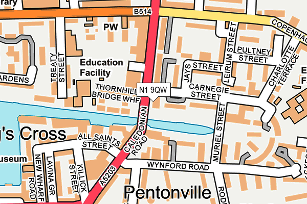
N1 9QW is located in the Barnsbury electoral ward, within the London borough of Islington and the English Parliamentary constituency of Islington South and Finsbury. The Sub Integrated Care Board (ICB) Location is NHS North Central London ICB - 93C and the police force is Metropolitan Police. This postcode has been in use since January 1980.


GetTheData
Source: OS OpenMap – Local (Ordnance Survey)
Source: OS VectorMap District (Ordnance Survey)
Licence: Open Government Licence (requires attribution)
| Easting | 530720 |
| Northing | 183506 |
| Latitude | 51.535332 |
| Longitude | -0.116687 |
GetTheData
Source: Open Postcode Geo
Licence: Open Government Licence
| Country | England |
| Postcode District | N1 |
➜ See where N1 is on a map ➜ Where is London? | |
GetTheData
Source: Land Registry Price Paid Data
Licence: Open Government Licence
Elevation or altitude of N1 9QW as distance above sea level:
| Metres | Feet | |
|---|---|---|
| Elevation | 30m | 98ft |
Elevation is measured from the approximate centre of the postcode, to the nearest point on an OS contour line from OS Terrain 50, which has contour spacing of ten vertical metres.
➜ How high above sea level am I? Find the elevation of your current position using your device's GPS.
GetTheData
Source: Open Postcode Elevation
Licence: Open Government Licence
| Ward | Barnsbury |
| Constituency | Islington South And Finsbury |
GetTheData
Source: ONS Postcode Database
Licence: Open Government Licence
| Carnegie Street (Caledonian Road) | Pentonville | 46m |
| Carnegie Street (Caledonian Road) | Pentonville | 89m |
| Killick Street (Caledonian Road) | Pentonville | 177m |
| Killick Street (Caledonian Road) | Pentonville | 192m |
| Hemingford Road (Copenhagen Street) | Barnsbury | 198m |
| King's Cross St. Pancras Underground Station | King's Cross | 688m |
| Angel Underground Station | Angel | 807m |
| Euston Underground Station | Euston | 1,440m |
| Russell Square Underground Station | Russell Square | 1,462m |
| Caledonian Road Underground Station | Caledonian Road | 1,472m |
| London Kings Cross Station | 0.7km |
| London St Pancras International Station | 0.8km |
| London St Pancras International LL Station | 0.8km |
GetTheData
Source: NaPTAN
Licence: Open Government Licence
GetTheData
Source: ONS Postcode Database
Licence: Open Government Licence


➜ Get more ratings from the Food Standards Agency
GetTheData
Source: Food Standards Agency
Licence: FSA terms & conditions
| Last Collection | |||
|---|---|---|---|
| Location | Mon-Fri | Sat | Distance |
| 186 Caledonian Road | 18:30 | 12:00 | 104m |
| 100 Caledonian Road | 18:30 | 12:00 | 199m |
| 57 Copenhagen Street | 18:30 | 12:00 | 318m |
GetTheData
Source: Dracos
Licence: Creative Commons Attribution-ShareAlike
The below table lists the International Territorial Level (ITL) codes (formerly Nomenclature of Territorial Units for Statistics (NUTS) codes) and Local Administrative Units (LAU) codes for N1 9QW:
| ITL 1 Code | Name |
|---|---|
| TLI | London |
| ITL 2 Code | Name |
| TLI4 | Inner London - East |
| ITL 3 Code | Name |
| TLI43 | Haringey and Islington |
| LAU 1 Code | Name |
| E09000019 | Islington |
GetTheData
Source: ONS Postcode Directory
Licence: Open Government Licence
The below table lists the Census Output Area (OA), Lower Layer Super Output Area (LSOA), and Middle Layer Super Output Area (MSOA) for N1 9QW:
| Code | Name | |
|---|---|---|
| OA | E00013417 | |
| LSOA | E01002697 | Islington 019B |
| MSOA | E02000572 | Islington 019 |
GetTheData
Source: ONS Postcode Directory
Licence: Open Government Licence
| N1 0UE | Barnsbury Estate | 40m |
| N1 0SJ | Barnsbury Estate | 55m |
| N1 9UU | Caledonian Road | 64m |
| N1 0RU | Thornhill Bridge Wharf | 70m |
| N1 0SP | Edward Square | 81m |
| N1 0UD | Barnsbury Estate | 82m |
| N1 0UB | Barnsbury Estate | 83m |
| N1 9RD | Caledonian Road | 103m |
| N1 9RA | Fife Terrace | 104m |
| N1 0SQ | Caledonian Road | 105m |
GetTheData
Source: Open Postcode Geo; Land Registry Price Paid Data
Licence: Open Government Licence