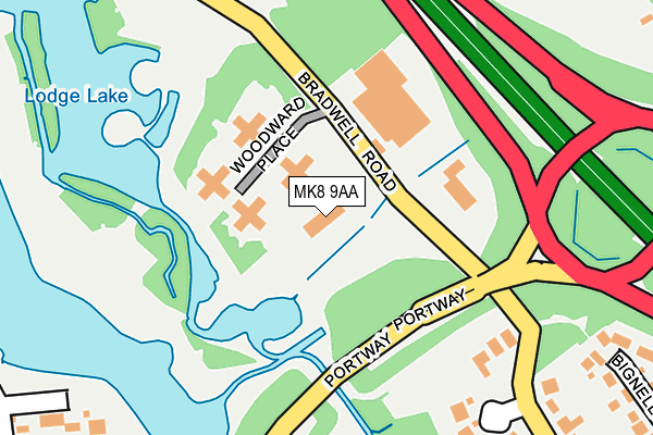
MK8 9AA is located in the Loughton & Shenley electoral ward, within the unitary authority of Milton Keynes and the English Parliamentary constituency of Milton Keynes South. The Sub Integrated Care Board (ICB) Location is NHS Bedfordshire, Luton and Milton Keynes ICB - M1J4Y and the police force is Thames Valley. This postcode has been in use since June 2009.


GetTheData
Source: OS OpenMap – Local (Ordnance Survey)
Source: OS VectorMap District (Ordnance Survey)
Licence: Open Government Licence (requires attribution)
| Easting | 483382 |
| Northing | 238342 |
| Latitude | 52.037222 |
| Longitude | -0.785831 |
GetTheData
Source: Open Postcode Geo
Licence: Open Government Licence
| Country | England |
| Postcode District | MK8 |
➜ See where MK8 is on a map ➜ Where is Milton Keynes? | |
GetTheData
Source: Land Registry Price Paid Data
Licence: Open Government Licence
Elevation or altitude of MK8 9AA as distance above sea level:
| Metres | Feet | |
|---|---|---|
| Elevation | 70m | 230ft |
Elevation is measured from the approximate centre of the postcode, to the nearest point on an OS contour line from OS Terrain 50, which has contour spacing of ten vertical metres.
➜ How high above sea level am I? Find the elevation of your current position using your device's GPS.
GetTheData
Source: Open Postcode Elevation
Licence: Open Government Licence
| Ward | Loughton & Shenley |
| Constituency | Milton Keynes South |
GetTheData
Source: ONS Postcode Database
Licence: Open Government Licence
| Lodge Lake (Portway H5) | Great Holm | 279m |
| Lodge Lake (Portway H5) | Great Holm | 284m |
| Lodge Roundabout North (Great Monks Street V5) | Wymbush | 627m |
| Lodge Roundabout North (Great Monks Street V5) | Wymbush | 643m |
| Kensington Drive (Portway H5) | Great Holm | 643m |
| Milton Keynes Central Station | 0.9km |
| Wolverton Station | 3.4km |
| Bletchley Station | 5.8km |
GetTheData
Source: NaPTAN
Licence: Open Government Licence
GetTheData
Source: ONS Postcode Database
Licence: Open Government Licence


➜ Get more ratings from the Food Standards Agency
GetTheData
Source: Food Standards Agency
Licence: FSA terms & conditions
| Last Collection | |||
|---|---|---|---|
| Location | Mon-Fri | Sat | Distance |
| Gatcombe | 17:30 | 12:00 | 421m |
| Church Lane | 17:30 | 09:30 | 551m |
| P | 18:30 | 634m | |
GetTheData
Source: Dracos
Licence: Creative Commons Attribution-ShareAlike
The below table lists the International Territorial Level (ITL) codes (formerly Nomenclature of Territorial Units for Statistics (NUTS) codes) and Local Administrative Units (LAU) codes for MK8 9AA:
| ITL 1 Code | Name |
|---|---|
| TLJ | South East (England) |
| ITL 2 Code | Name |
| TLJ1 | Berkshire, Buckinghamshire and Oxfordshire |
| ITL 3 Code | Name |
| TLJ12 | Milton Keynes |
| LAU 1 Code | Name |
| E06000042 | Milton Keynes |
GetTheData
Source: ONS Postcode Directory
Licence: Open Government Licence
The below table lists the Census Output Area (OA), Lower Layer Super Output Area (LSOA), and Middle Layer Super Output Area (MSOA) for MK8 9AA:
| Code | Name | |
|---|---|---|
| OA | E00084653 | |
| LSOA | E01016774 | Milton Keynes 020A |
| MSOA | E02003478 | Milton Keynes 020 |
GetTheData
Source: ONS Postcode Directory
Licence: Open Government Licence
| MK8 9LG | Woodward Place | 114m |
| MK5 8BS | Bradwell Road | 265m |
| MK8 9EZ | Littlecote | 319m |
| MK5 8BF | Bignell Croft | 337m |
| MK5 8DU | Edy Court | 358m |
| MK8 9ET | Gatcombe | 407m |
| MK8 9HL | Badminton View | 420m |
| MK8 9EQ | Chawton Crescent | 428m |
| MK5 8DT | Linceslade Grove | 436m |
| MK13 8LW | Deltic Avenue | 453m |
GetTheData
Source: Open Postcode Geo; Land Registry Price Paid Data
Licence: Open Government Licence