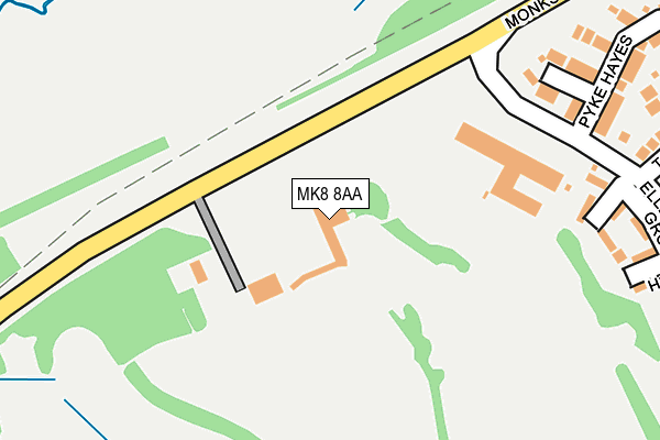
MK8 8AA is located in the Bradwell electoral ward, within the unitary authority of Milton Keynes and the English Parliamentary constituency of Milton Keynes South. The Sub Integrated Care Board (ICB) Location is NHS Bedfordshire, Luton and Milton Keynes ICB - M1J4Y and the police force is Thames Valley. This postcode has been in use since January 1980.


GetTheData
Source: OS OpenMap – Local (Ordnance Survey)
Source: OS VectorMap District (Ordnance Survey)
Licence: Open Government Licence (requires attribution)
| Easting | 481683 |
| Northing | 239079 |
| Latitude | 52.044110 |
| Longitude | -0.810398 |
GetTheData
Source: Open Postcode Geo
Licence: Open Government Licence
| Country | England |
| Postcode District | MK8 |
➜ See where MK8 is on a map ➜ Where is Milton Keynes? | |
GetTheData
Source: Land Registry Price Paid Data
Licence: Open Government Licence
Elevation or altitude of MK8 8AA as distance above sea level:
| Metres | Feet | |
|---|---|---|
| Elevation | 90m | 295ft |
Elevation is measured from the approximate centre of the postcode, to the nearest point on an OS contour line from OS Terrain 50, which has contour spacing of ten vertical metres.
➜ How high above sea level am I? Find the elevation of your current position using your device's GPS.
GetTheData
Source: Open Postcode Elevation
Licence: Open Government Licence
| Ward | Bradwell |
| Constituency | Milton Keynes South |
GetTheData
Source: ONS Postcode Database
Licence: Open Government Licence
| Abbey Hill Golf Course (Monks Way H3) | Two Mile Ash | 426m |
| Abbey Hill Golf Course (Monks Way H3) | Two Mile Ash | 431m |
| Downland (Clay Hill) | Two Mile Ash | 494m |
| Downland (Clay Hill) | Two Mile Ash | 501m |
| Brick Close (Pitfield) | Kiln Farm | 525m |
| Wolverton Station | 2.5km |
| Milton Keynes Central Station | 2.7km |
GetTheData
Source: NaPTAN
Licence: Open Government Licence
GetTheData
Source: ONS Postcode Database
Licence: Open Government Licence


➜ Get more ratings from the Food Standards Agency
GetTheData
Source: Food Standards Agency
Licence: FSA terms & conditions
| Last Collection | |||
|---|---|---|---|
| Location | Mon-Fri | Sat | Distance |
| Downlands | 17:00 | 12:00 | 485m |
| High Street | 17:30 | 12:00 | 522m |
| Badgemore Court | 17:15 | 12:00 | 535m |
GetTheData
Source: Dracos
Licence: Creative Commons Attribution-ShareAlike
The below table lists the International Territorial Level (ITL) codes (formerly Nomenclature of Territorial Units for Statistics (NUTS) codes) and Local Administrative Units (LAU) codes for MK8 8AA:
| ITL 1 Code | Name |
|---|---|
| TLJ | South East (England) |
| ITL 2 Code | Name |
| TLJ1 | Berkshire, Buckinghamshire and Oxfordshire |
| ITL 3 Code | Name |
| TLJ12 | Milton Keynes |
| LAU 1 Code | Name |
| E06000042 | Milton Keynes |
GetTheData
Source: ONS Postcode Directory
Licence: Open Government Licence
The below table lists the Census Output Area (OA), Lower Layer Super Output Area (LSOA), and Middle Layer Super Output Area (MSOA) for MK8 8AA:
| Code | Name | |
|---|---|---|
| OA | E00084818 | |
| LSOA | E01016816 | Milton Keynes 015D |
| MSOA | E02003473 | Milton Keynes 015 |
GetTheData
Source: ONS Postcode Directory
Licence: Open Government Licence
| MK8 8NP | Ellesborough Grove | 261m |
| MK8 8PA | The Approach | 278m |
| MK8 8PQ | Pyke Hayes | 308m |
| MK8 8PB | The Hythe | 358m |
| MK8 8BH | The Approach | 371m |
| MK8 8BJ | The Approach | 376m |
| MK8 8PD | Langton Drive | 389m |
| MK8 8BG | Clay Hill | 419m |
| MK8 8BE | Clay Hill | 453m |
| MK8 8AE | Atherstone Court | 461m |
GetTheData
Source: Open Postcode Geo; Land Registry Price Paid Data
Licence: Open Government Licence