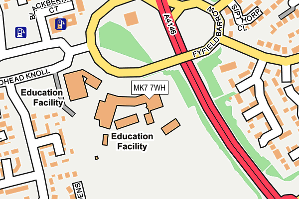
MK7 7WH is located in the Monkston electoral ward, within the unitary authority of Milton Keynes and the English Parliamentary constituency of Milton Keynes South. The Sub Integrated Care Board (ICB) Location is NHS Bedfordshire, Luton and Milton Keynes ICB - M1J4Y and the police force is Thames Valley. This postcode has been in use since December 2000.


GetTheData
Source: OS OpenMap – Local (Ordnance Survey)
Source: OS VectorMap District (Ordnance Survey)
Licence: Open Government Licence (requires attribution)
| Easting | 490091 |
| Northing | 236608 |
| Latitude | 52.020588 |
| Longitude | -0.688507 |
GetTheData
Source: Open Postcode Geo
Licence: Open Government Licence
| Country | England |
| Postcode District | MK7 |
➜ See where MK7 is on a map ➜ Where is Milton Keynes? | |
GetTheData
Source: Land Registry Price Paid Data
Licence: Open Government Licence
Elevation or altitude of MK7 7WH as distance above sea level:
| Metres | Feet | |
|---|---|---|
| Elevation | 80m | 262ft |
Elevation is measured from the approximate centre of the postcode, to the nearest point on an OS contour line from OS Terrain 50, which has contour spacing of ten vertical metres.
➜ How high above sea level am I? Find the elevation of your current position using your device's GPS.
GetTheData
Source: Open Postcode Elevation
Licence: Open Government Licence
| Ward | Monkston |
| Constituency | Milton Keynes South |
GetTheData
Source: ONS Postcode Database
Licence: Open Government Licence
| Fyfield Barrow (Tongwell Street V11) | Walnut Tree | 86m |
| Fyfield Barrow (Tongwell Street V11) | Wavendon Gate | 112m |
| Walton High School (Fyfield Barrow) | Walnut Tree | 132m |
| Dixie Lane (Gregories Drive) | Wavendon Gate | 202m |
| Dixie Lane (Gregories Drive) | Wavendon Gate | 217m |
| Bow Brickhill Station | 1.9km |
| Woburn Sands Station | 2.4km |
| Fenny Stratford Station | 3km |
GetTheData
Source: NaPTAN
Licence: Open Government Licence
GetTheData
Source: ONS Postcode Database
Licence: Open Government Licence


➜ Get more ratings from the Food Standards Agency
GetTheData
Source: Food Standards Agency
Licence: FSA terms & conditions
| Last Collection | |||
|---|---|---|---|
| Location | Mon-Fri | Sat | Distance |
| Fyfield Barrow | 17:30 | 12:00 | 228m |
| Highgate Over | 17:30 | 12:00 | 462m |
| Walton Road | 17:30 | 08:30 | 481m |
GetTheData
Source: Dracos
Licence: Creative Commons Attribution-ShareAlike
The below table lists the International Territorial Level (ITL) codes (formerly Nomenclature of Territorial Units for Statistics (NUTS) codes) and Local Administrative Units (LAU) codes for MK7 7WH:
| ITL 1 Code | Name |
|---|---|
| TLJ | South East (England) |
| ITL 2 Code | Name |
| TLJ1 | Berkshire, Buckinghamshire and Oxfordshire |
| ITL 3 Code | Name |
| TLJ12 | Milton Keynes |
| LAU 1 Code | Name |
| E06000042 | Milton Keynes |
GetTheData
Source: ONS Postcode Directory
Licence: Open Government Licence
The below table lists the Census Output Area (OA), Lower Layer Super Output Area (LSOA), and Middle Layer Super Output Area (MSOA) for MK7 7WH:
| Code | Name | |
|---|---|---|
| OA | E00084881 | |
| LSOA | E01016822 | Milton Keynes 022A |
| MSOA | E02003480 | Milton Keynes 022 |
GetTheData
Source: ONS Postcode Directory
Licence: Open Government Licence
| MK7 7ER | Huckleberry Close | 219m |
| MK7 7AZ | Dixie Lane | 229m |
| MK7 7DN | Lichfield Down | 238m |
| MK7 7NQ | Bergamot Gardens | 245m |
| MK7 7AN | Fyfield Barrow | 250m |
| MK7 7TH | Sipthorp Close | 258m |
| MK7 7SU | Fortuna Court | 264m |
| MK7 7NW | Lichfield Down | 272m |
| MK7 7SB | Gaddesden Crescent | 278m |
| MK7 7SA | Isaacson Drive | 278m |
GetTheData
Source: Open Postcode Geo; Land Registry Price Paid Data
Licence: Open Government Licence