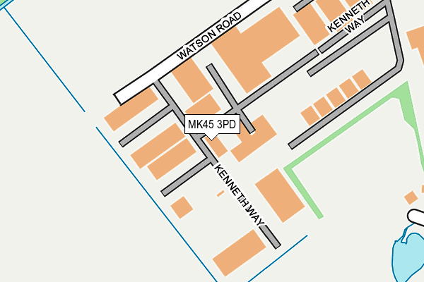
MK45 3PD is located in the Wixams & Wilstead electoral ward, within the unitary authority of Bedford and the English Parliamentary constituency of Mid Bedfordshire. The Sub Integrated Care Board (ICB) Location is NHS Bedfordshire, Luton and Milton Keynes ICB - M1J4Y and the police force is Bedfordshire. This postcode has been in use since September 1991.


GetTheData
Source: OS OpenMap – Local (Ordnance Survey)
Source: OS VectorMap District (Ordnance Survey)
Licence: Open Government Licence (requires attribution)
| Easting | 504924 |
| Northing | 244696 |
| Latitude | 52.090686 |
| Longitude | -0.469917 |
GetTheData
Source: Open Postcode Geo
Licence: Open Government Licence
| Country | England |
| Postcode District | MK45 |
➜ See where MK45 is on a map | |
GetTheData
Source: Land Registry Price Paid Data
Licence: Open Government Licence
Elevation or altitude of MK45 3PD as distance above sea level:
| Metres | Feet | |
|---|---|---|
| Elevation | 30m | 98ft |
Elevation is measured from the approximate centre of the postcode, to the nearest point on an OS contour line from OS Terrain 50, which has contour spacing of ten vertical metres.
➜ How high above sea level am I? Find the elevation of your current position using your device's GPS.
GetTheData
Source: Open Postcode Elevation
Licence: Open Government Licence
| Ward | Wixams & Wilstead |
| Constituency | Mid Bedfordshire |
GetTheData
Source: ONS Postcode Database
Licence: Open Government Licence
| Dove Lane (Green Lane) | Wixams | 543m |
| Dove Lane (Green Lane) | Wixams | 543m |
| Wilstead Industrial Park (Bedford Road) | Wixams | 545m |
| Wilstead Industrial Park (Bedford Road) | Wixams | 554m |
| Duck End Lane (Bedford Road) | Wilstead | 1,284m |
| Kempston Hardwick Station | 2.3km |
| Stewartby Station | 4.2km |
| Bedford St Johns Station | 4.3km |
GetTheData
Source: NaPTAN
Licence: Open Government Licence
| Median download speed | 6.0Mbps |
| Average download speed | 12.1Mbps |
| Maximum download speed | 57.09Mbps |
| Median upload speed | 1.0Mbps |
| Average upload speed | 2.3Mbps |
| Maximum upload speed | 11.43Mbps |
GetTheData
Source: Ofcom
Licence: Ofcom Terms of Use (requires attribution)
GetTheData
Source: ONS Postcode Database
Licence: Open Government Licence


➜ Get more ratings from the Food Standards Agency
GetTheData
Source: Food Standards Agency
Licence: FSA terms & conditions
| Last Collection | |||
|---|---|---|---|
| Location | Mon-Fri | Sat | Distance |
| Dane Lane Loop | 17:00 | 11:45 | 641m |
| Chapel End | 16:50 | 11:25 | 1,897m |
| Post Office Cotton End Road | 16:45 | 10:45 | 1,942m |
GetTheData
Source: Dracos
Licence: Creative Commons Attribution-ShareAlike
The below table lists the International Territorial Level (ITL) codes (formerly Nomenclature of Territorial Units for Statistics (NUTS) codes) and Local Administrative Units (LAU) codes for MK45 3PD:
| ITL 1 Code | Name |
|---|---|
| TLH | East |
| ITL 2 Code | Name |
| TLH2 | Bedfordshire and Hertfordshire |
| ITL 3 Code | Name |
| TLH24 | Bedford |
| LAU 1 Code | Name |
| E06000055 | Bedford |
GetTheData
Source: ONS Postcode Directory
Licence: Open Government Licence
The below table lists the Census Output Area (OA), Lower Layer Super Output Area (LSOA), and Middle Layer Super Output Area (MSOA) for MK45 3PD:
| Code | Name | |
|---|---|---|
| OA | E00173782 | |
| LSOA | E01017548 | Bedford 019C |
| MSOA | E02003634 | Bedford 019 |
GetTheData
Source: ONS Postcode Directory
Licence: Open Government Licence
| MK42 6BA | Green Lane | 398m |
| MK42 6BX | Bedford Road | 432m |
| MK45 3HU | Bedford Road | 451m |
| MK42 6HU | Bedford Road | 451m |
| MK42 6DS | Dunlin Grove | 452m |
| MK42 6DL | Avocet Road | 482m |
| MK42 6BW | Swan Road | 487m |
| MK45 3FN | The Rosary | 488m |
| MK42 6BB | Ladybird Way | 490m |
| MK42 6BY | Heron Gardens | 499m |
GetTheData
Source: Open Postcode Geo; Land Registry Price Paid Data
Licence: Open Government Licence