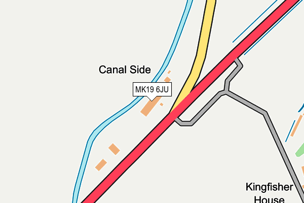
MK19 6JU lies on Buckingham Road in Deanshanger, Milton Keynes. MK19 6JU is located in the Deanshanger electoral ward, within the unitary authority of West Northamptonshire and the English Parliamentary constituency of South Northamptonshire. The Sub Integrated Care Board (ICB) Location is NHS Northamptonshire ICB - 78H and the police force is Northamptonshire. This postcode has been in use since July 1990.


GetTheData
Source: OS OpenMap – Local (Ordnance Survey)
Source: OS VectorMap District (Ordnance Survey)
Licence: Open Government Licence (requires attribution)
| Easting | 476469 |
| Northing | 238864 |
| Latitude | 52.042921 |
| Longitude | -0.886456 |
GetTheData
Source: Open Postcode Geo
Licence: Open Government Licence
| Street | Buckingham Road |
| Locality | Deanshanger |
| Town/City | Milton Keynes |
| Country | England |
| Postcode District | MK19 |
➜ See where MK19 is on a map | |
GetTheData
Source: Land Registry Price Paid Data
Licence: Open Government Licence
Elevation or altitude of MK19 6JU as distance above sea level:
| Metres | Feet | |
|---|---|---|
| Elevation | 70m | 230ft |
Elevation is measured from the approximate centre of the postcode, to the nearest point on an OS contour line from OS Terrain 50, which has contour spacing of ten vertical metres.
➜ How high above sea level am I? Find the elevation of your current position using your device's GPS.
GetTheData
Source: Open Postcode Elevation
Licence: Open Government Licence
| Ward | Deanshanger |
| Constituency | South Northamptonshire |
GetTheData
Source: ONS Postcode Database
Licence: Open Government Licence
| High Street (Stratford Road) | Deanshanger | 750m |
| Fox And Hounds Ph (High Street) | Deanshanger | 751m |
| Fox And Hounds Ph (High Street) | Deanshanger | 759m |
| Boswell Lane (High Street) | Deanshanger | 921m |
| Boswell Lane (High Street) | Deanshanger | 935m |
GetTheData
Source: NaPTAN
Licence: Open Government Licence
| Percentage of properties with Next Generation Access | 100.0% |
| Percentage of properties with Superfast Broadband | 50.0% |
| Percentage of properties with Ultrafast Broadband | 0.0% |
| Percentage of properties with Full Fibre Broadband | 0.0% |
Superfast Broadband is between 30Mbps and 300Mbps
Ultrafast Broadband is > 300Mbps
| Percentage of properties unable to receive 2Mbps | 0.0% |
| Percentage of properties unable to receive 5Mbps | 0.0% |
| Percentage of properties unable to receive 10Mbps | 0.0% |
| Percentage of properties unable to receive 30Mbps | 50.0% |
GetTheData
Source: Ofcom
Licence: Ofcom Terms of Use (requires attribution)
GetTheData
Source: ONS Postcode Database
Licence: Open Government Licence


➜ Get more ratings from the Food Standards Agency
GetTheData
Source: Food Standards Agency
Licence: FSA terms & conditions
| Last Collection | |||
|---|---|---|---|
| Location | Mon-Fri | Sat | Distance |
| North End | 16:45 | 09:15 | 680m |
| Post Office High Street | 17:15 | 09:45 | 947m |
| Honeywell Way | 17:00 | 08:30 | 1,154m |
GetTheData
Source: Dracos
Licence: Creative Commons Attribution-ShareAlike
The below table lists the International Territorial Level (ITL) codes (formerly Nomenclature of Territorial Units for Statistics (NUTS) codes) and Local Administrative Units (LAU) codes for MK19 6JU:
| ITL 1 Code | Name |
|---|---|
| TLF | East Midlands (England) |
| ITL 2 Code | Name |
| TLF2 | Leicestershire, Rutland and Northamptonshire |
| ITL 3 Code | Name |
| TLF24 | West Northamptonshire |
| LAU 1 Code | Name |
| E07000155 | South Northamptonshire |
GetTheData
Source: ONS Postcode Directory
Licence: Open Government Licence
The below table lists the Census Output Area (OA), Lower Layer Super Output Area (LSOA), and Middle Layer Super Output Area (MSOA) for MK19 6JU:
| Code | Name | |
|---|---|---|
| OA | E00169288 | |
| LSOA | E01027280 | South Northamptonshire 008B |
| MSOA | E02005688 | South Northamptonshire 008 |
GetTheData
Source: ONS Postcode Directory
Licence: Open Government Licence
| MK19 6HJ | The Green | 575m |
| MK19 6HQ | The Beeches | 615m |
| MK19 6HL | The Green | 651m |
| MK19 6HH | The Green | 674m |
| MK19 6HS | Patricks Lane | 726m |
| MK19 6LD | Bridge Walk | 730m |
| MK19 6HR | High Street | 778m |
| MK19 6GU | The Smithy | 798m |
| MK19 6JR | Wicken Road | 800m |
| MK19 6HN | Stratford Road | 806m |
GetTheData
Source: Open Postcode Geo; Land Registry Price Paid Data
Licence: Open Government Licence