MK18 1SA maps, stats, and open data
MK18 1SA lies on Hebridean in Buckingham. MK18 1SA is located in the Buckingham East electoral ward, within the unitary authority of Buckinghamshire and the English Parliamentary constituency of Buckingham. The Sub Integrated Care Board (ICB) Location is NHS Buckinghamshire, Oxfordshire and Berkshire West ICB - 14Y and the police force is Thames Valley. This postcode has been in use since June 2011.
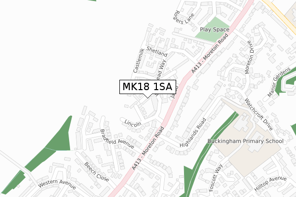
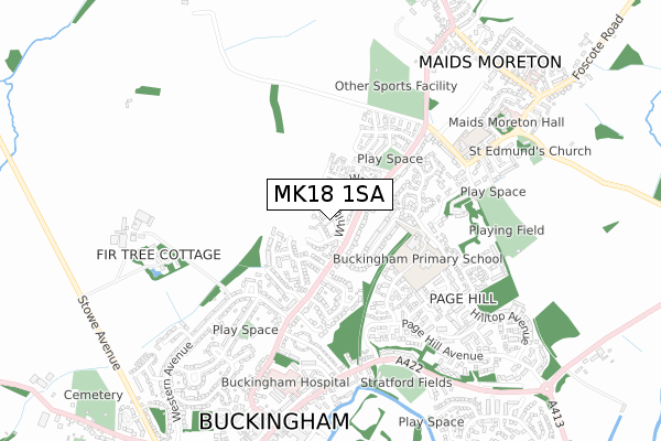
MK18 1SA maps


Licence: Open Government Licence (requires attribution)
Attribution: Contains OS data © Crown copyright and database right 2025
Source: Open Postcode Geo
Licence: Open Government Licence (requires attribution)
Attribution: Contains OS data © Crown copyright and database right 2025; Contains Royal Mail data © Royal Mail copyright and database right 2025; Source: Office for National Statistics licensed under the Open Government Licence v.3.0
MK18 1SA geodata
| Easting | 469896 |
| Northing | 234871 |
| Latitude | 52.007881 |
| Longitude | -0.983107 |
Where is MK18 1SA?
| Street | Hebridean |
| Town/City | Buckingham |
| Country | England |
| Postcode District | MK18 |
MK18 1SA Elevation
Elevation or altitude of MK18 1SA as distance above sea level:
| Metres | Feet | |
|---|---|---|
| Elevation | 110m | 361ft |
Elevation is measured from the approximate centre of the postcode, to the nearest point on an OS contour line from OS Terrain 50, which has contour spacing of ten vertical metres.
➜ How high above sea level am I? Find the elevation of your current position using your device's GPS.
Politics
| Ward | Buckingham East |
|---|---|
| Constituency | Buckingham |
Transport
Nearest bus stops to MK18 1SA
| Highlands Road (Moreton Road) | Buckingham | 157m |
| Highlands Road (Moreton Road) | Buckingham | 168m |
| Middle School (Foscott Way) | Buckingham | 335m |
| Woodlands Crescent | Buckingham | 369m |
| Western Avenue (Moreton Road) | Buckingham | 388m |
Broadband
Broadband access in MK18 1SA (2020 data)
| Percentage of properties with Next Generation Access | 100.0% |
| Percentage of properties with Superfast Broadband | 100.0% |
| Percentage of properties with Ultrafast Broadband | 0.0% |
| Percentage of properties with Full Fibre Broadband | 0.0% |
Superfast Broadband is between 30Mbps and 300Mbps
Ultrafast Broadband is > 300Mbps
Broadband speed in MK18 1SA (2019 data)
Download
| Median download speed | 36.6Mbps |
| Average download speed | 32.6Mbps |
| Maximum download speed | 61.32Mbps |
Upload
| Median upload speed | 7.4Mbps |
| Average upload speed | 6.1Mbps |
| Maximum upload speed | 11.70Mbps |
Broadband limitations in MK18 1SA (2020 data)
| Percentage of properties unable to receive 2Mbps | 0.0% |
| Percentage of properties unable to receive 5Mbps | 0.0% |
| Percentage of properties unable to receive 10Mbps | 0.0% |
| Percentage of properties unable to receive 30Mbps | 0.0% |
MK18 1SA gas and electricity consumption
Estimated total energy consumption in MK18 1SA by fuel type, 2015.
Gas
| Consumption (kWh) | 54,191 |
|---|---|
| Meter count | 11 |
| Mean (kWh/meter) | 4,926 |
| Median (kWh/meter) | 5,028 |
Electricity
| Consumption (kWh) | 26,910 |
|---|---|
| Meter count | 11 |
| Mean (kWh/meter) | 2,446 |
| Median (kWh/meter) | 2,722 |
- Consumption: The estimated total energy consumption, in kWh, across all meters in MK18 1SA, for 2015.
- Meter count: The total number of meters in MK18 1SA.
- Mean: The mean average consumption per meter, in kWh.
- Median: The median average consumption per meter, in kWh.
Source: Postcode level electricity estimates: 2015 (experimental)
Licence: Open Government Licence
Deprivation
37.4% of English postcodes are less deprived than MK18 1SA:Food Standards Agency
Three nearest food hygiene ratings to MK18 1SA (metres)


➜ Get more ratings from the Food Standards Agency
Nearest post box to MK18 1SA
| Last Collection | |||
|---|---|---|---|
| Location | Mon-Fri | Sat | Distance |
| Highlands Road | 17:45 | 12:00 | 122m |
| Foscot Way | 17:30 | 12:00 | 452m |
| Addington Road | 17:45 | 12:00 | 455m |
MK18 1SA ITL and MK18 1SA LAU
The below table lists the International Territorial Level (ITL) codes (formerly Nomenclature of Territorial Units for Statistics (NUTS) codes) and Local Administrative Units (LAU) codes for MK18 1SA:
| ITL 1 Code | Name |
|---|---|
| TLJ | South East (England) |
| ITL 2 Code | Name |
| TLJ1 | Berkshire, Buckinghamshire and Oxfordshire |
| ITL 3 Code | Name |
| TLJ13 | Buckinghamshire |
| LAU 1 Code | Name |
| E06000060 | Buckinghamshire |
MK18 1SA census areas
The below table lists the Census Output Area (OA), Lower Layer Super Output Area (LSOA), and Middle Layer Super Output Area (MSOA) for MK18 1SA:
| Code | Name | |
|---|---|---|
| OA | E00089065 | |
| LSOA | E01017646 | Aylesbury Vale 002C |
| MSOA | E02003653 | Aylesbury Vale 002 |
Nearest postcodes to MK18 1SA
| MK18 1GY | Lincoln | 65m |
| MK18 1SJ | Hill Radnor | 70m |
| MK18 1FL | Whitehead Way | 91m |
| MK18 1GE | Jacob | 94m |
| MK18 1FE | Balwen | 125m |
| MK18 1YA | Castlemilk | 127m |
| MK18 1FZ | Teeswater | 131m |
| MK18 1WG | Shetland | 153m |
| MK18 1PR | Bradfield Avenue | 154m |
| MK18 1PN | Highlands Road | 180m |