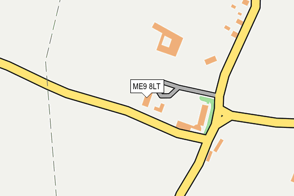
ME9 8LT lies on Hengist Field in Borden, Sittingbourne. ME9 8LT is located in the Borden and Grove Park electoral ward, within the local authority district of Swale and the English Parliamentary constituency of Sittingbourne and Sheppey. The Sub Integrated Care Board (ICB) Location is NHS Kent and Medway ICB - 91Q and the police force is Kent. This postcode has been in use since September 1991.


GetTheData
Source: OS OpenMap – Local (Ordnance Survey)
Source: OS VectorMap District (Ordnance Survey)
Licence: Open Government Licence (requires attribution)
| Easting | 587716 |
| Northing | 161938 |
| Latitude | 51.325561 |
| Longitude | 0.692856 |
GetTheData
Source: Open Postcode Geo
Licence: Open Government Licence
| Street | Hengist Field |
| Locality | Borden |
| Town/City | Sittingbourne |
| Country | England |
| Postcode District | ME9 |
➜ See where ME9 is on a map | |
GetTheData
Source: Land Registry Price Paid Data
Licence: Open Government Licence
Elevation or altitude of ME9 8LT as distance above sea level:
| Metres | Feet | |
|---|---|---|
| Elevation | 70m | 230ft |
Elevation is measured from the approximate centre of the postcode, to the nearest point on an OS contour line from OS Terrain 50, which has contour spacing of ten vertical metres.
➜ How high above sea level am I? Find the elevation of your current position using your device's GPS.
GetTheData
Source: Open Postcode Elevation
Licence: Open Government Licence
| Ward | Borden And Grove Park |
| Constituency | Sittingbourne And Sheppey |
GetTheData
Source: ONS Postcode Database
Licence: Open Government Licence
| Sutton Baron Road | Borden | 39m |
| Sutton Baron Road | Borden | 58m |
| Church (The Street) | Borden | 1,163m |
| Church (The Street) | Borden | 1,175m |
| Mountview (The Street) | Borden | 1,217m |
| Sittingbourne Station | 3.4km |
| Newington Station | 3.5km |
| Kemsley Station | 5.1km |
GetTheData
Source: NaPTAN
Licence: Open Government Licence
GetTheData
Source: ONS Postcode Database
Licence: Open Government Licence


➜ Get more ratings from the Food Standards Agency
GetTheData
Source: Food Standards Agency
Licence: FSA terms & conditions
| Last Collection | |||
|---|---|---|---|
| Location | Mon-Fri | Sat | Distance |
| Oad Street | 16:15 | 09:00 | 746m |
| Wrens Road | 16:00 | 09:00 | 755m |
| Primrose Corner | 16:00 | 09:00 | 1,173m |
GetTheData
Source: Dracos
Licence: Creative Commons Attribution-ShareAlike
The below table lists the International Territorial Level (ITL) codes (formerly Nomenclature of Territorial Units for Statistics (NUTS) codes) and Local Administrative Units (LAU) codes for ME9 8LT:
| ITL 1 Code | Name |
|---|---|
| TLJ | South East (England) |
| ITL 2 Code | Name |
| TLJ4 | Kent |
| ITL 3 Code | Name |
| TLJ43 | Kent Thames Gateway |
| LAU 1 Code | Name |
| E07000113 | Swale |
GetTheData
Source: ONS Postcode Directory
Licence: Open Government Licence
The below table lists the Census Output Area (OA), Lower Layer Super Output Area (LSOA), and Middle Layer Super Output Area (MSOA) for ME9 8LT:
| Code | Name | |
|---|---|---|
| OA | E00124636 | |
| LSOA | E01024554 | Swale 009A |
| MSOA | E02005123 | Swale 009 |
GetTheData
Source: ONS Postcode Directory
Licence: Open Government Licence
| ME9 8LG | Plots Cottages | 67m |
| ME9 8LE | Vigo Lane | 79m |
| ME9 8LJ | Duvards Place | 325m |
| ME9 8LH | Sutton Baron Road | 547m |
| ME9 8LD | Oad Street | 551m |
| ME9 8LB | Oad Street | 690m |
| ME9 8JE | Wrens Road | 690m |
| ME9 8BE | Vigo Lane | 703m |
| ME9 8LA | Oad Street | 767m |
| ME9 8JD | Wrens Road | 780m |
GetTheData
Source: Open Postcode Geo; Land Registry Price Paid Data
Licence: Open Government Licence