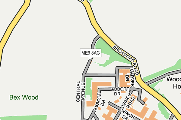
ME9 8AG is located in the West Downs electoral ward, within the local authority district of Swale and the English Parliamentary constituency of Sittingbourne and Sheppey. The Sub Integrated Care Board (ICB) Location is NHS Kent and Medway ICB - 91Q and the police force is Kent. This postcode has been in use since January 1980.


GetTheData
Source: OS OpenMap – Local (Ordnance Survey)
Source: OS VectorMap District (Ordnance Survey)
Licence: Open Government Licence (requires attribution)
| Easting | 589934 |
| Northing | 160876 |
| Latitude | 51.315286 |
| Longitude | 0.724055 |
GetTheData
Source: Open Postcode Geo
Licence: Open Government Licence
| Country | England |
| Postcode District | ME9 |
➜ See where ME9 is on a map | |
GetTheData
Source: Land Registry Price Paid Data
Licence: Open Government Licence
Elevation or altitude of ME9 8AG as distance above sea level:
| Metres | Feet | |
|---|---|---|
| Elevation | 60m | 197ft |
Elevation is measured from the approximate centre of the postcode, to the nearest point on an OS contour line from OS Terrain 50, which has contour spacing of ten vertical metres.
➜ How high above sea level am I? Find the elevation of your current position using your device's GPS.
GetTheData
Source: Open Postcode Elevation
Licence: Open Government Licence
| Ward | West Downs |
| Constituency | Sittingbourne And Sheppey |
GetTheData
Source: ONS Postcode Database
Licence: Open Government Licence
| Kent Science Park (Broadoak Road) | Woodstock | 217m |
| School (Tunstall Road) | Tunstall | 1,010m |
| School (Tunstall Road) | Tunstall | 1,026m |
| Hearts Delight Road | Tunstall | 1,106m |
| Hearts Delight Road | Tunstall | 1,110m |
| Sittingbourne Station | 3.1km |
| Newington Station | 5.7km |
GetTheData
Source: NaPTAN
Licence: Open Government Licence
GetTheData
Source: ONS Postcode Database
Licence: Open Government Licence


➜ Get more ratings from the Food Standards Agency
GetTheData
Source: Food Standards Agency
Licence: FSA terms & conditions
| Last Collection | |||
|---|---|---|---|
| Location | Mon-Fri | Sat | Distance |
| Broad | 16:15 | 09:00 | 670m |
| Highsted | 15:45 | 08:30 | 1,125m |
| Cromers Corner | 17:30 | 12:00 | 1,185m |
GetTheData
Source: Dracos
Licence: Creative Commons Attribution-ShareAlike
The below table lists the International Territorial Level (ITL) codes (formerly Nomenclature of Territorial Units for Statistics (NUTS) codes) and Local Administrative Units (LAU) codes for ME9 8AG:
| ITL 1 Code | Name |
|---|---|
| TLJ | South East (England) |
| ITL 2 Code | Name |
| TLJ4 | Kent |
| ITL 3 Code | Name |
| TLJ43 | Kent Thames Gateway |
| LAU 1 Code | Name |
| E07000113 | Swale |
GetTheData
Source: ONS Postcode Directory
Licence: Open Government Licence
The below table lists the Census Output Area (OA), Lower Layer Super Output Area (LSOA), and Middle Layer Super Output Area (MSOA) for ME9 8AG:
| Code | Name | |
|---|---|---|
| OA | E00125014 | |
| LSOA | E01024631 | Swale 013E |
| MSOA | E02005127 | Swale 013 |
GetTheData
Source: ONS Postcode Directory
Licence: Open Government Licence
| ME9 8AA | Ruins Barn Road | 438m |
| ME9 8AD | Broad Oak Road | 693m |
| ME9 8AE | Woodstock | 785m |
| ME10 4HS | Ruins Barn Road | 865m |
| ME9 8LQ | Doves Croft | 978m |
| ME9 0RS | Broad Oak Road | 981m |
| ME9 8EA | Bredgar Road | 994m |
| ME9 8DU | Flint Cottages | 1021m |
| ME9 8DX | School View | 1031m |
| ME9 0AD | Highsted Valley | 1090m |
GetTheData
Source: Open Postcode Geo; Land Registry Price Paid Data
Licence: Open Government Licence