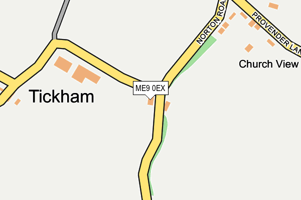
ME9 0EX lies on Norton Road in Norton, Sittingbourne. ME9 0EX is located in the Teynham and Lynsted electoral ward, within the local authority district of Swale and the English Parliamentary constituency of Sittingbourne and Sheppey. The Sub Integrated Care Board (ICB) Location is NHS Kent and Medway ICB - 91Q and the police force is Kent. This postcode has been in use since January 1980.


GetTheData
Source: OS OpenMap – Local (Ordnance Survey)
Source: OS VectorMap District (Ordnance Survey)
Licence: Open Government Licence (requires attribution)
| Easting | 596299 |
| Northing | 160811 |
| Latitude | 51.312546 |
| Longitude | 0.815268 |
GetTheData
Source: Open Postcode Geo
Licence: Open Government Licence
| Street | Norton Road |
| Locality | Norton |
| Town/City | Sittingbourne |
| Country | England |
| Postcode District | ME9 |
➜ See where ME9 is on a map ➜ Where is Tickham? | |
GetTheData
Source: Land Registry Price Paid Data
Licence: Open Government Licence
Elevation or altitude of ME9 0EX as distance above sea level:
| Metres | Feet | |
|---|---|---|
| Elevation | 40m | 131ft |
Elevation is measured from the approximate centre of the postcode, to the nearest point on an OS contour line from OS Terrain 50, which has contour spacing of ten vertical metres.
➜ How high above sea level am I? Find the elevation of your current position using your device's GPS.
GetTheData
Source: Open Postcode Elevation
Licence: Open Government Licence
| Ward | Teynham And Lynsted |
| Constituency | Sittingbourne And Sheppey |
GetTheData
Source: ONS Postcode Database
Licence: Open Government Licence
| Crossroads (London Road) | Norton | 1,189m |
| Lewson Street (London Road) | Teynham | 1,224m |
| Lewson Street (London Road) | Teynham | 1,239m |
| Crossroads (London Road) | Norton | 1,241m |
| Buckland Cottages (London Road) | Norton | 1,495m |
| Teynham Station | 2.4km |
GetTheData
Source: NaPTAN
Licence: Open Government Licence
| Percentage of properties with Next Generation Access | 100.0% |
| Percentage of properties with Superfast Broadband | 0.0% |
| Percentage of properties with Ultrafast Broadband | 0.0% |
| Percentage of properties with Full Fibre Broadband | 0.0% |
Superfast Broadband is between 30Mbps and 300Mbps
Ultrafast Broadband is > 300Mbps
| Percentage of properties unable to receive 2Mbps | 0.0% |
| Percentage of properties unable to receive 5Mbps | 0.0% |
| Percentage of properties unable to receive 10Mbps | 0.0% |
| Percentage of properties unable to receive 30Mbps | 100.0% |
GetTheData
Source: Ofcom
Licence: Ofcom Terms of Use (requires attribution)
GetTheData
Source: ONS Postcode Database
Licence: Open Government Licence


➜ Get more ratings from the Food Standards Agency
GetTheData
Source: Food Standards Agency
Licence: FSA terms & conditions
| Last Collection | |||
|---|---|---|---|
| Location | Mon-Fri | Sat | Distance |
| Lewson Street | 17:00 | 09:00 | 487m |
| Norton Corner | 16:00 | 09:00 | 1,501m |
| Batteries Terrace | 16:15 | 09:00 | 1,813m |
GetTheData
Source: Dracos
Licence: Creative Commons Attribution-ShareAlike
The below table lists the International Territorial Level (ITL) codes (formerly Nomenclature of Territorial Units for Statistics (NUTS) codes) and Local Administrative Units (LAU) codes for ME9 0EX:
| ITL 1 Code | Name |
|---|---|
| TLJ | South East (England) |
| ITL 2 Code | Name |
| TLJ4 | Kent |
| ITL 3 Code | Name |
| TLJ43 | Kent Thames Gateway |
| LAU 1 Code | Name |
| E07000113 | Swale |
GetTheData
Source: ONS Postcode Directory
Licence: Open Government Licence
The below table lists the Census Output Area (OA), Lower Layer Super Output Area (LSOA), and Middle Layer Super Output Area (MSOA) for ME9 0EX:
| Code | Name | |
|---|---|---|
| OA | E00124962 | |
| LSOA | E01024622 | Swale 016C |
| MSOA | E02005130 | Swale 016 |
GetTheData
Source: ONS Postcode Directory
Licence: Open Government Licence
| ME13 0SW | The Trefoil | 255m |
| ME13 0SN | Provender Lane | 265m |
| ME9 0HS | Tickham Lane | 324m |
| ME9 9JN | Lewson Street | 483m |
| ME13 0SL | Provender Lane | 485m |
| ME9 9JT | Lewson Street | 493m |
| ME9 0HR | Tickham Lane | 534m |
| ME9 9JS | Worlds End | 540m |
| ME9 9JJ | Lewson Street | 554m |
| ME9 9JW | Worlds End | 590m |
GetTheData
Source: Open Postcode Geo; Land Registry Price Paid Data
Licence: Open Government Licence