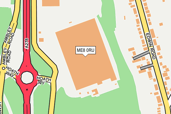
ME8 0RU is located in the Rainham South West electoral ward, within the unitary authority of Medway and the English Parliamentary constituency of Gillingham and Rainham. The Sub Integrated Care Board (ICB) Location is NHS Kent and Medway ICB - 91Q and the police force is Kent. This postcode has been in use since January 1980.


GetTheData
Source: OS OpenMap – Local (Ordnance Survey)
Source: OS VectorMap District (Ordnance Survey)
Licence: Open Government Licence (requires attribution)
| Easting | 579856 |
| Northing | 165451 |
| Latitude | 51.359654 |
| Longitude | 0.581912 |
GetTheData
Source: Open Postcode Geo
Licence: Open Government Licence
| Country | England |
| Postcode District | ME8 |
➜ See where ME8 is on a map ➜ Where is Gillingham? | |
GetTheData
Source: Land Registry Price Paid Data
Licence: Open Government Licence
Elevation or altitude of ME8 0RU as distance above sea level:
| Metres | Feet | |
|---|---|---|
| Elevation | 100m | 328ft |
Elevation is measured from the approximate centre of the postcode, to the nearest point on an OS contour line from OS Terrain 50, which has contour spacing of ten vertical metres.
➜ How high above sea level am I? Find the elevation of your current position using your device's GPS.
GetTheData
Source: Open Postcode Elevation
Licence: Open Government Licence
| Ward | Rainham South West |
| Constituency | Gillingham And Rainham |
GetTheData
Source: ONS Postcode Database
Licence: Open Government Licence
| Edwin Road Middle (Edwin Road) | Rainham | 246m |
| Edwin Road Middle (Edwin Road) | Rainham | 247m |
| Marshall Road (Edwin Road) | Rainham | 311m |
| Marshall Road (Edwin Road) | Rainham | 364m |
| Sylvan Road (Edwin Road) | Rainham | 446m |
| Rainham (Kent) Station | 2.2km |
| Gillingham (Kent) Station | 3.7km |
| Chatham Station | 4.8km |
GetTheData
Source: NaPTAN
Licence: Open Government Licence
GetTheData
Source: ONS Postcode Database
Licence: Open Government Licence


➜ Get more ratings from the Food Standards Agency
GetTheData
Source: Food Standards Agency
Licence: FSA terms & conditions
| Last Collection | |||
|---|---|---|---|
| Location | Mon-Fri | Sat | Distance |
| Edwin Road | 17:30 | 12:15 | 240m |
| Marshall Road | 17:30 | 12:15 | 526m |
| Wigmore Post Office | 17:30 | 12:00 | 806m |
GetTheData
Source: Dracos
Licence: Creative Commons Attribution-ShareAlike
The below table lists the International Territorial Level (ITL) codes (formerly Nomenclature of Territorial Units for Statistics (NUTS) codes) and Local Administrative Units (LAU) codes for ME8 0RU:
| ITL 1 Code | Name |
|---|---|
| TLJ | South East (England) |
| ITL 2 Code | Name |
| TLJ4 | Kent |
| ITL 3 Code | Name |
| TLJ41 | Medway |
| LAU 1 Code | Name |
| E06000035 | Medway |
GetTheData
Source: ONS Postcode Directory
Licence: Open Government Licence
The below table lists the Census Output Area (OA), Lower Layer Super Output Area (LSOA), and Middle Layer Super Output Area (MSOA) for ME8 0RU:
| Code | Name | |
|---|---|---|
| OA | E00081317 | |
| LSOA | E01016086 | Medway 030B |
| MSOA | E02003343 | Medway 030 |
GetTheData
Source: ONS Postcode Directory
Licence: Open Government Licence
| ME8 0AU | Edwin Place | 186m |
| ME8 0AQ | Edwin Road | 255m |
| ME8 0AH | Edwin Road | 293m |
| ME8 0AG | Edwin Road | 299m |
| ME8 0AJ | Marshall Road | 352m |
| ME8 0AL | Marshall Road | 365m |
| ME8 0JL | Edwin Road | 410m |
| ME8 0AE | Edwin Road | 411m |
| ME8 0AN | Marshall Road | 427m |
| ME8 0HQ | Lyndhurst Avenue | 428m |
GetTheData
Source: Open Postcode Geo; Land Registry Price Paid Data
Licence: Open Government Licence