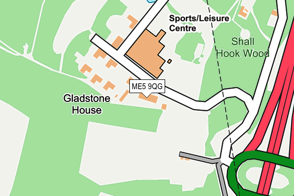
ME5 9QG is located in the Aylesford North & North Downs electoral ward, within the local authority district of Tonbridge and Malling and the English Parliamentary constituency of Chatham and Aylesford. The Sub Integrated Care Board (ICB) Location is NHS Kent and Medway ICB - 91Q and the police force is Kent. This postcode has been in use since January 1980.


GetTheData
Source: OS OpenMap – Local (Ordnance Survey)
Source: OS VectorMap District (Ordnance Survey)
Licence: Open Government Licence (requires attribution)
| Easting | 574394 |
| Northing | 163431 |
| Latitude | 51.343209 |
| Longitude | 0.502582 |
GetTheData
Source: Open Postcode Geo
Licence: Open Government Licence
| Country | England |
| Postcode District | ME5 |
➜ See where ME5 is on a map | |
GetTheData
Source: Land Registry Price Paid Data
Licence: Open Government Licence
Elevation or altitude of ME5 9QG as distance above sea level:
| Metres | Feet | |
|---|---|---|
| Elevation | 120m | 394ft |
Elevation is measured from the approximate centre of the postcode, to the nearest point on an OS contour line from OS Terrain 50, which has contour spacing of ten vertical metres.
➜ How high above sea level am I? Find the elevation of your current position using your device's GPS.
GetTheData
Source: Open Postcode Elevation
Licence: Open Government Licence
| Ward | Aylesford North & North Downs |
| Constituency | Chatham And Aylesford |
GetTheData
Source: ONS Postcode Database
Licence: Open Government Licence
| Bridgewood Roundabout (A2045) | Blue Bell Hill Village | 290m |
| Bridgewood Roundabout (A2045) | Blue Bell Hill Village | 362m |
| Asda (Maidstone Road) | Chatham | 395m |
| Asda (Maidstone Road) | Chatham | 449m |
| Asda (Maidstone Road) | Chatham | 464m |
| Snodland Station | 4.1km |
| Halling Station | 4.1km |
| Chatham Station | 4.3km |
GetTheData
Source: NaPTAN
Licence: Open Government Licence
GetTheData
Source: ONS Postcode Database
Licence: Open Government Licence


➜ Get more ratings from the Food Standards Agency
GetTheData
Source: Food Standards Agency
Licence: FSA terms & conditions
| Last Collection | |||
|---|---|---|---|
| Location | Mon-Fri | Sat | Distance |
| Davis Estate Post Office | 17:30 | 11:30 | 1,063m |
| King George Road | 17:30 | 11:30 | 1,132m |
| Blue Bell Hill | 16:00 | 10:30 | 1,141m |
GetTheData
Source: Dracos
Licence: Creative Commons Attribution-ShareAlike
The below table lists the International Territorial Level (ITL) codes (formerly Nomenclature of Territorial Units for Statistics (NUTS) codes) and Local Administrative Units (LAU) codes for ME5 9QG:
| ITL 1 Code | Name |
|---|---|
| TLJ | South East (England) |
| ITL 2 Code | Name |
| TLJ4 | Kent |
| ITL 3 Code | Name |
| TLJ46 | West Kent |
| LAU 1 Code | Name |
| E07000115 | Tonbridge and Malling |
GetTheData
Source: ONS Postcode Directory
Licence: Open Government Licence
The below table lists the Census Output Area (OA), Lower Layer Super Output Area (LSOA), and Middle Layer Super Output Area (MSOA) for ME5 9QG:
| Code | Name | |
|---|---|---|
| OA | E00125488 | |
| LSOA | E01024721 | Tonbridge and Malling 001C |
| MSOA | E02005149 | Tonbridge and Malling 001 |
GetTheData
Source: ONS Postcode Directory
Licence: Open Government Licence
| ME5 9SB | Rochester Road | 254m |
| ME5 9SD | Maidstone Road | 353m |
| ME5 9RX | Maidstone Road | 443m |
| ME5 9RS | Hallsfield Road | 486m |
| ME5 9SL | Woodhurst | 574m |
| ME5 9SE | Maidstone Road | 597m |
| ME5 9RT | Hallsfield Road | 645m |
| ME5 9SP | Kemp Close | 660m |
| ME5 9SW | Thorndale Close | 674m |
| ME5 0PP | Valerian Close | 706m |
GetTheData
Source: Open Postcode Geo; Land Registry Price Paid Data
Licence: Open Government Licence