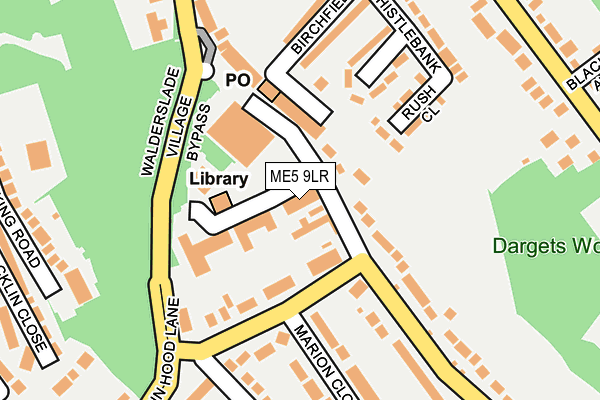
ME5 9LR is located in the Lordswood & Walderslade electoral ward, within the unitary authority of Medway and the English Parliamentary constituency of Chatham and Aylesford. The Sub Integrated Care Board (ICB) Location is NHS Kent and Medway ICB - 91Q and the police force is Kent. This postcode has been in use since January 1983.


GetTheData
Source: OS OpenMap – Local (Ordnance Survey)
Source: OS VectorMap District (Ordnance Survey)
Licence: Open Government Licence (requires attribution)
| Easting | 576092 |
| Northing | 163074 |
| Latitude | 51.339480 |
| Longitude | 0.526731 |
GetTheData
Source: Open Postcode Geo
Licence: Open Government Licence
| Country | England |
| Postcode District | ME5 |
➜ See where ME5 is on a map ➜ Where is Chatham? | |
GetTheData
Source: Land Registry Price Paid Data
Licence: Open Government Licence
Elevation or altitude of ME5 9LR as distance above sea level:
| Metres | Feet | |
|---|---|---|
| Elevation | 100m | 328ft |
Elevation is measured from the approximate centre of the postcode, to the nearest point on an OS contour line from OS Terrain 50, which has contour spacing of ten vertical metres.
➜ How high above sea level am I? Find the elevation of your current position using your device's GPS.
GetTheData
Source: Open Postcode Elevation
Licence: Open Government Licence
| Ward | Lordswood & Walderslade |
| Constituency | Chatham And Aylesford |
GetTheData
Source: ONS Postcode Database
Licence: Open Government Licence
| Sherwood Oak (Robin Hood Lane) | Walderslade | 87m |
| Sherwood Oak (Robin Hood Lane) | Walderslade | 96m |
| Village Centre (Walderslade Road) | Walderslade | 148m |
| Village Centre (Walderslade Road) | Walderslade | 149m |
| Dargets Road | Walderslade | 328m |
| Chatham Station | 4.6km |
| New Hythe Station | 5.8km |
| Cuxton Station | 5.9km |
GetTheData
Source: NaPTAN
Licence: Open Government Licence
| Percentage of properties with Next Generation Access | 100.0% |
| Percentage of properties with Superfast Broadband | 100.0% |
| Percentage of properties with Ultrafast Broadband | 100.0% |
| Percentage of properties with Full Fibre Broadband | 0.0% |
Superfast Broadband is between 30Mbps and 300Mbps
Ultrafast Broadband is > 300Mbps
| Median download speed | 40.0Mbps |
| Average download speed | 37.2Mbps |
| Maximum download speed | 79.98Mbps |
| Median upload speed | 6.0Mbps |
| Average upload speed | 8.0Mbps |
| Maximum upload speed | 20.00Mbps |
| Percentage of properties unable to receive 2Mbps | 0.0% |
| Percentage of properties unable to receive 5Mbps | 0.0% |
| Percentage of properties unable to receive 10Mbps | 0.0% |
| Percentage of properties unable to receive 30Mbps | 0.0% |
GetTheData
Source: Ofcom
Licence: Ofcom Terms of Use (requires attribution)
GetTheData
Source: ONS Postcode Database
Licence: Open Government Licence


➜ Get more ratings from the Food Standards Agency
GetTheData
Source: Food Standards Agency
Licence: FSA terms & conditions
| Last Collection | |||
|---|---|---|---|
| Location | Mon-Fri | Sat | Distance |
| Walderslade Post Office | 17:15 | 11:30 | 107m |
| Boxley Road | 16:00 | 11:00 | 525m |
| Chestnut Avenue | 17:30 | 11:30 | 553m |
GetTheData
Source: Dracos
Licence: Creative Commons Attribution-ShareAlike
The below table lists the International Territorial Level (ITL) codes (formerly Nomenclature of Territorial Units for Statistics (NUTS) codes) and Local Administrative Units (LAU) codes for ME5 9LR:
| ITL 1 Code | Name |
|---|---|
| TLJ | South East (England) |
| ITL 2 Code | Name |
| TLJ4 | Kent |
| ITL 3 Code | Name |
| TLJ41 | Medway |
| LAU 1 Code | Name |
| E06000035 | Medway |
GetTheData
Source: ONS Postcode Directory
Licence: Open Government Licence
The below table lists the Census Output Area (OA), Lower Layer Super Output Area (LSOA), and Middle Layer Super Output Area (MSOA) for ME5 9LR:
| Code | Name | |
|---|---|---|
| OA | E00081722 | |
| LSOA | E01016172 | Medway 037D |
| MSOA | E02003350 | Medway 037 |
GetTheData
Source: ONS Postcode Directory
Licence: Open Government Licence
| ME5 9LL | Walderslade Road | 59m |
| ME5 9GJ | Walderslade Centre | 102m |
| ME5 8AG | Birchfields | 119m |
| ME5 8AS | Rush Close | 136m |
| ME5 8AB | Mossbank | 149m |
| ME5 9NS | Robin Hood Lane | 161m |
| ME5 9QA | Marion Close | 189m |
| ME5 9PY | Oak Terrace | 191m |
| ME5 9LW | Walderslade Road | 195m |
| ME5 9LF | Boxley Road | 200m |
GetTheData
Source: Open Postcode Geo; Land Registry Price Paid Data
Licence: Open Government Licence